The Final Park in a 63-Park Journey — and the Realization That a Lifetime Would Not Be Enough
Some landscapes become part of our imagination through the photographs we find at the end of a long search. Kings Canyon National Park arrived at the end of this one — the last of 63 national parks in a project that began at the Everglades 25 miles from home, traveled to the sand dunes above the Arctic Circle, descended into the longest cave on earth, climbed to 10,000 feet above Maui, and arrives here in a canyon deeper than the Grand Canyon on the western slope of the Sierra Nevada in California.
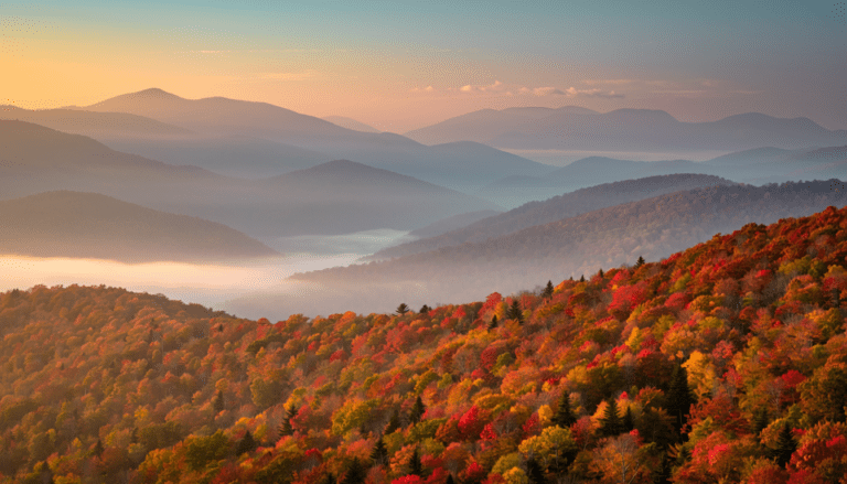
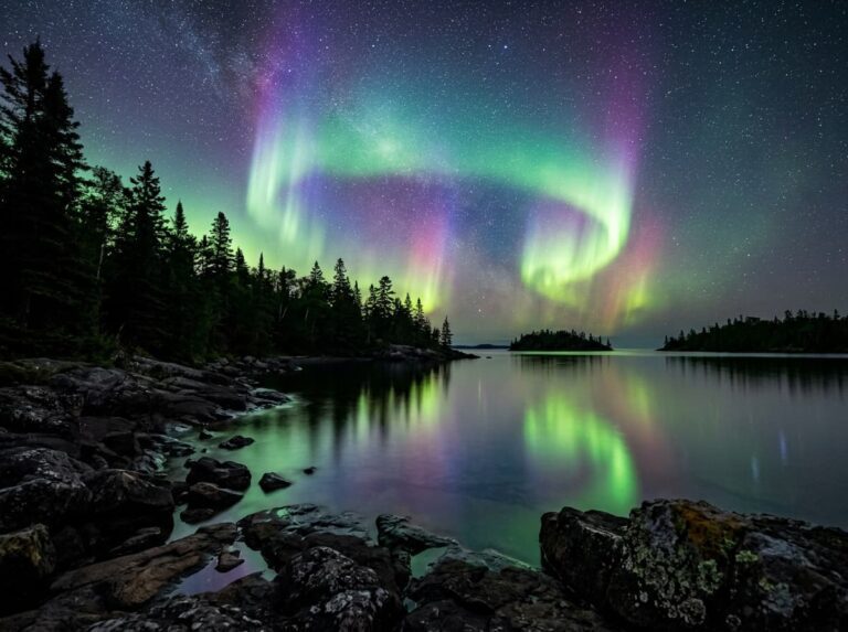
I browsed photographs of Kings Canyon while planning this final post and had the reaction that this project has been quietly building toward across 62 previous parks: the realization that a lifetime of visiting would not be enough. Not just for Kings Canyon, but for all of them. The Everglades in the different light of a different decade. Glacier Bay with better equipment and more patience. The Katmai bears in a September that the July permits missed. Isle Royale on the aurora night that the forecast said was coming. Every park in this series contains more than any single visit can discover, and the project that set out to document all 63 has instead produced 63 invitations to return.
Kings Canyon is the appropriate place to arrive at that realization. John Muir, who advocated passionately for the protection of this canyon, called it a rival to Yosemite. The Kings River has carved a gorge 8,200 feet deep through the granite of the Sierra Nevada — deeper than the Grand Canyon by nearly 200 feet, deeper than any other canyon in North America — and the walls of that gorge rise on both sides of the valley floor in the same scale of granite that Yosemite made famous, with a fraction of the visitors and none of the traffic management. Kings Canyon is what Yosemite was before the world found it.
The Landscape That Draws People Here
Kings Canyon National Park is managed jointly with Sequoia National Park to the south as a single administrative unit, and the combined parks cover 1,353 square miles of the central Sierra Nevada from the giant sequoia groves of the foothills to the granite peaks of the high country above 14,000 feet. The Kings Canyon name refers specifically to the canyon of the South Fork Kings River, accessible via the Kings Canyon Scenic Byway — Highway 180 descending from the Grant Grove area to the Cedar Grove valley floor in a series of switchbacks that drop 2,600 feet in elevation and reveal the canyon’s scale progressively as the road descends.
Grant Grove, at the park’s western entrance, contains the General Grant Tree — the world’s third largest tree by volume and the only living national monument in the United States, designated the Nation’s Christmas Tree by President Eisenhower. The General Grant Grove is smaller than Sequoia’s Giant Forest but the trees are no less extraordinary, and the morning light in the Grant Grove through the sequoia canopy in October produces the same shaft-of-light cinnamon bark photography that the Sequoia post identified as the primary photographic target.
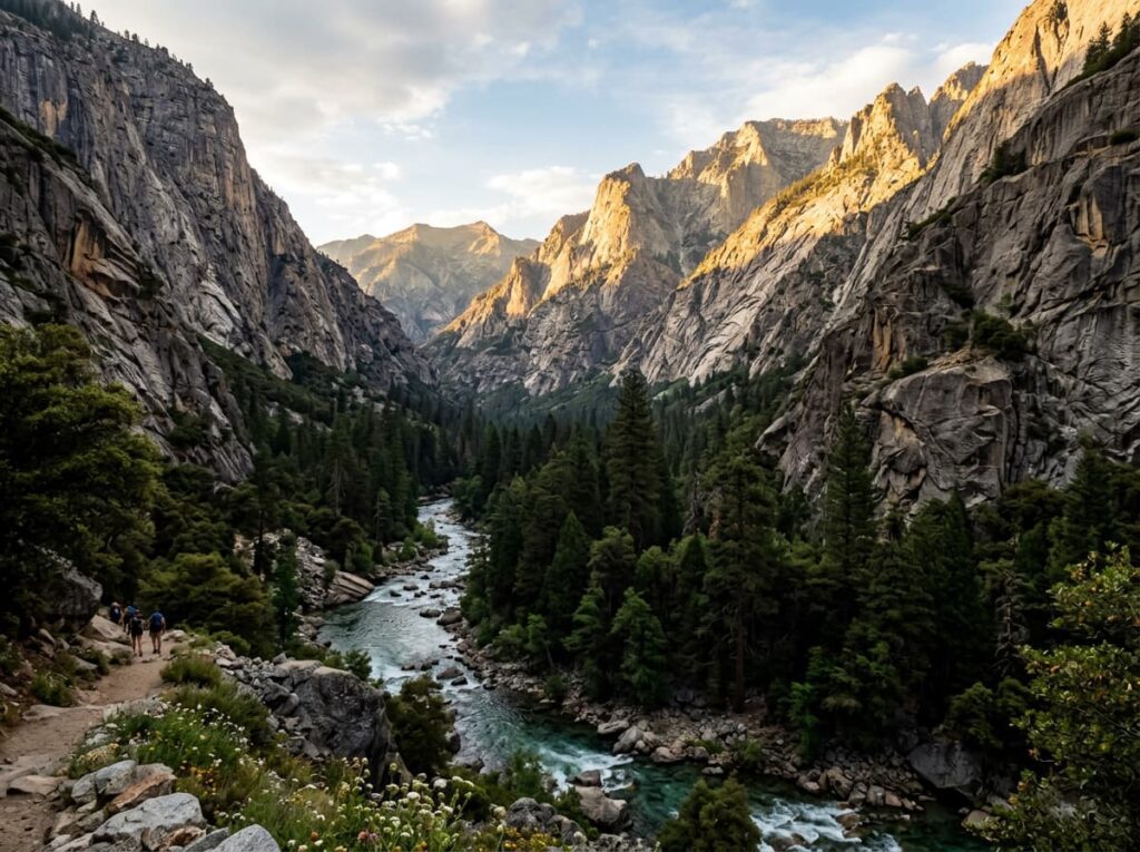
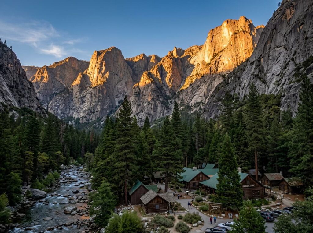
Cedar Grove, at the canyon floor, is the heart of the Kings Canyon experience — the valley where the Kings River runs between canyon walls that rise 8,200 feet above the water. The scale is not immediately comprehensible from the valley floor, which is part of what makes Kings Canyon different from the Grand Canyon overlook experience. At Kings Canyon you are inside the canyon rather than looking down into it, and the walls above you are so high that the full depth requires the drive out to understand. The Muir Rock, a large flat granite boulder on the river bank where John Muir is said to have given outdoor talks, is the valley floor gathering place — a photography position that frames the canyon walls on both sides and the river between them.
The Photographer’s Chase
The canyon wall photography from the Cedar Grove valley floor operates on the classic canyon light principle — the upper walls catch the direct sun while the valley floor is in shadow, and the transition between the two is the most dramatic photography condition the canyon produces. In the early morning the eastern walls catch the alpenglow above while the valley floor is still in pre-dawn blue. In the late afternoon the western walls go from shadow to warm amber as the sun drops toward the Sierra crest. The canyon is not accessible for rim photography the way the Grand Canyon is — there is no rim road, no overlook system above the valley. The photography is from inside the canyon looking up, which communicates the scale in a way that the overlook view cannot.
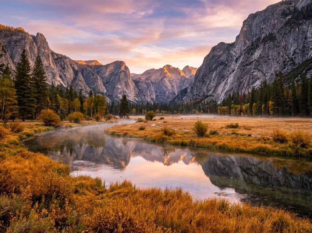
Zumwalt Meadow, a short walk from the Cedar Grove area, is the valley floor composition that most Kings Canyon photographers consider the park’s primary image — a flat meadow beside the Kings River with the canyon walls rising directly above it, the river reflecting the walls and the sky in still morning water, and the meadow’s golden autumn grass in October providing the color foreground that the summer green cannot. The Zumwalt Meadow Loop trail is 1.5 miles and flat, accessible for any fitness level, and in the early morning before the day visitors arrive it provides the solitude and the light that Yosemite’s equivalent meadows have not offered for decades.
The Roaring River Falls, accessible by a short trail from a Cedar Grove parking area, is the canyon waterfall photography — a powerful cascade falling into a green pool in a granite alcove, most productive in the spring snowmelt season when the flow is at its peak. The Kings River itself, running through the canyon floor over granite boulders and through deeper pools, provides the close-range river photography that the canyon walls cannot — the water in the morning light, the reflections of the walls in the still pools between the rapids, the granite boulders as foreground.
The Kings Canyon Scenic Byway descent from Grant Grove to Cedar Grove is the drive that must be treated as a photography session rather than a transit route. The canyon reveals itself progressively as the road descends — the first view of the valley from the upper switchbacks, the canyon deepening with each turn, the walls growing taller and closer until the valley floor opens below Junction View, where both arms of the canyon are visible simultaneously in the most complete single view of the Kings Canyon system. Stop at Junction View. Stay for the light.
The Grant Grove sequoia photography connects Kings Canyon to the Sequoia post earlier in this series — the same cinnamon bark, the same shaft-of-light morning photography, the same macro lens discipline at the base of trees that were alive before the Roman Empire. The General Grant Tree in the early morning, before the tour groups arrive, is the intimate sequoia session that the larger Giant Forest at Sequoia offers in greater abundance but that Kings Canyon provides with fewer people and a more specifically human scale.
Visiting the Park
Kings Canyon and Sequoia are managed jointly and share an entrance fee — one pass covers both parks. The Kings Canyon Scenic Byway to Cedar Grove is open from approximately late May through early November, when the snow closes the upper road. The Grant Grove area is accessible year-round from the park’s western entrance on Highway 180 from Fresno.
October is the month — the fall color in the valley floor cottonwoods and the sequoia forest understory, the low-angle autumn light that builds the most shadow and dimension into the canyon walls, the first dusting of snow on the high country visible above the canyon rim, and the thinning crowds after the summer season. The combination of the October canyon light and the Grant Grove sequoias in the same trip covers both the canyon and the forest in their finest photography conditions.
The nearest airports are Fresno Yosemite International (FAT), about 80 miles west, and Visalia Municipal (VIS), about 55 miles southwest. Both provide convenient access for a Kings Canyon and Sequoia combined visit. The drive east from Fresno on Highway 180 through the orange grove country of the San Joaquin Valley and into the Sierra foothills is one of the great approach drives in the California park system — the transition from the flat agricultural valley to the mountain forest to the canyon is a progression worth experiencing without rushing.
Where to Stay
John Muir Lodge and Grant Grove Cabins at Grant Grove Village provide in-park lodging in the sequoia forest at the park’s western section. The John Muir Lodge is the most comfortable in-park option — a timber lodge in the forest with the Grant Grove trails accessible from the lodge grounds. Cedar Grove Lodge, in the canyon at the valley floor, provides the most dramatically positioned in-park accommodation — rooms at the base of the 8,200-foot canyon walls, the Kings River audible from the lodge, and the Zumwalt Meadow trailhead within walking distance. Cedar Grove Lodge operates only during the summer and early fall season.
Fresno provides the gateway city lodging at a 90-minute drive from Cedar Grove. Three Rivers, the small community at the southern end of Sequoia National Park, provides the closest outside accommodation with mountain character and proximity to both parks. The combination of Kings Canyon and Sequoia in a single multi-day Sierra Nevada trip is the natural itinerary, with Kings Canyon’s canyon depth and Cedar Grove valley experience complementing Sequoia’s Giant Forest sequoia concentration in a complete Sierra story.
For RV travelers, the Sentinel Campground and the Moraine Campground at Cedar Grove provide in-canyon camping with the canyon walls directly above the sites. The campgrounds are reservable through recreation.gov for peak season and provide the early morning canyon access that no outside lodging can match. The road to Cedar Grove has no specific RV size restrictions but the switchback descent requires careful driving in larger rigs.
If I Were Planning My First Visit
October. Cedar Grove Lodge if available, Sentinel Campground if not. Being in the canyon rather than above it is the essential choice — Kings Canyon is experienced from the inside and that requires being there overnight.
The Kings Canyon Scenic Byway driven slowly from Grant Grove to Cedar Grove as a photography session — Junction View in the afternoon light, the canyon deepening with every switchback, arriving at the valley floor in the last direct light of the day with the western walls going warm amber above.
Zumwalt Meadow before sunrise on the first morning — in position on the meadow before the alpenglow begins on the eastern walls, the river reflecting the pre-dawn sky and the first color arriving from the east. The morning that John Muir experienced in this valley, available to anyone who sets the alarm early enough.
The Grant Grove General Grant Tree in the early morning on the second day — the shaft of light through the sequoia canopy, the cinnamon bark at macro range, the scale that requires a person at the base to communicate. Then the drive out through the Grant Grove in the golden morning light, the sequoias above, the Sierra Nevada behind, and 63 national parks in the rearview mirror.
The Light I’m Curious About
It is the morning light at Zumwalt Meadow — the specific moment when the alpenglow touches the upper eastern canyon walls and the light descends the granite face while the valley floor below is still in the pre-dawn blue that the canyon depth creates.
That light has been arriving on this meadow every clear morning since the Kings River carved the canyon to its current depth. John Muir saw it. The generations of visitors who followed him saw it. The photographs I studied while planning this final post showed it in the specific way that only the canyon geometry and the Sierra Nevada sky can produce — the warmth descending the granite in a progression that takes perhaps twenty minutes from the first alpenglow on the highest point to the direct sun on the valley floor.
This project began at the Everglades, 25 miles from home, with the mosquitoes and the mangrove light and the roseate spoonbill over the sawgrass. It ends at Kings Canyon, in a canyon deeper than the Grand Canyon, at Zumwalt Meadow at dawn with the granite walls above and the Kings River below and the morning light arriving as it always has and always will.
63 parks. 63 different answers to the same question: what does this place look like when the light is right? I have been planning trips to find out. A lifetime of returning would not exhaust the question. That is not a limitation. It is the invitation the parks have been extending all along.
A Deeper Exploration
This article is the final post in my ongoing project documenting and photographing all 63 national parks across the United States.
The project began as a framework for planning visits and became something larger — a photographic field journal written in advance, a set of 63 invitations to landscapes I have visited and landscapes I have not yet reached, and a record of what the national park system contains that no single visit, single season, or single lifetime can fully exhaust.
Kings Canyon is the last entry. It is not the end of the journey. The deeper guides for each park are next. The 63at63 visits are coming. The light at every one of these places is still arriving every morning, indifferent to whether a photographer is in position for it, patient in the way that granite and glacier and canyon and desert are patient — in the way that landscapes measured in millions of years have earned the right to be.
Go find it.
One more thing — just between us.
Kings Canyon rewards the visitor who goes beyond the Cedar Grove valley and the Grant Grove sequoias. Three places worth knowing for the trip that takes the time to look around.
Boyden Cavern — in the canyon walls of the Kings Canyon gorge on Highway 180 before the Cedar Grove descent — is a small commercial cave with a 45-minute guided tour that puts visitors inside the canyon wall itself. After two cave national parks in this series, the perspective of being inside the rock that forms the canyon exterior is worth the brief detour.
For the high Sierra experience that extends the Kings Canyon canyon floor visit into the wilderness above, the Rae Lakes Loop — a 41-mile backpacking circuit through some of the finest alpine lake country in the Sierra Nevada — is the multi-day Sierra wilderness experience that the Cedar Grove day visit suggests but cannot provide. The Rae Lakes at dawn, with the granite peaks above and the clear Sierra water below, is the Kings Canyon photograph that requires a wilderness permit and several days of elevation gain to reach.
And for the complete Sierra Nevada story that connects Kings Canyon to the parks that came before it in this series, the drive south on the Generals Highway through Sequoia National Park to the Giant Forest and the General Sherman Tree closes the Sierra arc — the canyon, the sequoias, the high country above — in a single day that John Muir would have recognized as the full scope of what he spent his life trying to protect.