A Photographer’s First Look at Michigan’s Wilderness Island — Mosquitoes, Boats, Advance Plans, and the Northern Lights
Every photographer eventually builds a list of images they have studied so carefully they can almost feel the conditions that produced them. The Northern Lights above Lake Superior, reflected in the still water off an Isle Royale shoreline, is on that list. It is the photograph that requires mosquitoes, a boat, advance planning, and the particular willingness to commit to a wilderness island in the middle of the largest freshwater lake in the world on the chance that the aurora will appear.
Isle Royale National Park is an island — 45 miles long and 9 miles wide — sitting in the northwest corner of Lake Superior, closer to Ontario than to Michigan despite being a Michigan national park. It has no roads connecting it to the mainland. It has no bridges. It closes entirely from November through mid-April when the lake ice makes access impossible. It receives fewer than 25,000 visitors per year, making it the least visited national park in the contiguous United States — and that low number is not accidental. Isle Royale selects for commitment. The logistics require advance planning, a ferry reservation, and the genuine understanding that you are going somewhere genuinely remote and genuinely wild.
The mosquitoes are real. June and July are the peak season and the peak insect season simultaneously — the boreal forest island in a northern lake produces mosquitoes in volumes that first-time visitors consistently describe as the most significant surprise of the trip. Long sleeves, head nets, and DEET are not optional accessories. They are the price of admission for a landscape that produces wolf and moose photography, loon calls across glassy lake coves at dawn, and the aurora dancing above Lake Superior on clear September nights. The mosquitoes filter out the casual visitor. What remains is the island.
The Landscape That Draws People Here
Isle Royale National Park protects the island and its surrounding waters in a landscape that is as close to true wilderness as the national park system offers east of the Rockies. The island’s boreal forest — spruce, fir, birch, and aspen — covers a ridge-and-valley topography created by ancient lava flows and shaped by glaciation, with inland lakes and bogs and beaver ponds scattered through the interior and the rocky coastline of Lake Superior surrounding everything. The island has no permanent human residents during the operating season and no road system — movement is by foot on the island’s trail network or by water around its perimeter.
The wolf and moose ecosystem is the park’s most famous ecological distinction — Isle Royale hosts one of the longest-running predator-prey studies in the world, tracking the relationship between the island’s wolf and moose populations since 1958. The moose arrived on the island by swimming from Ontario in the early 1900s. The wolves crossed on an ice bridge from Canada in 1949. The two populations have been influencing each other on an island with no other large predators ever since, producing a natural experiment in population dynamics that has generated more scientific papers than almost any other wildlife study in North America. For a photographer, the moose are reliably visible in the island’s inland lakes and bogs — wading in the shallows, feeding on aquatic vegetation, indifferent to observers in a way that mainland moose rarely are.
The Lake Superior shoreline is the landscape photography subject that the island’s interior cannot provide — the ancient volcanic rock of the island’s ridgelines meeting the cold clear water of the largest freshwater lake on earth, the lake stretching to the horizon with no land visible in any direction except the island itself. The rock formations along the shoreline, sculpted by wave action into pools and channels and overhanging ledges, provide the foreground geometry for the lake photography. And on clear nights from late August through October, when the solar activity is sufficient and the aurora forecast is favorable, the northern lights appear above the lake horizon in colors that the populated south of the country cannot see.
The Photographer’s Chase
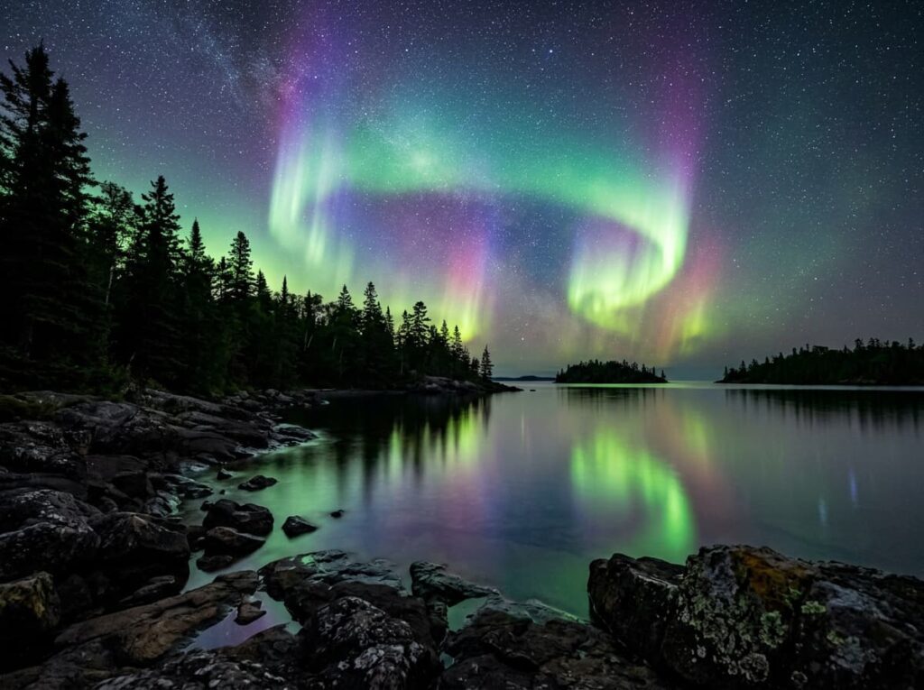
The aurora photography is the primary reason a photographer commits to the Isle Royale logistics, and it requires the September timing that puts the peak aurora season together with the end of the mosquito season and the beginning of the fall color in the island’s birch and aspen. September at Isle Royale is the sweet spot — the insects are diminishing, the fall color is beginning in the upper canopy, the moose are active in the pre-rut period, and the aurora forecasts are at their most favorable for the season. A clear night in September at Isle Royale, away from any campground lights, with the lake surface still and the aurora building above the northern horizon — that is the image.
The aurora photography requires positioning on the island’s north-facing shores — Tobin Harbor, Blake Point, and the northeastern end of the island provide the open northern horizon over the lake that the aurora requires for the reflection composition. A wide angle for the full aurora arch above the lake, a long exposure to capture the aurora movement in the dark sky, and a foreground of the volcanic rock shoreline or a lone birch tree silhouetted against the curtain above — these are the technical parameters that the aurora images I have studied were made with, and they are achievable for any photographer who makes the crossing.
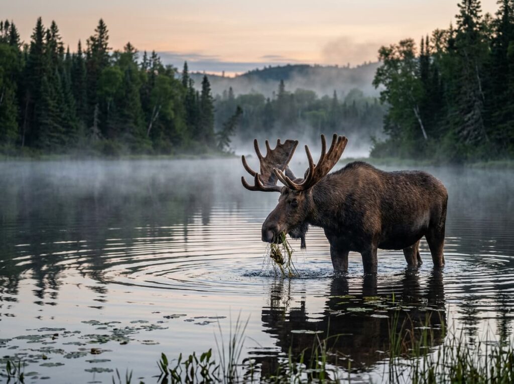
The moose photography is the daylight counterpart to the aurora work — the inland lakes and beaver ponds where moose feed in the early morning and late evening are accessible by trail from the Rock Harbor and Windigo areas. Moose at Isle Royale are less habituated to humans than in some other parks but the island’s confined geography concentrates them in the productive aquatic habitats, and patience at a lakeside position in the early morning produces the moose-in-water portrait that is the classic Isle Royale wildlife image. A long lens — 400mm or longer — from a stable position at the lake edge is the practical setup.
The loon photography is the acoustic experience that becomes a photography obsession once you have been on the island. Common loons nest on the inland lakes at Isle Royale in densities that the mainland cannot replicate, and the dawn call of loons echoing across a glassy boreal lake with the mist still on the water — with a loon pair visible in the foreground and the spruce forest reflected in the still surface — is the Isle Royale image that has nothing to do with the aurora or the moose and everything to do with what the island sounds and looks like in the first light of a September morning.
Getting There — The Boats and the Seaplane
Isle Royale is accessible by three ferry routes and one seaplane service — all requiring advance reservations, particularly for the peak July and August season and for the September aurora window.
The Isle Royale Queen IV departs from Copper Harbor, Michigan — the northernmost tip of the Keweenaw Peninsula — for a 3.5-hour crossing to Rock Harbor on the island’s eastern end. This is the most direct route from the Michigan mainland and the one that most first-time visitors use. The Ranger III, operated by the NPS, departs from Houghton, Michigan — about 50 miles south of Copper Harbor — for a 6-hour crossing to Rock Harbor, carrying more passengers and freight. The Voyageur II operates from Grand Portage, Minnesota — just south of the Canadian border — and serves both Rock Harbor and Windigo on the island’s western end, with a crossing of about 2 hours to Windigo.
Isle Royale Seaplanes operates floatplane service from Houghton to Rock Harbor — a 35-minute flight that provides the aerial perspective on the island and eliminates the lake crossing entirely. For photographers, the seaplane arrival over the island’s ridge-and-lake topography is the first photography opportunity of the trip, and for those prone to seasickness on a potentially rough Lake Superior crossing, the seaplane is the practical solution. All ferry and seaplane options require advance booking through the respective operators; the NPS Ranger III reservations fill months in advance for summer departures.
Where to Stay
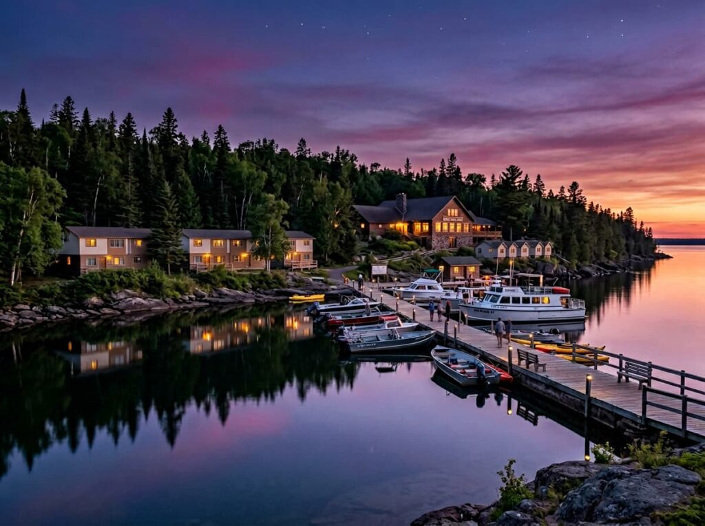
Rock Harbor Lodge, on the island’s eastern end operated by the NPS concessionaire, is the only in-park lodging — a collection of waterfront cabins and motel-style rooms facing the lake, with a dining room and a marina. The lodge operates from mid-June through early September and provides the only above-ground-cloth accommodation on the island. Booking opens in January for the coming season and the cabins fill quickly for July and August; September availability is generally better and coincides with the best photography conditions.
Camping is the alternative — and for the aurora photography specifically, the campgrounds away from the Rock Harbor lodge area provide the darkest sky positions. The Tobin Harbor campground, a short walk from Rock Harbor, faces northeast across the harbor with an open horizon for aurora viewing. The more remote campgrounds along the Greenstone Ridge and on the island’s northeastern end require multi-day backpacking but provide the most complete wilderness immersion and the darkest skies.
There is no RV access to Isle Royale under any circumstances — the island has no roads and no vehicle access. All visitors arrive by boat or seaplane and move on foot or by canoe and kayak. Gear must be carried or paddled. For a photographer, this constraint is clarifying — the kit that makes it onto the island is the kit that genuinely matters, and the discipline of packing light for a wilderness island produces a different kind of photography than a vehicle-accessible park allows.
If I Were Planning My First Visit
September. The aurora window, the diminishing mosquitoes, the fall color beginning in the birch and aspen, and the moose in pre-rut activity. Five nights minimum — two at Rock Harbor Lodge for the eastern end photography and three nights camping at progressively more remote positions for the dark sky access.
The seaplane in — the aerial perspective on arrival, the 35-minute crossing above the island’s ridge-and-lake topography, and arriving on the island with energy rather than lake crossing behind me. The ferry out — the slower return, the lake crossing in the other direction, the island receding behind the boat.
The aurora forecast monitored every day from the moment the trip is booked. SpaceWeatherLive and the NOAA Space Weather Prediction Center both provide Kp index forecasts — a Kp of 4 or higher is the threshold for visible aurora at Isle Royale’s latitude, and a Kp of 6 or higher produces the full curtain display that the images I have been studying were made in. When the forecast says go to the north-facing shore, go immediately.
The mosquito head net packed and accessible at all times from June through August. In September the insects thin. The aurora brightens. The moose move. The loons call across the morning lakes. That is the Isle Royale that the advance planning and the boat ride and the mosquito tolerance are all in service of.
The Light I’m Curious About
It is the aurora reflected in Lake Superior — the specific image that brought this park to my attention in the first place and that has been in my photographic imagination long enough to feel like a place I have almost been.
The images I have studied show a green curtain rising above the northern lake horizon and its reflection below in water so still and so dark and so far from any city that the surface becomes a second sky. The volcanic rock of the island shoreline in the foreground. The boreal forest silhouette to either side. The aurora filling the frame above and below the horizon line in a symmetry that the light itself creates without any compositional assistance from the photographer.
That image requires the boat and the mosquitoes and the advance planning and the September timing and the clear sky and the solar activity and the north-facing shoreline and the photographer already in position before the display begins. It requires, in other words, exactly the kind of committed, prepared, patient trip that this project was built around. Isle Royale is not a park you stumble into. It is a park you earn. The aurora is the receipt.
A Deeper Exploration
This article is part of my ongoing project documenting and photographing all 63 national parks across the United States.
Along the way, I’m creating deeper guides that explore photography locations, travel planning, seasonal light conditions, and personal reflections from the road. Isle Royale is the park that most directly rewards the project’s central commitment — show up prepared, arrive with intention, stay long enough for the place to show you what it is. The island has 25,000 visitors a year. On a September night with the aurora above the lake, it feels like you are the only one.
Because the aurora does not perform on schedule. It arrives when the sun cooperates and the sky is clear and the photographer is already at the north-facing shore with the tripod extended. Isle Royale is the park where being ready and being there are the same thing.
One more thing — just between us.
Isle Royale’s remoteness is its own crowd filter — 25,000 visitors a year to a wilderness island that closes for six months. The insider tip here is about the approach and the regional context that most visitors skip.
Copper Harbor at the tip of the Keweenaw Peninsula — the departure point for the Isle Royale Queen — is worth arriving a day early for. The Keweenaw is one of the most dramatically beautiful peninsulas in the Great Lakes, with copper mining history, Lake Superior shoreline, and the Fort Wilkins State Park lighthouse at Copper Harbor providing the photography of the mainland side of the crossing. The aurora is visible from Copper Harbor on the same nights it is visible from the island — and the harbor lighthouse in the aurora light is a composition worth having before you even board the boat.
For the wolf-moose research that makes Isle Royale scientifically significant, the Isle Royale Wolf-Moose Project websitepublishes annual reports that are worth reading before the trip — understanding the population dynamics and the current state of the island’s predator-prey balance changes what you look for in the forest.
And for the aurora photography preparation, the NOAA Space Weather Prediction Center Kp index forecast is the tool serious aurora photographers check daily in the week before a northern lights trip. Bookmark it before you leave home. Check it every night on the island. The aurora doesn’t announce itself — you have to be watching for it.