A Photographer’s First Look at California’s Hidden Volcanic Park — Condors, Talus Caves, and the Rock Spires Most People Drive Past
Some landscapes become part of our imagination through the surprise of their existence. Pinnacles National Park sits about 80 miles south of San Jose in the Gabilan Mountains of central California, and most people who have driven Highway 101 through the Salinas Valley have passed within 30 miles of it without knowing it was there. It became a national park in 2013, elevated from national monument status, and it remains one of the least visited parks in California despite being within day trip distance of the San Francisco Bay Area and Los Angeles.
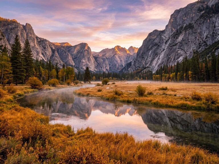
The park protects the remnant of an ancient volcano that has been carried 195 miles northwest from its original location by the movement of the San Andreas Fault. The other half of the same volcanic formation sits near Lancaster in the Mojave Desert, where the Pacific Plate left it when the North American Plate carried the Pinnacles section north over millions of years. What remains in the Gabilan Mountains is a jumble of volcanic rock spires, crags, and boulders eroded into dramatic formations that rise above the surrounding oak woodland in a landscape that looks nothing like the rest of the California coast range.
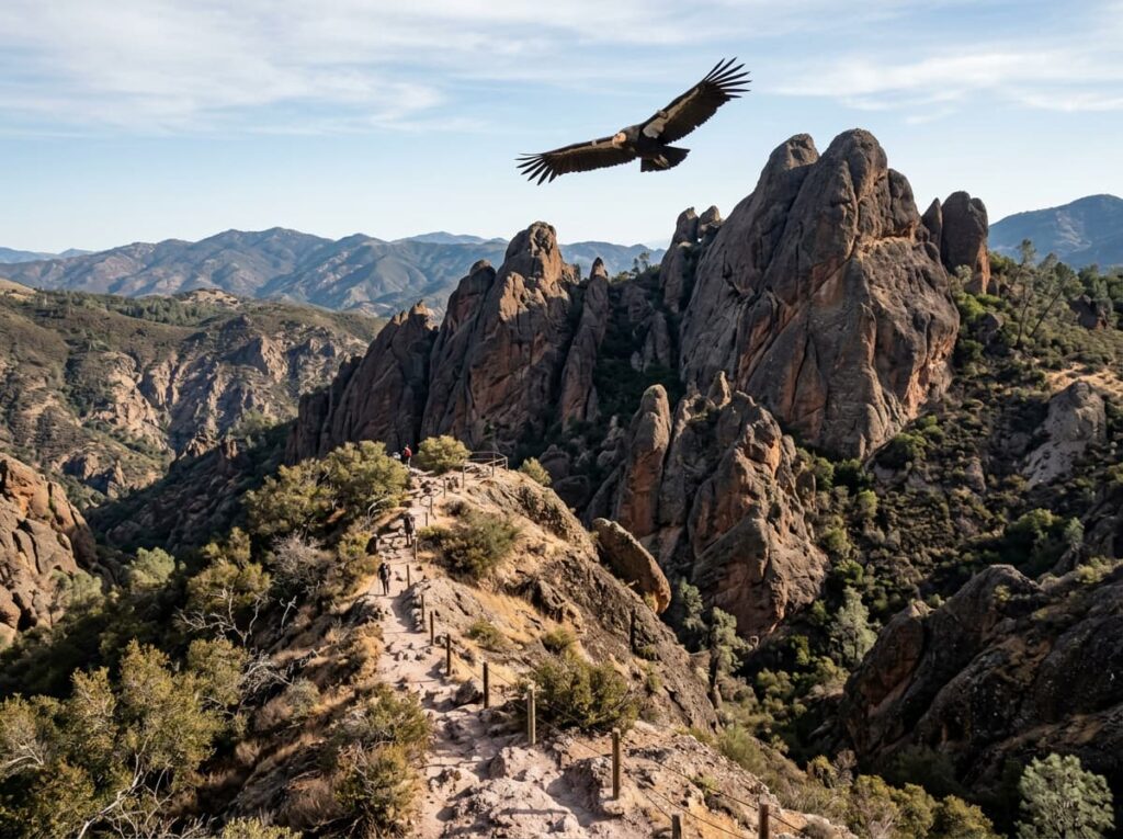
The California condor is the wildlife subject that has made Pinnacles known to people who might otherwise never find it. The park is one of the primary condor release sites in the recovery program that has brought North America’s largest land bird back from the brink of extinction, and the condors soaring on thermals above the rock spires produce the aerial wildlife photography that no other California national park can offer. With a 9.5-foot wingspan visible against the blue sky above the pinnacles, these are not birds that require a telephoto lens to identify.
The Landscape That Draws People Here
Pinnacles National Park covers 26,000 acres of the Gabilan Mountains, with two separate entrances — the west entrance near Soledad off Highway 101 and the east entrance near Hollister off Highway 25. The two sides of the park are not connected by a through road, which means visitors must choose an entrance, explore that side, and return the same way. The east side is more developed, with the Bear Gulch area, the visitor center, and the primary talus cave access. The west side is quieter and less visited, with the Chaparral trailhead providing access to the High Peaks trail system.
The High Peaks trail is the park’s primary above-ground photography route — a loop that climbs through the volcanic rock formations to the highest points in the park, with views across the Salinas Valley to the Santa Lucia Range and the coast range in multiple directions. The trail passes through the rock spire formations at close range, requiring hand-holds on iron rungs in the steeper sections and providing the intimate volcanic rock photography that the valley floor overlooks cannot. The spires in morning light, with the oak woodland in the valley below and the rock textures catching the low angle sun, are the Pinnacles images that the park’s visual identity is built around.
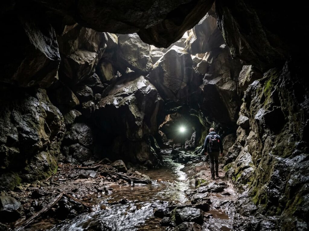
The talus caves are the park’s most unusual and most specifically Pinnacles subject. Two cave systems — Bear Gulch Cave and Balconies Cave — formed when massive boulders fell into stream canyons and created enclosed passages above the creek beds. Bear Gulch Cave is partially closed seasonally to protect the Townsend’s big-eared bat maternity colony that roosts there from spring through early fall. Balconies Cave on the west side is open year-round and requires a headlamp for the creek-bed passage through the darkness beneath the boulder roof. The cave photography — the light entering from the boulder gaps above, the creek visible below, the rock walls in the filtered light — is a subject specific to Pinnacles and unlike any cave photography in the system.
The Photographer’s Chase
The condor photography is the primary wildlife target and it requires patience and positioning rather than pursuit. The condors soar on thermals that develop over the rock formations in the late morning and afternoon, and the High Peaks area is the most reliable position for condor observation from a fixed point. A 500mm or longer lens tracks the birds as they circle on the thermals, and the specific moment when a condor banks and the full 9.5-foot wingspan catches the light against a clear sky is the photograph. The condors are individually numbered with wing tags, and the NPS publishes information on the tagged birds at the park — knowing which condors are flying above you and their individual histories adds the recovery program context to the wildlife photography.
The morning light on the High Peaks formations is the landscape photography window — the volcanic rock spires in the first direct sun from the east, with the chaparral and oak woodland in the valley below still in shadow and the rock textures building dimension as the light angle increases. The High Peaks trail in the early morning, before the midday hikers arrive at the trailhead, produces the rock formation photography in the quietest and most productive light conditions the park offers. An early start from the east entrance, on the trail by 7am, reaches the High Peaks before the thermally-driven winds develop and the light is still raking across the rock faces.
The talus cave photography at Balconies Cave requires a headlamp and the willingness to wade the creek in the passage sections where the water level requires it. The light inside Balconies Cave enters through the gaps between the boulders overhead in shafts that move across the cave floor as the sun moves — the same shaft-of-light principle that the Narrows at Zion and the Carlsbad Caverns produce, but in a naturally formed boulder cave with a creek running through it. The cave photography is the intimate Pinnacles experience that the above-ground spire views cannot provide.
Spring is the primary photography season at Pinnacles for two reasons. The wildflower bloom from February through April covers the chaparral and grassland slopes in a color display — goldfields, blue dicks, California poppies, and owl’s clover — that the dry summer cannot replicate. And the condor activity is high in spring as the breeding season brings the birds to the nest sites in the rock formations. The combination of wildflower foreground, volcanic rock spires as mid-ground, and condors in the air above is the complete Pinnacles composition that only spring can assemble.
Visiting the Park
Pinnacles is open year-round. No timed entry reservations are currently required, though the east side parking areas fill on spring weekends when the wildflowers are at peak and the condor activity is highest. The two separate entrances require a choice — there is no through road connecting east to west. Most photographers prioritize the east entrance for the Bear Gulch area, the High Peaks trailhead, and the primary condor viewing positions. The west entrance provides the Balconies Cave access and the quieter Chaparral trailhead for the High Peaks from the western approach.
February through May is the primary season. The wildflower timing varies by rainfall year — a wet winter produces an exceptional spring bloom and a dry winter produces a muted one. Checking the California Wildflower Hotline and the park’s own social media in late February gives a current sense of bloom timing for any specific year. Summer is hot and dry and the wildflowers are gone, though the condors remain active. Fall brings the first cooler temperatures and the possibility of the Townsend’s big-eared bats emerging at dusk from Bear Gulch Cave before the maternity colony departs.
The nearest airport is San Jose International (SJC), about 80 miles north via Highway 101 and Highway 25. The Monterey Regional Airport (MRY) provides an alternative arrival point with scenic coastal access and a longer but more atmospheric drive through the Salinas Valley to the park’s west entrance.
Where to Stay
There is one in-park campground — the Pinnacles Campground on the east side, operated by a concessionaire with tent sites and RV sites with hookups. The campground’s position at the base of the east entrance trails makes early morning High Peaks starts practical without any commute, and the campground store provides basic supplies. Reservations through the campground website are essential for spring weekends.
Hollister, about 30 miles north of the east entrance on Highway 25, provides the nearest city lodging for the east side. Soledad, about 12 miles from the west entrance on Highway 101, is the nearest community on the western approach. King City, further south on 101, has additional options and the character of a Salinas Valley agricultural town that is genuine rather than tourist-facing.
Carmel and Monterey, about 50 miles west on the coast, make a natural combination destination — Pinnacles for the volcanic rock and condor photography inland, Point Lobos State Natural Reserve and the Big Sur coast for the marine and coastal photography that the inland park cannot offer. The two experiences in the same trip cover the full range of central California’s most visually extraordinary landscapes.
If I Were Planning My First Visit
March or April, monitoring the rainfall-dependent wildflower forecast in the weeks before arrival. East entrance campground for two nights — the early morning High Peaks trail access and the full dark sky for any night photography.
The High Peaks trail at first light on the first morning — on the trail before 7am, reaching the spire formations in the raking early light, watching for condors on the thermals as the morning warms. The condor sighting is not guaranteed but the morning thermal activity above the High Peaks is the most reliable viewing window in the park.
Balconies Cave on the second morning — the west entrance drive the previous afternoon to scout the trailhead, the cave walk in the early morning before the trail fills with day hikers, the headlamp and the creek passage and the boulder gap light shafts. Then the return to the east side for the afternoon condor thermals and the High Peaks in the late afternoon light.
And the spring wildflowers wherever they are concentrated that year — the grassland slopes below the High Peaks, the chaparral margins along the creek trails, the California poppies that appear reliably in the open areas near the campground. The complete Pinnacles composition assembles itself in spring. The rest of the year you get most of it. In spring you get all of it.
The Light I’m Curious About
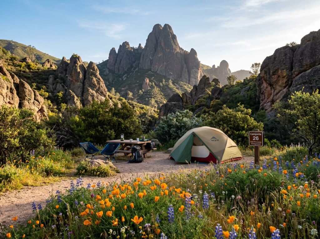
It is the spring morning light on the High Peaks formations — the specific combination of volcanic rock spires in the raking early sun, a California poppy field in the foreground below, and a condor banking on the first thermal of the day above, all in the same frame.
Each element of that composition exists independently in this park at other times. The rock spires are there year-round. The condors soar on any warm afternoon. The poppies bloom for a few weeks in spring in a rainfall-dependent display that varies by year. The convergence of all three — the orange foreground, the red-brown rock middle ground, the bird against the blue sky above — requires being in the right place in the right season and accepting that some conditions align by luck as much as by planning.
Pinnacles has been California’s hidden park for most of its history, elevated to national park status only in 2013 and still largely unknown to the millions of Bay Area residents within day trip distance. The condors soaring above the volcanic spires in spring morning light are the photography that the park has been waiting for someone to chase properly. That chase is on the list.
A Deeper Exploration
This article is part of my ongoing project documenting and photographing all 63 national parks across the United States.
Along the way, I am creating deeper guides that explore photography locations, travel planning, seasonal light conditions, and personal reflections from the road. Pinnacles is the California park this series most needed to round out the state’s extraordinary national park collection — the inland volcanic counterpoint to the coastal and Sierra parks, the condor recovery story, and the talus cave experience that exists nowhere else in the system.
Because a volcano that has been carried 195 miles by the San Andreas Fault over millions of years, leaving half of itself in the Mojave and arriving in the Gabilan Mountains with a condor colony and a talus cave system, is exactly the kind of specific and improbable landscape this project exists to document.
One more thing — just between us.
Pinnacles is already the quiet California park, but here are three places worth knowing for the trip that builds a complete central California experience around it.
Point Lobos State Natural Reserve near Carmel — about 50 miles west — is arguably the finest coastal landscape photography location in California. Sea otters in the kelp, harbor seals on the rocks, Monterey cypress silhouetted against the Pacific fog, and a state reserve that limits vehicle entry and produces some of the most uncrowded coastal photography in the state. Combining Pinnacles with a Point Lobos morning is the complete central California photography trip.
For the condor context that deepens the Pinnacles wildlife experience, the Ventana Wildlife Society condor program information provides the recovery program background — the individual bird histories, the current population count, and the release site information that makes a condor sighting at Pinnacles more than a wildlife encounter and more like a conservation story made visible.
And the Salinas Valley agricultural landscape on the drive to and from the park is one of the most productive agricultural regions in the world and a photography subject in its own right — the lettuce and strawberry fields, the morning fog rolling in from Monterey Bay, the farmworkers in the early light. John Steinbeck wrote about this valley. It still looks like what he described. Worth stopping for.