A Photographer’s First Look at the Most Improbable Landscape in Alaska — Sand Dunes Above the Arctic Circle
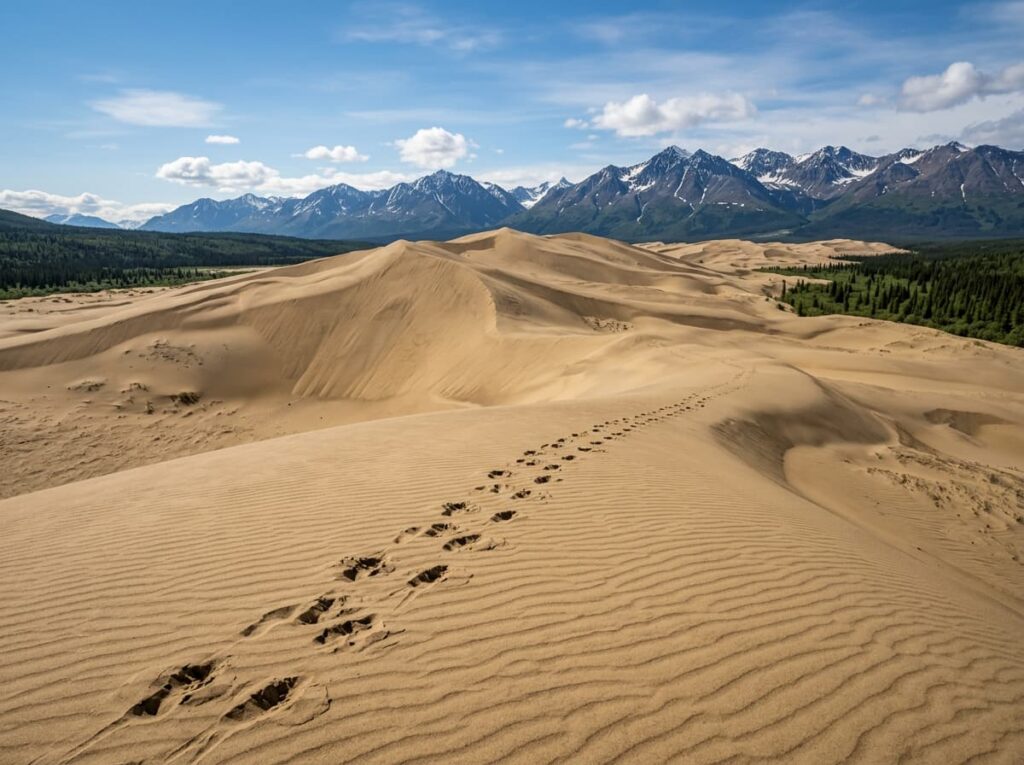
When planning a visit to America’s national parks, some destinations require a second look at the map to confirm what the photograph is showing. Kobuk Valley National Park contains active sand dunes above the Arctic Circle. Not near the Arctic Circle, not at its edge — 35 miles north of it, in the boreal forest and tundra of northwestern Alaska, where the Great Kobuk Sand Dunes rise to 100 feet above the Kobuk River valley floor with the Brooks Range as backdrop and the caribou migration passing through them twice a year.
The dunes formed from glacial outwash sand deposited during the last ice age and subsequently moved and shaped by the same katabatic winds that drain down from the Brooks Range above. The dune field has been active for at least 12,500 years and covers 25 square miles — not the scale of Great Sand Dunes in Colorado, but in the context of the surrounding boreal wilderness, a dune field of any size above the Arctic Circle is not something the mind accepts without effort.
Kobuk Valley National Park receives approximately 15,000 to 20,000 visitors per year, making it consistently one of the two or three least visited parks in the entire system. There are no roads to the park, no trails within it, no campgrounds, and no visitor facilities inside the boundary. Access is entirely by small aircraft or by river. The park was established specifically to protect the Kobuk River corridor, the dune systems, and the cultural landscape that the Inupiaq people have inhabited for 12,500 years — longer than almost any continuously inhabited landscape in North America.
The Landscape That Draws People Here
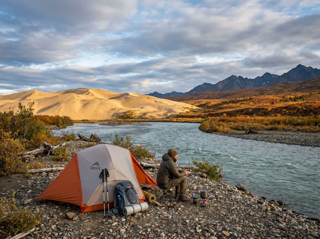
Kobuk Valley National Park protects 1.75 million acres of the Kobuk River valley in northwestern Alaska, enclosed on the north and south by the Brooks Range foothills. The park contains three dune systems — the Great Kobuk Sand Dunes at 25 square miles, the Little Kobuk Sand Dunes, and the Hunt River Dunes — all formed from the same glacial outwash source and all active under the valley’s persistent katabatic winds. The Great Kobuk dunes are the primary photography destination, accessible by a short walk from the floatplane landing area on the Kobuk River near the dune field.
The Kobuk River itself is the primary access and navigation corridor — a clear, cold, salmon-bearing river that flows west through the valley toward Kotzebue Sound on the Chukchi Sea. Float trips on the Kobuk, typically launched by floatplane at a put-in above the park and floated to the village of Kiana or Kobuk outside the park boundary, are the multi-day framework within which photographers experience the full valley landscape — the dunes visible from the river, the Brooks Range above, the Inupiaq fish camps along the banks, and the fall color of the boreal tundra in August and September.
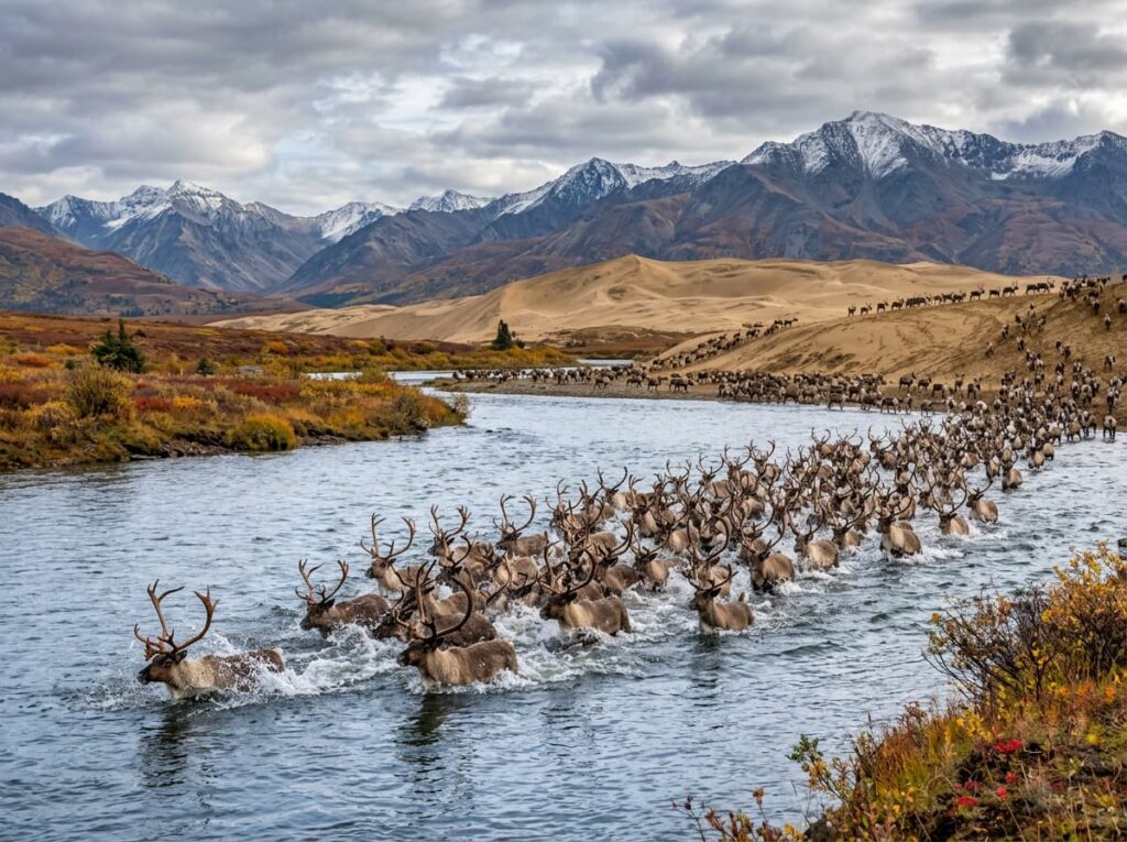
The caribou migration is the wildlife spectacle that makes the timing of a Kobuk Valley visit more important than almost any other variable. The Western Arctic caribou herd, approximately 190,000 animals, passes through the Kobuk Valley twice each year — moving north through the valley in late spring and south through it in early fall. The fall migration, typically in August and September, brings the herd through the dune field and across the river in a crossing that local Inupiaq hunters and wildlife photographers have documented for generations. The sight of caribou crossing the Kobuk River with the Great Kobuk Sand Dunes visible behind them is one of the most specifically extraordinary wildlife photography subjects in the Arctic.
The Photographer’s Chase
The dune photography at Kobuk Valley operates on the same light timing discipline as Great Sand Dunes and White Sands — the raking early morning and late afternoon light that builds shadow and dimension into the sand surface is the photography window, and the midday overhead sun flattens the dune forms as completely in the Arctic as it does in Colorado or New Mexico. The specific difference at Kobuk Valley is the midnight sun in midsummer — the same 24-hour daylight that Gates of the Arctic offers — which means the low-angle raking light that Great Sand Dunes provides only at dawn and dusk is available at Kobuk Valley throughout the night in June and early July. The dunes at 2am in midsummer, in the same golden low-angle light that costs a 4am alarm at lower latitudes, is the Arctic photography advantage that no temperate dune park can replicate.
The caribou crossing photography requires the fall migration timing — August through early September — and positioning on the river banks at the primary crossing points near the dune field. The timing of the herd’s passage through any specific section of the valley varies by year and is not predictable with the precision that the Brooks Falls bear activity allows. Local guides from the Inupiaq villages of Kobuk and Ambler, who have observed the migration for generations, provide the most reliable guidance on herd location and movement. Planning a Kobuk Valley trip with a local guide is not only the most productive approach for the caribou photography — it is also the most responsible, as the migration corridor is a subsistence resource for the Inupiaq communities and the relationship between the photographer and the landscape should reflect that.
The Kobuk River float trip is the framework that provides the most complete photographic access to the valley. A five to seven day float from an upper valley put-in to the village takeout below the park passes the dune fields, the primary caribou crossing zones, the archaeological sites that document 12,500 years of Inupiaq presence in the valley, and the full Brooks Range landscape that flanks the river on both sides. A packraft or an inflatable canoe is the practical vessel for a solo photographer. Guided float trips through operators based in Kotzebue or Fairbanks provide the logistics and the local knowledge that make the self-guided approach safer and more productive.
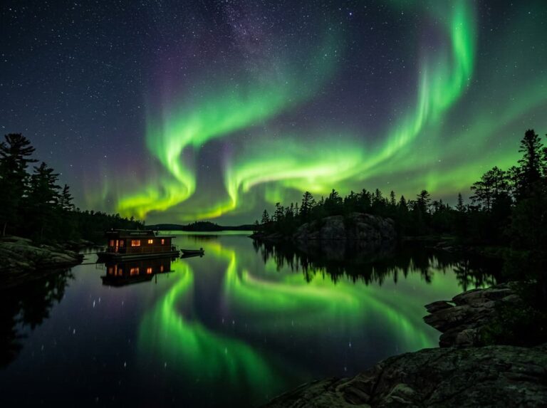
The aurora photography from Kobuk Valley in late August and September — as the midnight sun season ends and the first dark nights return — is the same opportunity that Gates of the Arctic and Isle Royale offer, with the added compositional element of the sand dunes as aurora foreground. The Great Kobuk Sand Dunes illuminated by the northern lights above them is a photograph that exists at the intersection of the most improbable dune system in North America and the most dramatic sky condition in the Arctic. It requires being there when both align. The planning difficulty is proportional to the reward.
Getting There — Floatplane and River
Kobuk Valley National Park has no roads and no scheduled transportation connections. All access is by small aircraft or by river. The primary gateways are Kotzebue, a regional hub on the Chukchi Sea coast served by Alaska Airlines from Anchorage, and Fairbanks, which provides floatplane access to the upper Kobuk valley. From Kotzebue, air taxis provide floatplane service to landing strips near the Great Kobuk Sand Dunes and to the Kobuk River corridor. The flight from Kotzebue to the dune landing area takes approximately 45 minutes.
The park visitor contact station in Kotzebue — the Nana Museum and the NPS office — is the essential first stop for current conditions, river levels, bear activity information, and the cultural context that makes a Kobuk Valley visit more meaningful than a pure landscape trip. The Alaska Public Lands Information Center in Anchorage and Fairbanks also provides Kobuk Valley planning resources.
The visit requires the same honest self-assessment that Gates of the Arctic demands. Kobuk Valley is a genuine wilderness with no visitor infrastructure, active wildlife including bears and wolves, weather that changes quickly, and access points that require dependable small aircraft operation. First-time visitors to this level of Alaska wilderness are best served by a guided experience with an operator who knows the valley, the wildlife patterns, and the logistics of remote Arctic travel.
Where to Stay
There is no in-park lodging and no established campgrounds inside Kobuk Valley National Park. Camping is primitive and dispersed — setting up on river gravel bars and tundra benches with all food in bear canisters and all waste packed out. The float trip framework naturally provides the camping structure, with gravel bar camps each night along the river route.
Kotzebue provides the primary outside base — a small Arctic city of approximately 3,000 residents on the Chukchi Sea, accessible by commercial flight from Anchorage. The Bayside Hotel and several other small properties provide basic comfortable lodging for staging days before and after the park visit. Kotzebue’s position as a regional Inupiaq community center makes it worth understanding before using it as a transit point — the community has a rich cultural identity that the park visit benefits from engaging with rather than passing through.
There is no RV access to Kobuk Valley under any circumstances. No road connects the park to anywhere. The camera bag refined to essentials, the bear canister packed, the floatplane booked — that is the logistics framework, and it is more demanding than any park in this series except Gates of the Arctic.
If I Were Planning My First Visit
Late August — the tail end of the midnight sun, the first dark nights returning and with them the aurora possibility, the fall color beginning in the dwarf birch and willow of the tundra slopes, and the caribou migration moving south through the valley toward the dune field.
A guided five-day float trip from an upper valley put-in to the Kobuk village takeout, with a local Inupiaq guide who knows the caribou movement patterns and the cultural history of the river corridor. The dune field photography on day two or three — in position on the sand before the low-angle late afternoon light arrives, staying through the first dark hours of the returning night for any aurora that develops above the dunes.
The caribou crossing if the migration timing aligns — positioned on the river bank at the primary crossing zone with the long lens and the patience that the migration requires. And the dunes in the first low-angle light of the returning arctic morning, in the same raking light that Great Sand Dunes offers at 5am but available here at a more civilized hour because the sun never fully set.
The most improbable dunes in North America, in the most remote national park accessible by floatplane from a commercial airport, above the Arctic Circle in Alaska. After 61 parks, this is the second-to-last stop in the project. The scale of what this journey has covered — from the Everglades 25 miles from home to the dunes 35 miles above the Arctic Circle — is beginning to become clear.
The Light I’m Curious About
It is the midnight sun light on the Great Kobuk Sand Dunes — the specific low-angle golden light that in late June circles the horizon continuously and illuminates the dune faces at 2am in the same raking quality that requires a 4am alarm at Great Sand Dunes in Colorado.
Every other dune park in this series has a narrow golden hour window that requires precise timing and early departure. Kobuk Valley in midsummer dissolves that constraint entirely. The sun stays low. The raking light that builds shadow into the dune faces continues through the night. The photographer can work the dune field at any hour and find the same light quality that elsewhere is available for twenty minutes around sunrise.
Sand dunes above the Arctic Circle, in the midnight sun, with the Brooks Range behind them and the caribou tracks crossing the face below. That is the most improbable dune photograph available in the national park system and it is available in a park that receives 15,000 visitors per year. The floatplane is the barrier. The light is the reward.
A Deeper Exploration
This article is part of my ongoing project documenting and photographing all 63 national parks across the United States.
Along the way, I am creating deeper guides that explore photography locations, travel planning, seasonal light conditions, and personal reflections from the road. Kobuk Valley is the 62nd park in this series — the second-to-last stop in a journey that began at the Everglades 25 miles from home and has traveled to the dunes 35 miles above the Arctic Circle. One park remains. The distance covered in this project, measured in the diversity of what these landscapes contain, is more than any number of miles can express.
Because active sand dunes above the Arctic Circle are not something the imagination proposes on its own. The national park system makes them accessible, the floatplane makes them reachable, and the midnight sun makes the photography possible at hours that no other dune park in the world can offer. One more park. Then the count is complete.
One more thing — just between us.
Kobuk Valley is already as remote as the national park system gets outside of Gates of the Arctic. The insider extensions here are about the regional context that makes the visit more meaningful.
The NANA Museum of the Arctic in Kotzebue is the essential cultural orientation before entering Kobuk Valley — the museum presents the Inupiaq culture, the 12,500-year history of human presence in the Kobuk corridor, and the relationship between the community and the caribou migration that the park visit will intersect with. Understanding that history changes what you see in the dune field and on the river.
The Noatak National Preserve — immediately north of Kobuk Valley — protects the Noatak River corridor, the longest undisturbed river watershed in the United States, in a preserve that shares the same Brooks Range foothills landscape and the same caribou migration. A combined Kobuk Valley and Noatak float trip, if the time and logistics allow, covers the full northwest Alaska river system in one expedition.
And for the Kotzebue experience that most park visitors skip in their urgency to reach the floatplane, Kotzebue Sound on the Chukchi Sea at midsummer, when the midnight sun sits on the Arctic Ocean horizon at 11pm, is an Arctic light photography experience that requires no floatplane and no wilderness skills — just walking to the water’s edge in a small Alaska Arctic city and pointing the camera north.