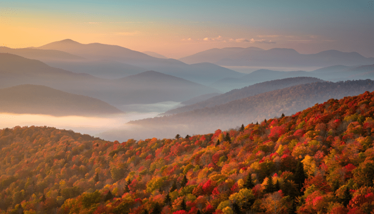
A Photographer’s First Look at the Park That Lives Both Above and Below the South Dakota Prairie
Every photographer eventually builds a list of places they almost visited. Wind Cave National Park went on that list during my 50 at 60 journey through the Dakotas — I was in the area, saw it on the map, noted it as somewhere I should head. I was tight on time. I kept moving. The park stayed on the map and in the back of my mind, which is exactly where unfinished business tends to live.
The return trip is overdue. And the research I have done in preparation has made it more interesting than I expected when I first noticed the name on a South Dakota highway map.
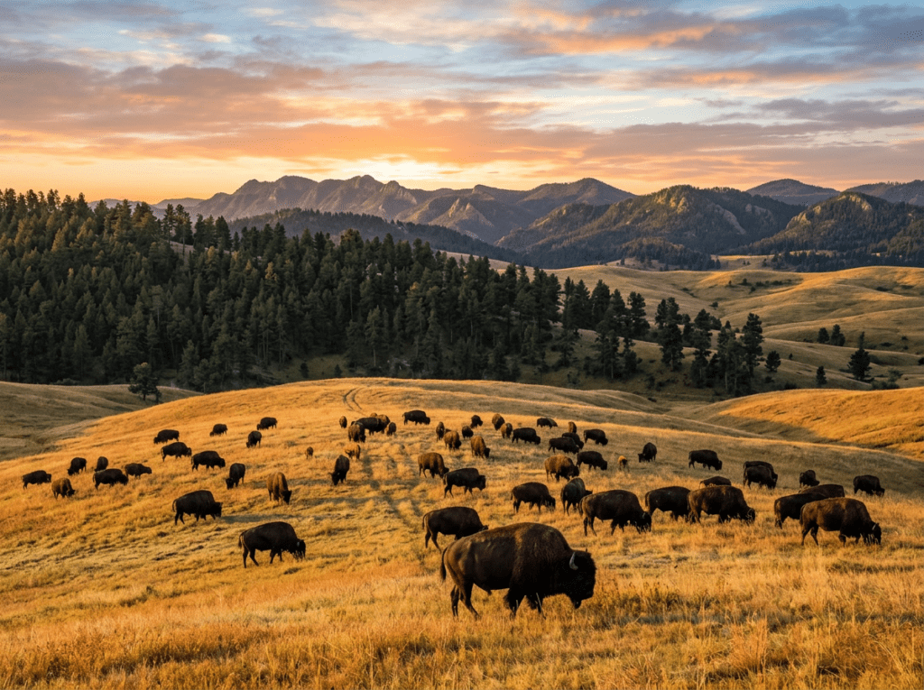
Wind Cave is doing something that no other park in this series does — it is two completely different parks stacked on top of each other. Above ground: a mixed-grass prairie and ponderosa pine forest supporting one of the finest free-ranging wildlife populations in the Great Plains, with bison, elk, pronghorn, prairie dogs, and black-footed ferrets in a landscape that looks and feels like the pre-settlement Great Plains in a way that few places still do. Below ground: one of the longest and most geologically complex caves in the world, with 150 miles of mapped passages and a mineral formation called boxwork — a honeycomb of thin calcite fins projecting from the cave walls — that exists in significant quantity in only one other place on earth. The above-ground and below-ground experiences have almost nothing to do with each other photographically, which makes the planning for this visit genuinely interesting.
The Landscape That Draws People Here
Wind Cave National Park sits in the Black Hills of southwestern South Dakota, about 10 miles north of the town of Hot Springs and about 60 miles south of the more famous Badlands. The park covers 33,970 acres of surface land — a rolling landscape of mixed-grass prairie and ponderosa pine forest that serves as the transition zone between the Great Plains and the Black Hills uplift. The surface feels expansive and open in the way that prairie parks do, with the kind of long sightlines that allow wildlife viewing across distances that forest parks cannot provide.
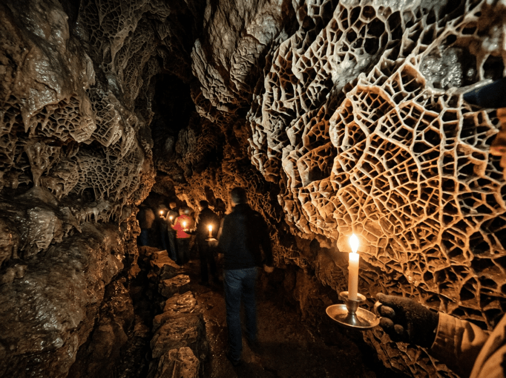
The cave itself extends beneath nearly the entire park — 150 miles of surveyed passages make it the sixth longest cave in the world, with new passages still being discovered. The cave’s defining geological feature is the boxwork formation: thin blades of calcite projecting from the cave walls and ceiling in honeycomb patterns that formed when calcite-filled cracks were left standing as the surrounding softer limestone eroded away. Wind Cave contains 95 percent of the world’s known boxwork — the remaining 5 percent is scattered in a handful of other locations globally. For a photographer, boxwork is an abstract architectural subject unlike anything in the surface world — geometric, intricate, lit by the tour guide’s light in a way that creates deep shadows within the honeycomb cells.
The park takes its name from the air movement through its single natural entrance — a small hole in the rock through which air rushes in or out depending on the atmospheric pressure differential between the surface and the cave interior. When surface pressure drops, air rushes out of the cave. When surface pressure rises, air rushes in. The Lakota people knew this entrance long before European discovery and considered the cave sacred — the oral traditions of several Sioux nations describe the cave as the place where their ancestors emerged from the underground world into this one.
The Photographer’s Chase
The above-ground photography operates on the same wildlife logic as Theodore Roosevelt and the Badlands — the open prairie sightlines that allow long-distance wildlife viewing, the early morning and late evening light that is when the animals are most active and the light is most photogenic. The bison herds at Wind Cave are free-ranging within the park boundary and are regularly visible from the park roads in the early morning. A long lens from a vehicle, shooting the bison in the golden prairie light with the ponderosa pine forest as background, is the above-ground image that the park’s low profile keeps largely unclaimed in the photographic canon.
The prairie dog towns along the park’s road system are the wildlife photography subject that most visitors overlook in favor of the larger bison and elk — the same lesson I learned at Theodore Roosevelt about the joy of having the right lens for small subjects. A 500 or 600mm focal length, shooting from a vehicle at eye level with the burrow entrances, produces the same behavioral portraits here as in the North Dakota badlands. The Wind Cave prairie dog colonies are healthy and active and the population supports black-footed ferret sightings — the most endangered mammal in North America, reintroduced here as part of the recovery program that Wind Cave has been part of since 1994. A black-footed ferret photograph from Wind Cave would be among the rarest wildlife images in this entire project.
The cave photography is a completely different discipline from anything else in the 63-park series — interior, low-light, entirely dependent on the tour guide’s lighting and the positions available from the cave passages. The NPS offers several cave tours of different lengths and difficulty levels, from the paved Garden of Eden tour to the more strenuous Natural Entrance tour to the candlelight tour that illuminates the cave passages with the same light source the early explorers used. The candlelight tour is the most photographic — the warm, directional light of candles creates the shadow depth and the atmospheric quality that electric tour lighting cannot replicate. A fast lens, a steady hand or a monopod, and a high ISO capability are the technical requirements. The boxwork formation under candlelight, the honeycomb shadows deep within each cell, is the image that most specifically and most remarkably captures what Wind Cave is.
The park’s location within a broader Black Hills itinerary adds context to the above-ground experience — the same ponderosa pine forest that covers the Black Hills surrounds the park, and the transition from the open prairie of Wind Cave to the forested geology of Custer State Park immediately to the north is one of the more dramatic landscape shifts in the region. Planning a Wind Cave visit as part of a broader Black Hills circuit — with Custer, Jewel Cave National Monument, and the Needles Highway — gives the park its full regional context.
Visiting the Park
Wind Cave is open year-round and the surface park has no entry fee for walking and wildlife viewing — cave tours require tickets purchased through recreation.gov or at the visitor center. The cave maintains a constant temperature of 53 degrees Fahrenheit year-round regardless of surface conditions, which means cave visitors should bring a jacket even in summer. Cave tour tickets sell out on peak summer days and advance booking is recommended for the candlelight tour in particular.
Late spring and fall are the best seasons for the above-ground photography — the bison calves appear in May and June, the fall color in the ponderosa pine forest arrives in September, and the crowds are significantly lower than the summer peak. The cave tours operate year-round and the underground experience is genuinely season-independent — 53 degrees and dark regardless of what the prairie is doing above. Winter on the surface is cold and the park roads can be icy, but the wildlife viewing can be excellent and the park is virtually uncrowded.
The nearest airport is Rapid City Regional (RAP), about 55 miles north, which also serves as the gateway for Mount Rushmore, Badlands, and the broader Black Hills circuit. Combining Wind Cave with Badlands and Theodore Roosevelt in a Dakota loop — as I was attempting during the 50 at 60 journey when time ran short — is the natural regional itinerary and gives each park enough time to show what it actually is.
Where to Stay
There is no in-park lodging at Wind Cave. Hot Springs, about 10 miles south, is the closest town — a small South Dakota community with the fascinating Mammoth Site, where more than 60 Columbian and woolly mammoths have been excavated from a sinkhole that trapped them approximately 26,000 years ago. The Mammoth Site is one of the finest paleontological sites in the world and is worth building into the itinerary for the photography and the context it adds to the regional prehistoric landscape.
Custer, about 20 miles north, is the more developed Black Hills gateway town and the central base for a broader regional visit. The State Game Lodge in Custer State Park — the historic hotel where Presidents Coolidge and Eisenhower stayed — is the most atmospheric lodging option in the region, sitting in the park among the granite formations and the ponderosa forest with bison and burros routinely wandering the grounds.
Elk Mountain Campground inside Wind Cave is the in-park camping option — 62 sites in a meadow and forest setting near the visitor center, first-come first-served, and one of the more pleasant campgrounds in the Great Plains parks. For RV travelers the campground accommodates standard rigs and the park roads are well-suited to most vehicle sizes. Being inside the park for the early morning bison and prairie dog photography is the practical advantage that a Hot Springs or Custer hotel cannot match.
If I Were Planning My First Visit
This is the visit I should have made during the 50 at 60 journey when the map showed me the park and the schedule said keep moving. The return corrects that.
Two nights at Elk Mountain Campground inside the park. First morning on the prairie roads before sunrise — the bison in the golden light, the prairie dogs worked from the vehicle window with a long lens. The candlelight cave tour booked in advance for the afternoon of the first day — the boxwork in warm light, the cave passages as the early explorers saw them.
A day trip to Custer State Park for the Needles Highway and the Wildlife Loop Road — the granite spires and the free-ranging bison and burro herds that make Custer one of the finest state parks in the country. And the Mammoth Site in Hot Springs on the way in or out — the excavation still active, the bones still being uncovered, the 26,000-year-old story still being told.
The park I almost visited on the 50 at 60 journey is still there. The map was right. The schedule was wrong. This time I am building the time in.
The Light I’m Curious About
There are two, above and below, and they could not be more different from each other.
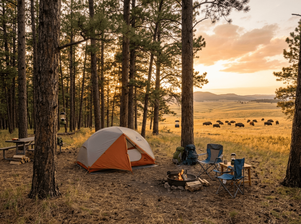
Above ground it is the early morning prairie light — the specific quality of the first sun on mixed-grass prairie, the bison moving through the golden hour with the ponderosa forest behind them and the long shadows of the grasses in the foreground. The Great Plains light that Theodore Roosevelt described as the most beautiful in North America, now falling on a park I was standing close enough to visit and didn’t.
Below ground it is the candlelight on the boxwork — the warm directional light of a candle illuminating a mineral formation that has been growing in the dark for millions of years, casting shadows into the honeycomb cells that electric lighting cannot produce. A formation found in significant quantity nowhere else on earth, seen in the light of a single flame. That is the image that lives specifically and completely underground, available only to the person who books the candlelight tour and goes below.
Two parks. Two different kinds of light. Both waiting in South Dakota for the visit the schedule kept preventing. That visit is coming.
A Deeper Exploration
This article is part of my ongoing project documenting and photographing all 63 national parks across the United States.
Along the way, I’m creating deeper guides that explore photography locations, travel planning, seasonal light conditions, and personal reflections from the road. Wind Cave is the park that got away during the 50 at 60 journey — seen on a map, noted, bypassed. The 63-park project exists partly to correct exactly this kind of near-miss.
Because the map was right. The park was there. It is still there. And the candlelight tour runs every day.
One more thing — just between us.
Wind Cave is already one of the quieter national parks in the system, but the Black Hills region rewards deeper exploration well beyond the park boundary. Three places worth knowing for the visit that takes the time to look around.
Jewel Cave National Monument — about 35 miles northwest near Custer — is the third longest cave in the world and Wind Cave’s geological sibling, with calcite crystal formations that Wind Cave’s boxwork cannot offer. The two caves together tell a more complete story of Black Hills underground geology than either alone, and the Jewel Cave tours are consistently less crowded than Wind Cave’s peak season.
Custer State Park’s Wildlife Loop Road immediately north of Wind Cave is one of the finest wildlife drives in the country — free-ranging bison herds, pronghorn, burros that will approach your vehicle, and the granite formations of the Needles visible to the north. A morning loop through Custer combined with a Wind Cave afternoon is a full-day Black Hills photography circuit that most visitors never assemble.
And the Mammoth Site in Hot Springs — 10 miles south — is the active paleontological excavation where more than 60 mammoths have been uncovered from a 26,000-year-old sinkhole. The excavation is still ongoing and the guided tour puts you on a walkway above the active dig. The photography of exposed mammoth bones in situ, with the paleontologists working around them, is the kind of specific and unrepeatable image that this region produces and that no other national park visit generates. A very small club. Worth joining.