A Photographer’s Return to Tucson — This Time for the Cactus Forest, the Monsoon Light, and the Javelinas
Every photographer eventually builds a list of places they know from work that they want to return to with a camera and no schedule. Tucson is on that list — I lit an event there years ago and came away with a strong sense of the place, the light, the landscape, and the wildlife that moves through it with complete indifference to the humans temporarily occupying the same space. The javelinas specifically. Those compact, bristly, borderline prehistoric animals trotting through the desert vegetation like the Sonoran Desert belongs to them, which it does.
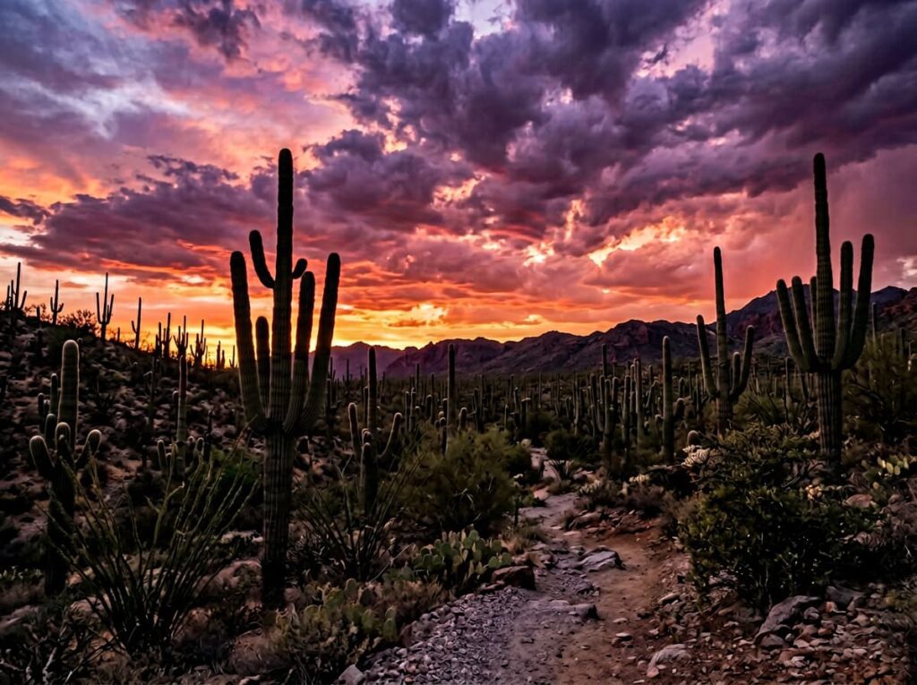
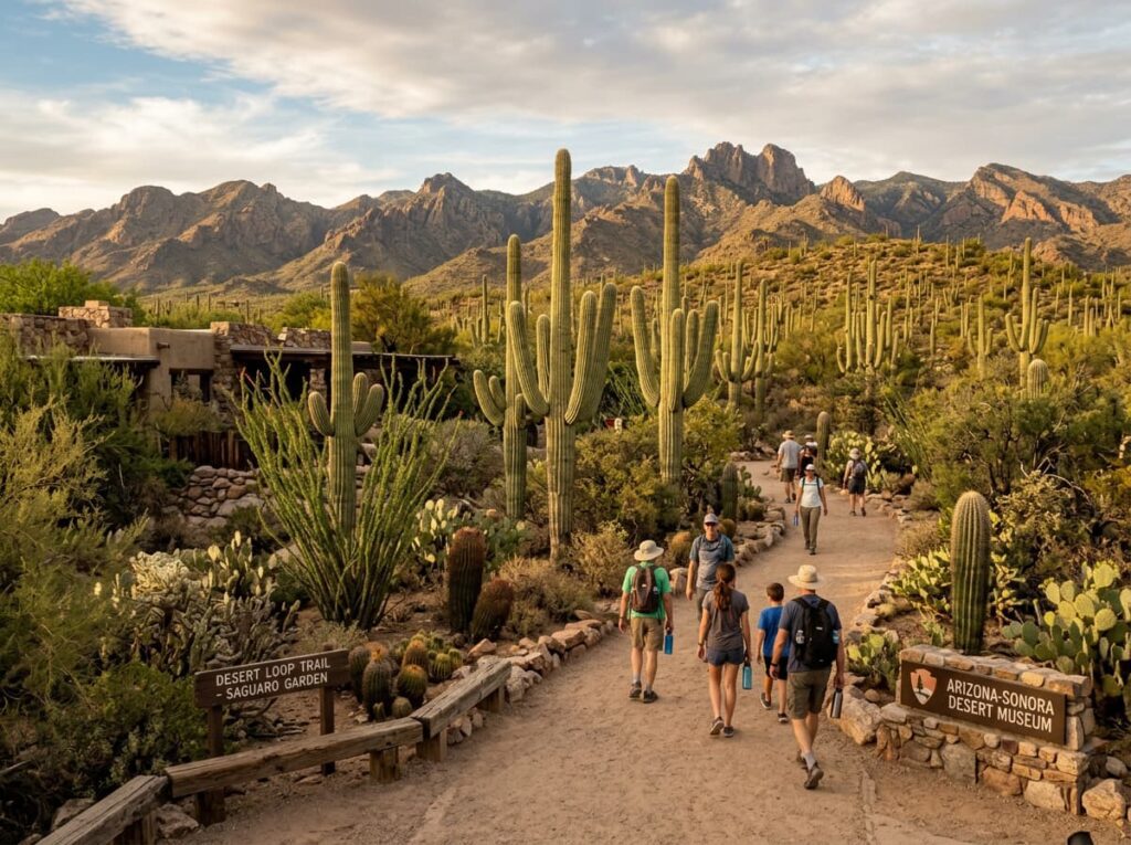
Saguaro National Park brackets Tucson on both sides — the Rincon Mountain District to the east and the Tucson Mountain District to the west, with the city between them and the park essentially surrounding the urban area in a way that makes Saguaro one of the most unusually positioned parks in the system. The saguaro cactus — the tall, multi-armed iconic cactus of the American Southwest that appears in every Western film ever made — grows naturally only in the Sonoran Desert, and the park protects the finest and densest concentrations of mature saguaros in the world. A forest of saguaros at sunset, the arms silhouetted against a monsoon sky — that is the Saguaro National Park image, and the Tucson area delivers it with a regularity and a drama that the park’s urban adjacency cannot diminish.
I have been to Tucson. I have not been to the park properly — on foot, in the cactus forest, with a camera and the time to let the desert show what it does in the right light. The return trip corrects that.
The Landscape That Draws People Here
Saguaro National Park’s two districts protect different elevations and different ecological communities of the same Sonoran Desert landscape. The Tucson Mountain District to the west is the lower, hotter, and more accessible district — the Arizona-Sonora Desert Museum is immediately adjacent, the Bajada Loop Drive winds through dense saguaro forest, and the red rock formations of the Tucson Mountains provide the backdrop for the classic sunset compositions. The Rincon Mountain District to the east is higher — the Rincon Mountains rising to 8,666 feet at Mica Mountain — and contains an elevational transect from the saguaro desert at the base to Douglas fir forest at the summit, the full vertical range of the Sonoran Desert ecological community compressed into a single range.
The saguaro itself is the park’s defining subject and one of the most photographically specific plants in the American landscape. A mature saguaro takes 75 years to grow its first arm and can live 150 to 200 years, reaching heights of 40 feet and weights of several tons. The oldest and largest specimens in the park have been standing since before Arizona was a state. Their forms — the classic two-armed silhouette, the multi-branched elder specimens, the young single-columned plants emerging from the desert floor — are as distinctive and as specifically Sonoran as the giant sequoias are specifically Sierran. The forest they create is unlike any other plant community in the national park system.
The Sonoran Desert wildlife is the park’s most animated photography subject — the javelinas moving through the cactus in small herds, the Gila woodpeckers excavating nest cavities in the saguaro arms, the elf owls nesting in those same cavities at night, the cactus wrens building their nests in the cholla, the desert tortoise moving with geological patience across the desert floor, the roadrunners sprinting between the palo verde and the mesquite. The Sonoran Desert has more species of birds, reptiles, and mammals per square mile than almost any other North American desert, and the park’s two districts between them contain the full range of that community.
The Photographer’s Chase
The monsoon light is the photography condition that elevates Saguaro above every other season and every other weather pattern the park produces. The Arizona monsoon arrives in July and runs through September — afternoon thunderstorms that build over the desert from late morning, producing towering cumulonimbus clouds above the saguaro forest that create the most dramatic sky photography in the Southwest. The specific condition that saguaro photographers plan around is the post-monsoon sunset — the storm passing to the east while the western sky clears, the last sun of the day illuminating the saguaro silhouettes from the west while the storm clouds still present to the east and the sky between them goes every color that sunset photography exists to capture.
The Tucson Mountain District’s Signal Hill and the Bajada Loop Drive provide the sunset positions — elevated enough to see the saguaro forest spread below with the Tucson Mountains behind and the sky above open in the western direction. Signal Hill also has one of the finest petroglyph sites in the park — Hohokam petroglyphs carved into the granite boulders on the hillside, the human history layer that gives the desert landscape its full temporal depth. The petroglyphs in the late afternoon light, with the saguaro forest below and the monsoon clouds building to the east, is the Saguaro image that the pure landscape shots cannot tell.
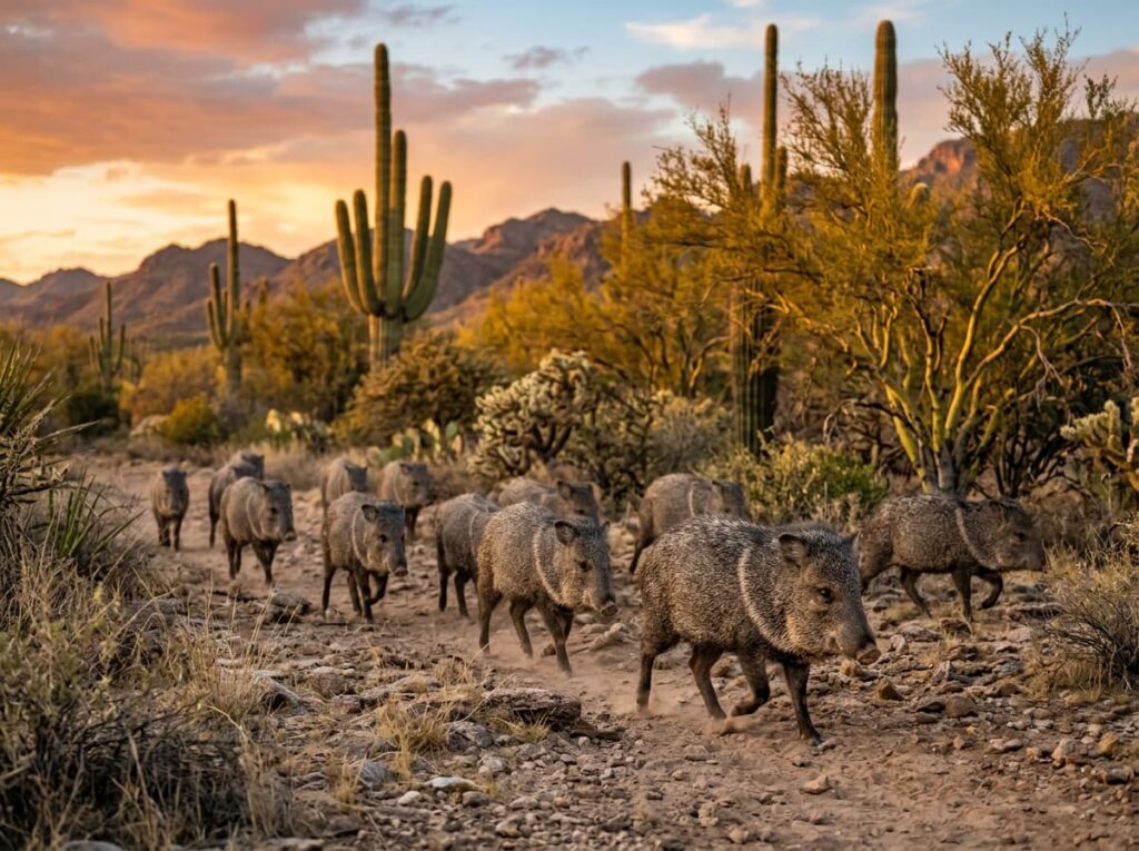
The javelina photography is the early morning and late afternoon subject — the herds move most actively in the cooler hours and are regularly encountered on the desert trails in both districts. A wide-to-moderate zoom from a crouched position at ground level, shooting toward the herd as they move through the cactus, produces the environmental portrait that communicates both the animal and the landscape they inhabit. Javelinas have poor eyesight but an excellent sense of smell — approaching from downwind and moving slowly produces closer encounters than a direct approach.
The saguaro bloom in late April and May is the wildflower event that most photographers who know the park return for specifically — the saguaro flowers open at night and are pollinated by lesser long-nosed bats, with the blooms remaining into the morning hours for insect pollinators. The white flowers at the tip of each saguaro arm, photographed close with a longer lens against the blue morning sky, is the intimate saguaro image that the silhouette shots cannot provide. The Saguaro National Park bloom is not as famous as the Death Valley super bloom but it is as beautiful and considerably more reliable.
Visiting the Park
Saguaro National Park is open year-round and both districts are accessible by car from Tucson — the Rincon Mountain District entrance is about 15 miles east of downtown, and the Tucson Mountain District entrance is about 15 miles west. No timed entry reservations are currently required. The park entrance fee applies to both districts; the America the Beautiful pass covers both.
October through April is the primary season for comfortable outdoor photography — the desert temperatures are moderate, the light quality is at its annual best, and the winter rains produce the wildflower display that peaks in March. The monsoon season from July through September is the most photographically dramatic but also the hottest and the most logistically demanding — the afternoon storms develop quickly and lightning in an open desert with 40-foot steel-reinforced cacti around you is not an abstract concern. Start early, be off the exposed desert by early afternoon, and return for the post-storm sunset.
Tucson International Airport is the natural arrival point — a major airport with direct service from most American hubs, 20 minutes from the Rincon Mountain District entrance. Tucson itself is one of the more underrated cities in the American Southwest — a university town with a genuine food scene, the Arizona-Sonora Desert Museum immediately adjacent to the western park district, and a character shaped by the Mexican border culture and the desert landscape that makes it feel specific and real rather than generic.
Where to Stay
There is no in-park lodging at Saguaro. Tucson provides the full range — from the boutique hotels of the downtown arts district to the resort properties in the Catalina Foothills and the Rincon Valley. The Arizona Inn, a 1930 property in central Tucson, is the most atmospheric — a pink-walled garden hotel that has been hosting guests since the resort era of desert tourism and that communicates the Tucson character in a way the chain hotels cannot. The Hacienda del Sol Guest Ranch Resort in the Catalina Foothills provides the mountain-facing resort experience with Tucson below and the Rincon Mountains visible to the east.
For photographers targeting the sunrise eastern district photography and the sunset western district photography in the same day, a central Tucson location minimizes the commute to both. The Rincon Mountain District’s Mica Mountain trails and the Tucson Mountain District’s Bajada Loop are in opposite directions from the city center but both are within a 20-minute drive. The Arizona-Sonora Desert Museum — a living desert museum that is arguably the finest natural history institution in the Southwest — sits immediately adjacent to the western district and deserves a half-day on its own.
For RV travelers, the Rincon Mountain District has no in-park RV camping. The Gilbert Ray Campground in Tucson Mountain Park, immediately adjacent to the western park district, is the closest camping option — operated by Pima County and accessible to RVs. The Colossal Cave Mountain Park east of Tucson provides additional camping with a historic character and proximity to the eastern district. Tucson’s commercial RV parks serve the full range of hookup needs.
If I Were Planning My First Visit
October — past the monsoon season’s peak heat, the desert cooled to comfortable hiking temperatures, the monsoon storm clouds still occasionally producing the dramatic sky conditions that July and August generate consistently. The light in October in the Sonoran Desert is the low-angle autumn quality that does the most interesting things to the saguaro silhouettes and the red rock of the Tucson Mountains.
The western district at sunset on the first evening — the Bajada Loop Drive, Signal Hill for the petroglyphs in the late afternoon light, the sunset position for the saguaro silhouette against whatever the western sky produces. Early morning on the second day in the eastern district — the Cactus Forest Loop Drive before the day hikers arrive, the javelinas in the first light, the Rincon Mountains catching the alpenglow above the saguaro forest.
And the Arizona-Sonora Desert Museum in the late afternoon of the second day — the living desert museum that puts the park’s wildlife in context and provides the close-range reptile and raptor photography that the desert trails cannot guarantee. The return to a place I know from work, this time with the camera as the primary purpose and the desert as the destination rather than the backdrop. That is the visit the Tucson memory has been waiting for.
The Light I’m Curious About
It is the post-monsoon sunset — the specific condition when the afternoon storm has moved east and the western sky clears while the storm clouds still hang above the Rincon Mountains, and the last direct sun of the day illuminates the saguaro forest from the west in a light that the cloud-filtered desert cannot produce at any other time.
I lit events in Tucson and I understand how the desert light changes through the day — the flat bleaching quality of the midday overhead sun, the way the afternoon angle begins to build shadow and dimension back into the landscape as the sun drops, and then the last twenty minutes when the light goes from warm to gold to the deep orange of a desert sunset that has no equal in the temperate world. The monsoon clouds behind the saguaro silhouettes amplify that light into something that requires no photographic assistance beyond being there and pointing the camera at it.
The javelinas were there when I was working. They will be there when I return with the camera. The desert has been doing this for a long time and it does not particularly care whether a photographer is present for it. That indifference is the invitation.
A Deeper Exploration
This article is part of my ongoing project documenting and photographing all 63 national parks across the United States.
Along the way, I’m creating deeper guides that explore photography locations, travel planning, seasonal light conditions, and personal reflections from the road. Saguaro is the park that completes the Tucson connection — a place I knew from work, returning to as a photographer with the time and the intention that the event schedule did not allow. The desert was always there. Now I get to photograph it.
Because the saguaro cactus grows naturally only in the Sonoran Desert, the Sonoran Desert exists only in southern Arizona and northwestern Mexico, and Saguaro National Park protects the finest concentration of mature saguaros on earth. The landscape is specific. The light is extraordinary. And the javelinas are still trotting through it with complete indifference to anyone watching.
One more thing — just between us.
Saguaro’s accessibility from Tucson means it sees significant day visitor traffic at the popular sunset positions — but a few moves put you in the cactus forest with considerably more room.
The Hugh Norris Trail in the western district — a 9.8-mile round trip climbing to Wasson Peak at 4,687 feet — provides the elevated perspective on the saguaro forest below that the Bajada Loop cannot and is consistently less crowded than the roadside positions. The view from the summit at sunset, with the saguaro forest spreading to the valley floor below and the Tucson lights beginning to appear, is the park panorama most day visitors never find.
For the Rincon Mountain backcountry that most eastern district visitors never enter, the Manning Camp trail system climbs through four ecological zones from the desert floor to the Douglas fir forest above 8,000 feet — a two-day backpacking trip that produces the complete Sonoran Desert elevational story from saguaro to alpine.
And for the broader Tucson experience that extends the park visit into genuine Southwest immersion, the Barrio Viejo neighborhood in downtown Tucson — the historic adobe neighborhood immediately south of downtown with painted buildings, Mexican street art, and the James Turrell Roden Crater visible on clear nights — is the Tucson character photography that the desert trails cannot provide. The city that brackets the park is worth exploring on its own terms.