A Photographer’s First Look at Washington’s Alpine Wilderness — the Park That Was East of Where I Was Headed
Every photographer eventually builds a list of landscapes they drove away from. North Cascades National Park is on that list — east of Seattle, east of where I was headed when I flew into Washington to begin the 50 at 60 journey, east of the Pacific coast and Olympic that pulled me westward on that first trip. I could see the Cascade Range from the highway. I turned left instead of right and never made it.
The research I have done since has made that missed turn feel increasingly significant. North Cascades is one of the most dramatic mountain landscapes in the national park system — more glaciers than any other park in the contiguous United States, peaks rising to over 9,000 feet in jagged forms that the older, more eroded ranges of the Rockies cannot match, and a Pacific Northwest moisture regime that drapes the lower valleys in a density of temperate rainforest that Olympic’s coastal character cannot fully replicate. It is the American Alps, in a state I started my journey in, in a park I drove away from.
The return trip corrects that. And everything I have seen of this park in photographs suggests the correction is long overdue.
The Landscape That Draws People Here
North Cascades National Park covers 504,000 acres of the Northern Cascades in northwestern Washington — a landscape of jagged granite peaks, over 300 glaciers, and deep river valleys that the Pacific moisture system fills with one of the most complex and diverse temperate ecosystems in North America. The park is managed as the North Cascades National Park Complex, which includes Ross Lake National Recreation Area and Lake Chelan National Recreation Area — three units together covering nearly 700,000 acres of the most remote mountain terrain in the contiguous United States.
The North Cascades Highway — Washington State Route 20 — crosses the park from west to east through the Skagit River valley, climbing over Washington Pass at 5,477 feet before descending to the drier eastern slopes. This is the park’s primary access corridor and one of the great scenic drives in the Pacific Northwest — the valley walls rising thousands of feet on both sides, the Picket Range visible to the north, the Colonial and Pyramid peaks flanking the road near Diablo Lake. The highway is closed from late November through April when the passes fill with snow; the full crossing is possible only from late spring through early fall.
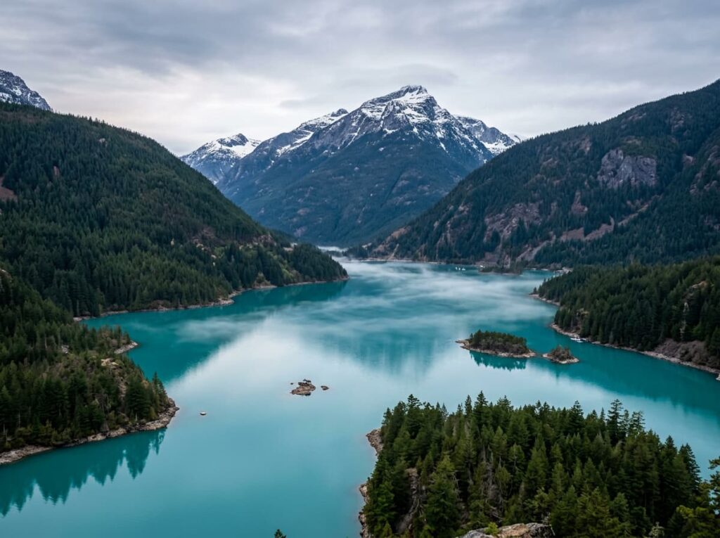
Diablo Lake is the visual centerpiece of the accessible park — a reservoir whose extraordinary turquoise color is produced by glacial flour suspended in the water, the same phenomenon that colors the lakes of the Canadian Rockies and the Alaska backcountry. The Diablo Lake Overlook, directly off Highway 20, provides the postcard view — the turquoise water, the forested ridgelines, the Colonial Peak and the surrounding summits. It is one of the most reliably stunning roadside overlooks in the Washington state park system and it is essentially unknown outside the Pacific Northwest.
The Photographer’s Chase
The Diablo Lake photography is the accessible starting point — the overlook is roadside and the turquoise color is present from spring snowmelt through fall, when the glacial flour concentration is highest. Morning light from the east illuminates the lake surface and the surrounding peaks simultaneously, and the pre-dawn drive to the overlook — in position before the first light hits the peaks — produces the alpenglow-above-turquoise-water composition that is the park’s most immediately compelling image. The afternoon light from the west illuminates the western faces of the Colonial and Pyramid peaks across the lake, producing a different and equally strong composition with the lake as foreground.
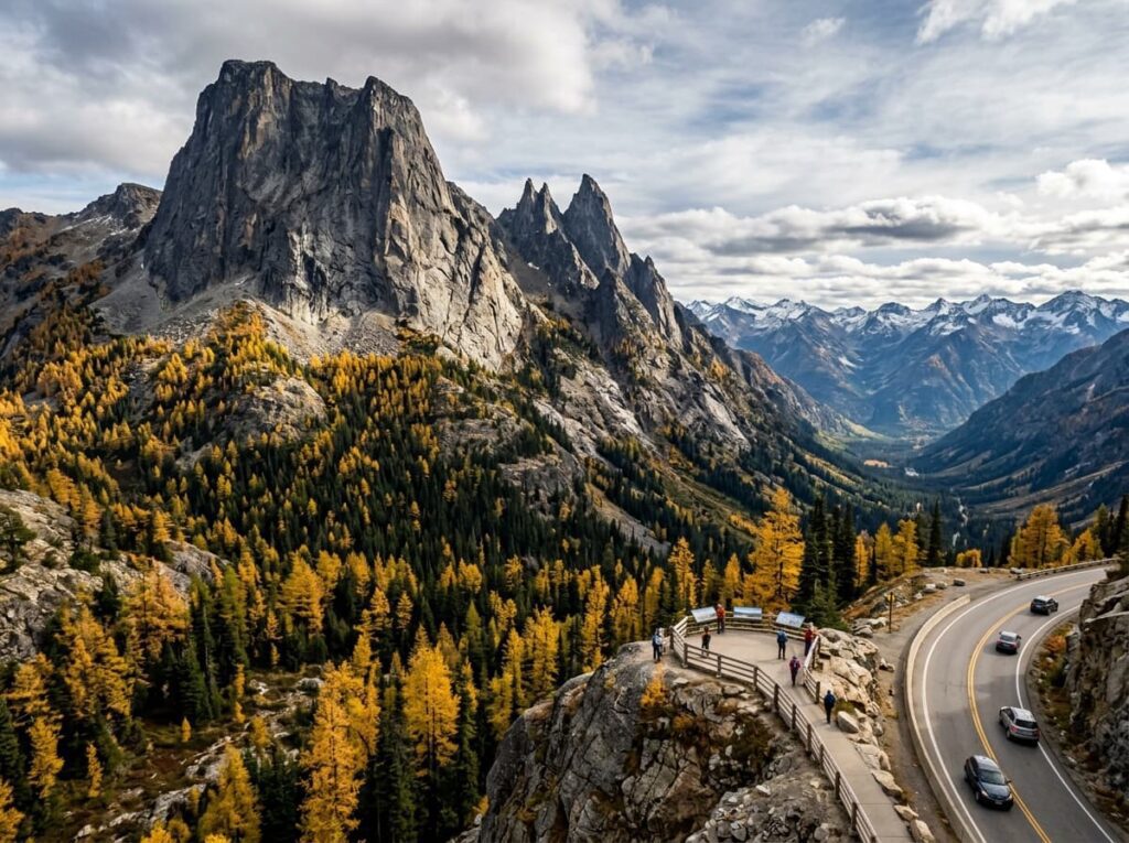
Washington Pass Overlook, at the top of the highway crossing, provides the most dramatic mountain vista accessible by road — the sheer east faces of Early Winters Spires and Liberty Bell Mountain rising directly above the overlook, the Methow Valley dropping away to the east. The October color in the larch trees that populate the eastern slopes near the pass is one of the Pacific Northwest’s most dramatic fall photography events — the western larch, the only deciduous conifer in the region, turns bright gold in October against the dark green of the surrounding evergreen forest and the gray granite of the peaks above.
The backcountry is where the North Cascades reveals its full character — the Cascade Pass trail, a 7.4-mile round trip climbing to a high alpine saddle with views of the Pelton Basin and the Quien Sabe Glacier below, is the most accessible serious backcountry hike in the park and the position from which the glaciated peaks that define the North Cascades are most comprehensively visible. The morning light on the Cascade Pass cirque, with the glaciers visible above and the valley floor thousands of feet below, is the photograph that communicates why this park is considered the American Alps.
The boat tour on Diablo Lake — operated by Seattle City Light, which manages the dams that created the reservoir — provides water-level access to the lake and the surrounding peaks with a naturalist guide who contextualizes the geology and the ecology. For photographers, the water-level perspective on the turquoise lake and the surrounding peaks is completely different from the overlook above, and the tour’s access to the Ross Lake area above Diablo Dam opens the longer reservoir and the more remote mountain terrain beyond.
Visiting the Park
The North Cascades Highway — the primary access route — typically opens in late April and closes in November, with the exact dates varying by snowpack and weather. The full highway crossing from west to east is one of the park’s primary visitor experiences; driving it in both directions over two days, with overnight stops at the campgrounds in the Skagit River valley, provides the most complete above-road sense of the park’s character.
July through October is the primary season. July and August bring the subalpine wildflower bloom on the Cascade Pass and other high-elevation trails. October is the larch color month — the specific two-to-three-week window when the western larch turns gold on the eastern slopes near Washington Pass. The larch color combined with the October low-angle light and the first dusting of snow on the higher peaks makes October the finest photography month in the park by most accounts, and the shoulder season crowds are dramatically lower than the summer peak.
No timed entry reservations are currently required for highway access. The Cascade Pass trailhead parking fills on summer weekends; early arrival is essential. The park’s backcountry requires permits for overnight travel, available through recreation.gov. Cell service is essentially absent through most of the park corridor; download offline maps before entering.
Where to Stay
There is no traditional hotel lodging inside the national park units. The Ross Lake Resort — accessible only by boat or float plane, floating on Ross Lake behind Ross Dam — is the most unusual lodging option in the park complex, a collection of floating cabins on the reservoir with the North Cascades peaks above and no road access. It books out well in advance for summer season and provides an isolation and an intimacy with the lake landscape that the highway corridor cannot replicate.
Stehekin, at the head of Lake Chelan in the Lake Chelan National Recreation Area, is accessible only by ferry or floatplane from Chelan and provides a remote valley community experience — a handful of permanent residents, a small lodge, and trails into the surrounding wilderness. The Stehekin valley in the fall color, accessible by the passenger ferry from Chelan, is a backcountry photography destination that most Pacific Northwest visitors never reach.
The gateway communities along Highway 20 — Marblemount and Concrete on the western side, Winthrop and Twisp on the eastern side — provide the full range of lodging close to the park. Winthrop, on the eastern slope in the Methow Valley, is a western-themed small town with a strong independent lodging and dining scene and direct access to the October larch color on the eastern slopes. For RV travelers, Colonial Creek Campground on the shore of Diablo Lake is the prime in-park camping position — water-level access to the turquoise lake and the evening and morning light on the surrounding peaks.
If I Were Planning My First Visit
October. The larch color, the low-angle autumn light, the first snow on the high peaks, and the crowds thinned to the serious visitors who understand what this month delivers. Based in Winthrop on the eastern side for the Washington Pass larch photography, with a full day drive of the highway from east to west stopping at every overlook.
The Diablo Lake Overlook before sunrise on the first morning — in position before the alpenglow begins on the peaks above the turquoise water. The Washington Pass Overlook in the afternoon for the sheer east faces of the spires in the late light with the larch gold below. The Cascade Pass trail on the second day — early start, in the high alpine saddle before the clouds build.
And the drive itself, both directions, at different times of day — the North Cascades Highway as a photography subject rather than just a transit route. The valley walls, the river below, the peaks appearing and disappearing as the road climbs and descends. Washington was the first state of the 50 at 60 journey. North Cascades is the part of it I still owe a visit. The right turn I did not make is still there, waiting.
The Light I’m Curious About
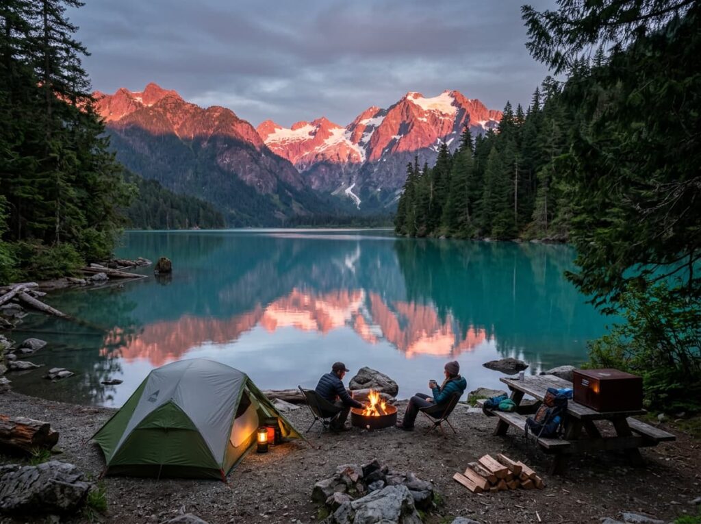
It is the October morning light on Diablo Lake — the specific combination of the turquoise glacial flour water, the gold of the larch trees on the surrounding slopes, and the first snow dusting on the higher peaks, all in the low-angle October light that builds the most shadow and dimension into the mountain faces.
That three-way color combination — turquoise water, gold larch, white snow on dark granite — exists for approximately two to three weeks each October in the North Cascades. The larch peak moves slightly from year to year with the temperature. The first snow timing is unpredictable. The turquoise of the lake is present throughout the season. The window when all three align is the North Cascades October photograph that photographers who know this park plan their trips around.
I turned left out of Seattle on the 50 at 60 journey and headed for Olympic. North Cascades was east, waiting. It has been waiting since. The right turn is overdue.
A Deeper Exploration
This article is part of my ongoing project documenting and photographing all 63 national parks across the United States.
Along the way, I’m creating deeper guides that explore photography locations, travel planning, seasonal light conditions, and personal reflections from the road. North Cascades is the park that Washington was hiding behind Olympic — equally extraordinary, less famous, and waiting for the photographer who finally makes the right turn.
Because the American Alps are in Washington State, east of Seattle, on a highway that closes in November. The larch turns gold for three weeks in October. Some right turns are worth taking even when they are years late.
One more thing — just between us.
North Cascades already sees far fewer visitors than Olympic or Rainier, but the highway corridor concentrates the ones who do come at the overlooks and campgrounds along Route 20. Here are three places worth knowing when you want the North Cascades experience with even more solitude.
Maple Pass Loop — a 7-mile loop from the Rainy Pass trailhead on Highway 20 — is consistently ranked among the finest fall hikes in Washington and delivers the larch color at its most concentrated, above Lake Ann and around the Maple Pass ridge, with views of the surrounding peaks that the highway overlooks cannot match. The trail is more popular than most in the area but still incomparably quieter than anything at Rainier or Olympic.
For the remote lake experience that most highway visitors never reach, Ross Lake — the long reservoir stretching north from Ross Dam toward the Canadian border — is accessible by trail or by water taxi from the Diablo Lake area and provides the most remote lake photography in the park complex. The North Cascades peaks above Ross Lake, seen from a kayak or canoe on the water surface, are the inside-the-wilderness composition that the highway cannot provide.
And the Methow Valley on the eastern slope — the sun-drenched valley below the Cascades rain shadow — is the counterpoint landscape to the wet western side. Winthrop and the valley in October, with the ponderosa pine forest going gold and the Cascades rising to the west, is a completely different Washington than the one most visitors experience and the quieter side of the park that October larch photographers know well.