A Photographer’s First Look at Alaska’s Grand Scale — Where the Ice Is Larger, the Fjords Are Longer, and Time Moves at a Geological Pace
Some landscapes become part of our imagination through comparison. Glacier Bay National Park entered mine through Kenai Fjords — the Alaska park where a spontaneous boat tour became one of the most memorable experiences of my 50 at 60 journey. The tidewater glaciers calving into the fjord. The puffins on the sea stacks. The humpback whales surfacing close enough to feel the water move. If Kenai Fjords could produce all of that from a last-minute ticket at the Seward harbor, what might Glacier Bay — larger, more remote, more deliberately planned — produce with proper intention and preparation?
The comparison is instructive and the distinction is worth understanding before arrival. Kenai Fjords is intimate and accessible — a boat tour from a working harbor town, the glaciers visible within hours of leaving the dock, the wildlife concentrated in productive waters close to shore. Glacier Bay operates at a different scale entirely. The bay itself is 65 miles long. The tidewater glaciers at its upper end are among the largest accessible by boat in North America. The park covers 3.3 million acres — larger than the entire state of Connecticut — and most of it is wilderness that no road touches and very few people ever enter.
The other thing worth understanding about Glacier Bay before arrival is its geological youth. In 1750, the entire bay was covered by a single massive glacier — the Grand Pacific Glacier, which filled the bay to a depth of 4,000 feet and extended to the coast. By 1780, the ice had begun retreating. By 1916, it had pulled back 65 miles to where it sits today near the bay’s head. The retreat of the Glacier Bay glaciers is the fastest documented glacial retreat in recorded history, and what exists now — the 65-mile bay, the fjords, the newly exposed rock walls still being colonized by plants — is a landscape that did not exist 250 years ago. Standing at the face of the Grand Pacific or the Margerie Glacier is not just looking at ice. It is watching the world being remade.
The Landscape That Draws People Here
Glacier Bay National Park and Preserve occupies the northwestern corner of the Alaska Panhandle, accessible only by air or water from Juneau — there are no roads connecting the park to the outside world. The town of Gustavus, at the bay’s entrance, has a small airport with service from Juneau and a handful of lodges; the Glacier Bay Lodge at Bartlett Cove, inside the park, is the only in-park lodging. Beyond Bartlett Cove, the bay extends 65 miles to the northwest into two arms — the West Arm, ending at the Johns Hopkins and Margerie glaciers, and the East Arm, ending at the McBride and Riggs glaciers. All of it is accessible by the park’s concessionaire boat tour, by private vessel, or by kayak for those with the skills and equipment to paddle a glacial fjord.
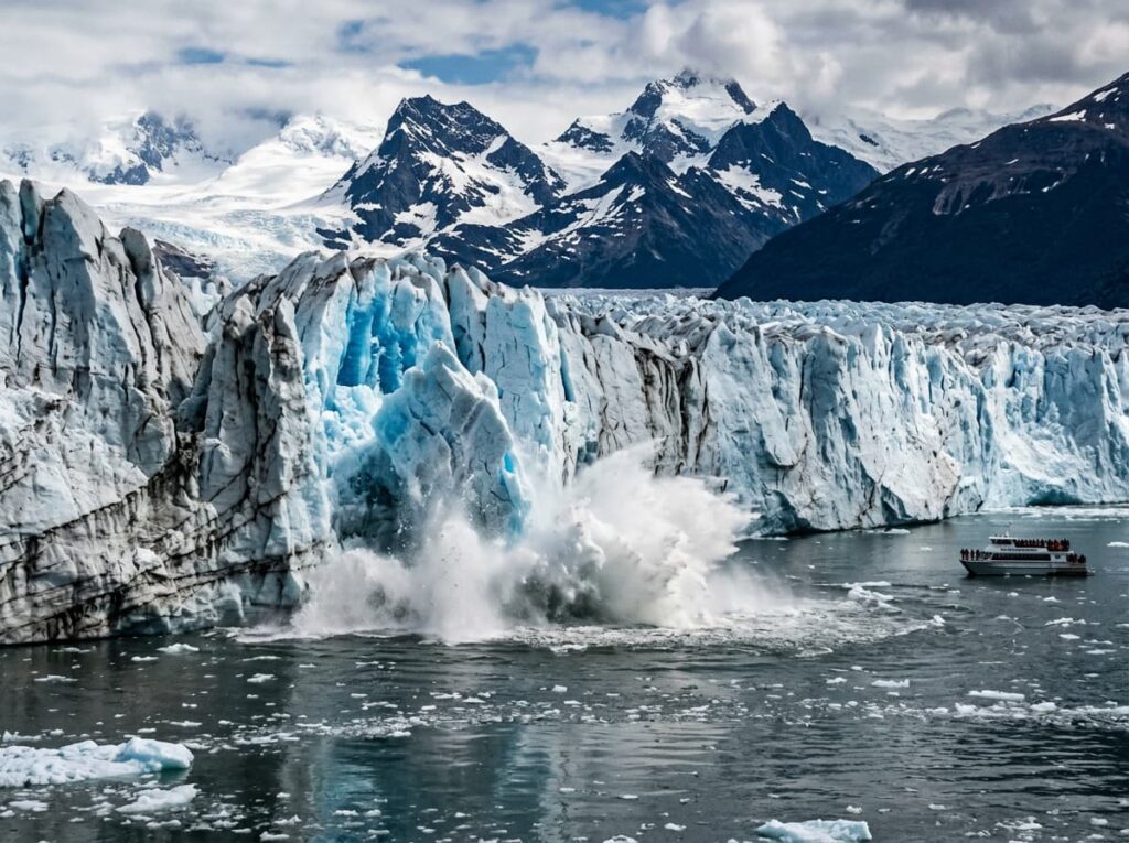
The Margerie Glacier is the park’s most visited tidewater glacier — a mile-wide, 250-foot-tall wall of ice at the head of the West Arm that calves continuously into the bay below. The sound of the calving — the deep crack of the ice fracturing, followed by the boom of the ice mass entering the water, followed by the wave that rocks the boat — is the defining sensory experience of the park. The blue of the deep glacial ice at the calving face, where the ice is dense enough to absorb all wavelengths of light except blue, is a color that photographs consistently fail to capture and that visitors consistently describe as the most remarkable thing they saw.
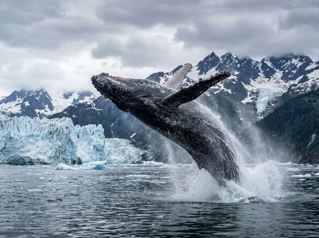
The wildlife of Glacier Bay concentrates in the productive waters of the bay — humpback whales feeding on krill and small fish in the nutrient-rich glacial runoff, orca pods moving through the bay, harbor porpoises, Steller sea lions on the rocky outcroppings, harbor seals hauled out on ice floes near the glacier faces. Brown bears walk the beaches at low tide. Mountain goats navigate the cliff faces above the waterline. Bald eagles are present throughout the bay at densities that Alaska produces and the lower 48 cannot. The wildlife photography from a boat in Glacier Bay is among the most productive in the national park system — the open water sightlines, the wildlife density, and the dramatic backdrop of the glaciated peaks produce images in combination that individual subjects alone cannot.
The Photographer’s Chase
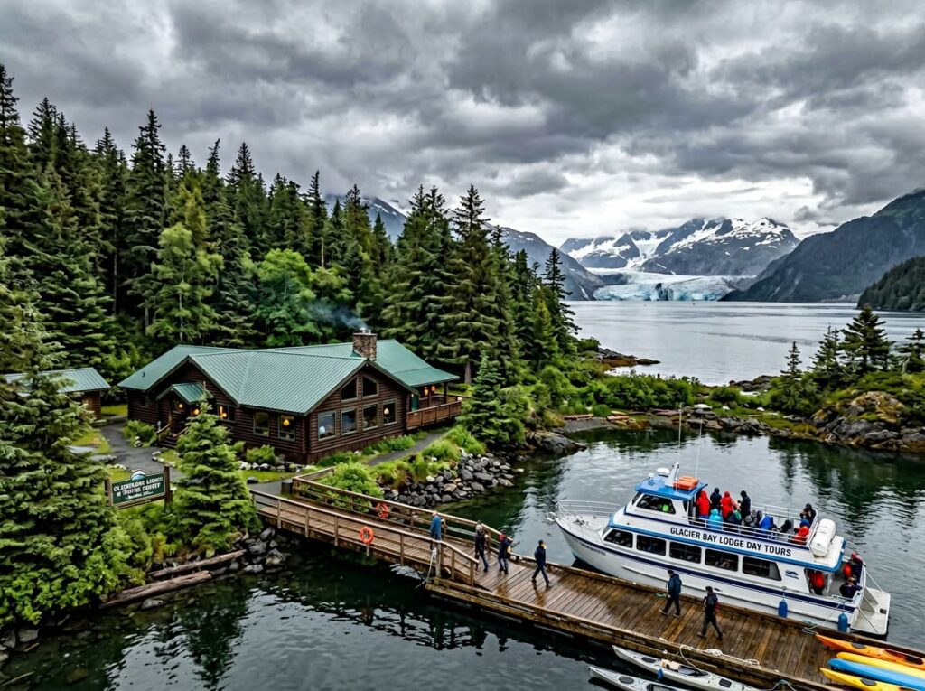
The day boat tour from Bartlett Cove — an eight-hour round trip to the upper bay glaciers operated by Glacier Bay Lodge — is the access mechanism for most visitors and provides the full upper bay experience: the two arms, the major glacier faces, the wildlife of the bay in sequence. For photographers, the boat positions itself at the glacier faces and holds for extended periods — the calving photography requires patience and a fast shutter speed, as the ice drops without warning and the sequence from fracture to splash to wave takes only seconds. A 400mm or longer lens is the practical minimum for glacier face detail shots from the boat; a wide angle captures the scale but loses the blue ice detail that makes the calving photography specific.
The overcast light that Pacific Alaska produces with regularity is the best condition for glacier face photography — the diffused light eliminates the harsh contrast between the bright ice and the dark rock walls that direct sun creates, and reveals the blue of the deep ice in the calving faces more accurately than sunny conditions can. The same overcast that would disappoint a landscape photographer elsewhere is the ideal glacier photography condition at Glacier Bay. Arrive expecting Pacific weather and let it work for you rather than against you.
The kayaking is the photography experience that the boat tour cannot provide — water level, in the silence of a glacial fjord, approaching the ice at a pace that allows compositional decisions rather than the boat’s predetermined positions. Multi-day kayak camping in the upper bay requires a backcountry permit, advance planning, and genuine paddling experience in cold-water conditions. It is not an entry-level undertaking. But the photographs from kayakers who have camped at the glacier faces — the ice at dawn, the calving from water level, the wildlife approaching a kayak with the curiosity that a silent vessel produces — are the images that define what Glacier Bay actually is for the people who go deepest into it.
The Bartlett Cove area near the lodge provides the accessible above-water photography — forest trails through the temperate rainforest, the beach walk where brown bears are regularly seen at low tide, and the tidal flats where the bird life concentrates during the migration periods. The intertidal zone at Bartlett Cove in the early morning, with the Fairweather Range visible to the northwest on clear days, is the establishing Glacier Bay landscape photography that contextualizes the scale of everything further up the bay.
Visiting the Park
Getting to Glacier Bay requires flying to Juneau — Alaska Airlines serves Juneau from Seattle with connections to most major US cities — and then either flying the 50 miles to Gustavus on a small commuter aircraft or taking the high-speed ferry that operates seasonally. The Gustavus airport has service from Juneau on Alaska Airlines and several small carriers; the flight takes about 20 minutes and the approach over the bay on clear days is the first photography opportunity of the trip.
The primary season runs from late May through September, when the lodge and the day boat tour operate and the upper bay is navigable. The park is technically open year-round but winter access is limited to those with the equipment and experience for cold-weather Alaska wilderness travel. June through August is the peak season; late May and September provide meaningful crowd reduction without sacrificing access. The day boat tour should be booked in advance through the park concessionaire at visitglacierbay.com — tours fill for peak season weeks ahead.
Vessel quotas limit the number of private boats permitted in the upper bay on any given day — private vessel operators must obtain a permit through the park, available at nps.gov/glba. The quota system protects the wildlife and the experience quality; it also means that the upper bay on any given day has a finite and relatively small number of boats, contributing to the wilderness character that larger, less controlled parks cannot replicate.
Where to Stay
Glacier Bay Lodge at Bartlett Cove is the only in-park lodging and the practical center of the visitor experience — the day boat tour departs from the lodge dock, the park visitor center and ranger programs are adjacent, and the trails through the temperate rainforest begin at the lodge. The lodge is modest by resort standards but the location is everything — at the edge of a wilderness that no road touches, with the bay visible from the dining room and the forest beginning at the back door. It operates from late May through mid-September and books out for peak season well in advance.
Gustavus, the small community at the bay entrance, has several independent lodges and bed and breakfast properties — the Gustavus Inn is the most established, a working farm and lodge that has been hosting Glacier Bay visitors for decades and produces the kind of home-cooked dinner that a day on the water in Alaska makes feel like the finest restaurant meal you have ever had. The inn’s owners are a resource for local knowledge about the bay, the wildlife, and the conditions that no guidebook can substitute for.
There is no RV access to Glacier Bay — no road connects Gustavus to the outside world and no vehicle ferry serves the community. This is a fly-in destination in the truest sense. The Bartlett Cove Campground provides the in-park camping experience — tent camping in the temperate rainforest, a short walk from the lodge and the boat dock, with bear boxes required and bear awareness essential. Backcountry camping in the upper bay requires a permit and the skills and equipment for remote Alaska wilderness camping.
If I Were Planning My First Visit
Kenai Fjords taught me that Alaska’s boat tours reward the person who books in advance and shows up ready to work — camera accessible, lens already on, expectations calibrated to the weather the Pacific delivers rather than the weather one hopes for. Glacier Bay gets the same approach with more preparation time and a longer itinerary.
Three nights minimum — two at Glacier Bay Lodge and one at the Gustavus Inn for the local knowledge dinner conversation that sets up the experience. The day boat tour on the first full day — the full upper bay circuit, both arms, the Margerie Glacier face, the wildlife in between. Overcast preferred. The calving in the overcast light is the glacier photography that the sunny-day postcard cannot match.
The Bartlett Cove beach walk at low tide on the second morning — the brown bears, the intertidal zone photography, the Fairweather Range on the northwest horizon if the weather allows. And the kayak, if the skill level and the confidence with cold Pacific water are present — even a half-day paddle in the lower bay, in the silence of a glacial fjord, produces the water-level perspective that the boat tour cannot.
Kenai Fjords was a last-minute ticket that became a highlight of the season. Glacier Bay gets the advance planning it deserves. Same Alaska ice, different scale, different intention. I am looking forward to finding out what the larger version looks like.
The Light I’m Curious About
It is the blue of the deep glacier ice at the calving face — the specific color that appears where the ice is old enough and dense enough to have compressed all the air bubbles out and absorbed every wavelength of light except blue.
I saw this color at Kenai Fjords from the boat tour deck and I photographed it imperfectly — the scale was right but the light was flat and the distance was greater than my lens wanted. Glacier Bay gets a longer lens, a better understanding of what overcast does for the color, and the patience to wait at the glacier face until the light and the calving align in the same frame.
The ice at the Margerie Glacier face is 250 feet tall. It is moving. It has been moving for longer than any photograph of it has existed. The color it produces in the calving fractures — that deep, impossible blue — is the light that the glacier makes itself, from the physics of ancient compressed ice interacting with the wavelengths of the Pacific sky. That is the image Glacier Bay has been producing since before anyone was there to photograph it. I intend to be there when it produces it next.
A Deeper Exploration
This article is part of my ongoing project documenting and photographing all 63 national parks across the United States.
Along the way, I’m creating deeper guides that explore photography locations, travel planning, seasonal light conditions, and personal reflections from the road. Glacier Bay is the second Alaska ice park in this series after Kenai Fjords — the larger, more remote, more deliberately planned version of the Alaska glacier experience that the spontaneous Seward boat ticket introduced. Kenai Fjords showed me what Alaska ice was. Glacier Bay is where I go to understand it properly.
Because the bay did not exist 250 years ago. The glaciers retreated 65 miles and left this behind. Whatever is here now — the fjords, the wildlife, the calving ice — is a gift from geological processes that operate without any awareness of photographers waiting at the bow of a tour boat. Being there for it is the whole plan.
One more thing — just between us.
Glacier Bay’s remoteness is its own crowd filter — the logistics of getting here keep the visitor numbers low by national park standards. The insider tip is about extending the southeast Alaska experience beyond the bay itself, because this corner of Alaska rewards the visitor who looks around.
Mendenhall Glacier in Juneau — accessible by bus from downtown Juneau — is one of the most accessible glaciers in Alaska and provides the close-range ice photography and the glacier lake that Glacier Bay’s boat tour cannot match for proximity. The ice caves in the glacier’s face, accessible by guided tour in winter, are one of the most extraordinary interior ice photography subjects in Alaska.
For the Alaska rainforest experience that complements the bay’s marine character, Tongass National Forest — the largest national forest in the United States, surrounding virtually all of southeast Alaska — provides old-growth Sitka spruce and western hemlock forest photography at a scale that the temperate rainforests of the lower 48 cannot approach. The forest along the road systems accessible from Juneau is the terrestrial counterpoint to the marine wilderness of the bay.
And for the complete southeast Alaska experience, a night in downtown Juneau — the only US state capital inaccessible by road, surrounded by the Tongass and the Gastineau Channel — is a genuinely interesting small city with independent restaurants, a gold rush history, and the particular character of a place that the highway system never reached. Worth an evening and a camera before the flight to Gustavus.