A Photographer’s First Look at Utah’s Forgotten National Park — and the 100-Mile Wrinkle in the Earth That Most People Drive Past
Every photographer eventually builds a list of landscapes they cannot believe they have not yet visited. Capitol Reef National Park sits near the top of mine — and the fact that it sits between Bryce Canyon and Arches on the Utah national parks circuit, two parks I have written about in this series, makes the gap feel more conspicuous than it should.
Capitol Reef is the middle child of the Utah parks — less famous than Zion and Bryce to the southwest, less visited than Arches and Canyonlands to the east, consistently overlooked in favor of its more celebrated neighbors. Most visitors to southern Utah drive Highway 24 through the park without stopping, catching a glimpse of the Waterpocket Fold from the road and continuing toward whichever more famous park is on the itinerary. This is a mistake.
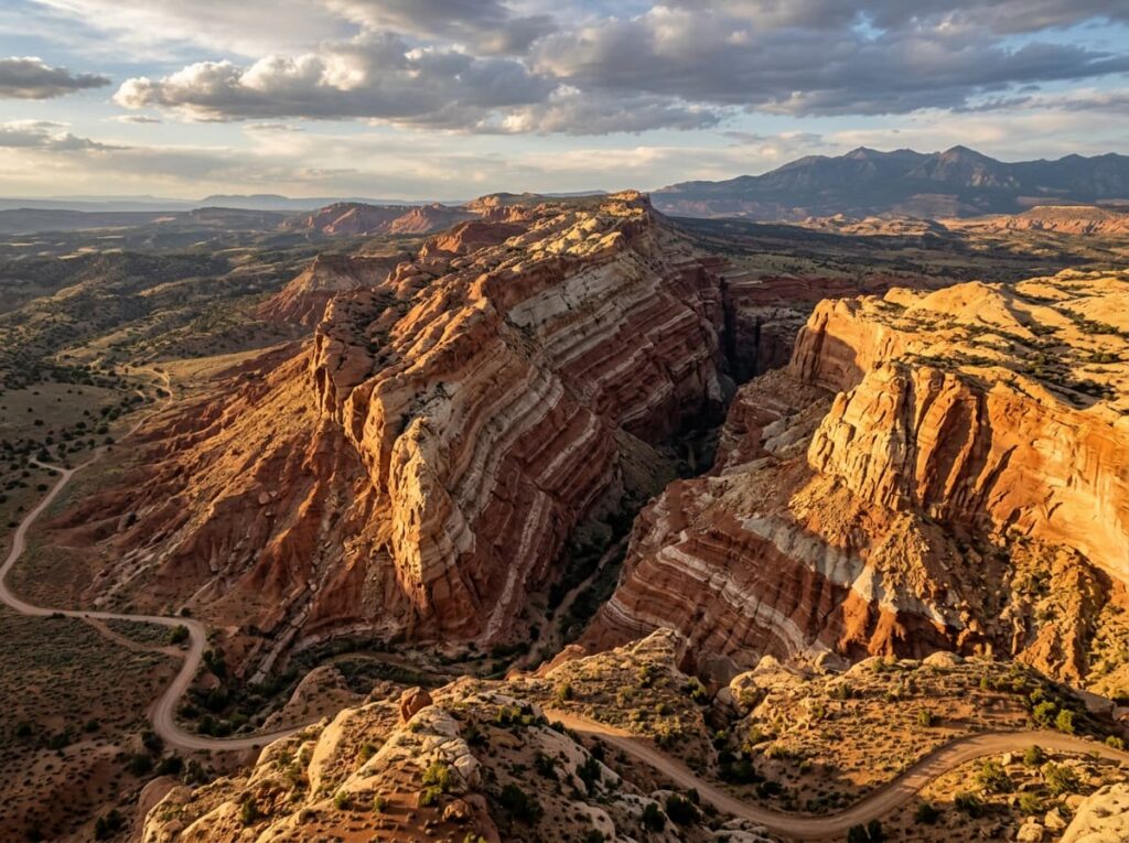
The Waterpocket Fold — the geological feature that defines Capitol Reef — is a 100-mile long monocline, a wrinkle in the earth’s crust where rock layers that were once flat have been tilted and exposed in a nearly continuous ridge running north to south across the Colorado Plateau. It is one of the most dramatic examples of a monocline in North America, and the cross-section of geological time it exposes — layers of sandstone, shale, and limestone representing hundreds of millions of years of deposition — produces a color palette and a landscape complexity that the more visited Utah parks do not. The Waterpocket Fold is the reason this park exists. Understanding it before you arrive changes everything you see when you get there.
The Landscape That Draws People Here
Capitol Reef takes its name from two features — the white Navajo sandstone domes that early settlers thought resembled the dome of the US Capitol, and the reef-like barrier the Waterpocket Fold presented to 19th-century travel across southern Utah. The park is long and narrow, following the fold for nearly its full 100-mile length, with the main visitor area concentrated around the small historic community of Fruita in the center. The Fremont River runs through Fruita, watering a historic orchard of apple, peach, pear, and cherry trees planted by Mormon settlers in the 1880s — one of the more unusual visitor experiences in the park system, where visitors are welcome to pick and eat fruit in season as a living connection to the agricultural history of the settlement.
The park divides into three geographic sections. The northern district, accessed from Highway 24 and the park’s main road, contains the Fruita historic district, the Capitol Gorge, the Grand Wash, and the iconic Capitol Dome formation. The southern district, accessible via Notom-Bullfrog Road — a partially paved, partially dirt road running the length of the fold’s eastern face — provides access to the Strike Valley Overlook and the Cathedral Valley, the most remote and most dramatic sections of the park. The northern district is where most visitors spend their time; the southern and northern extremes are where the park reveals itself most completely.
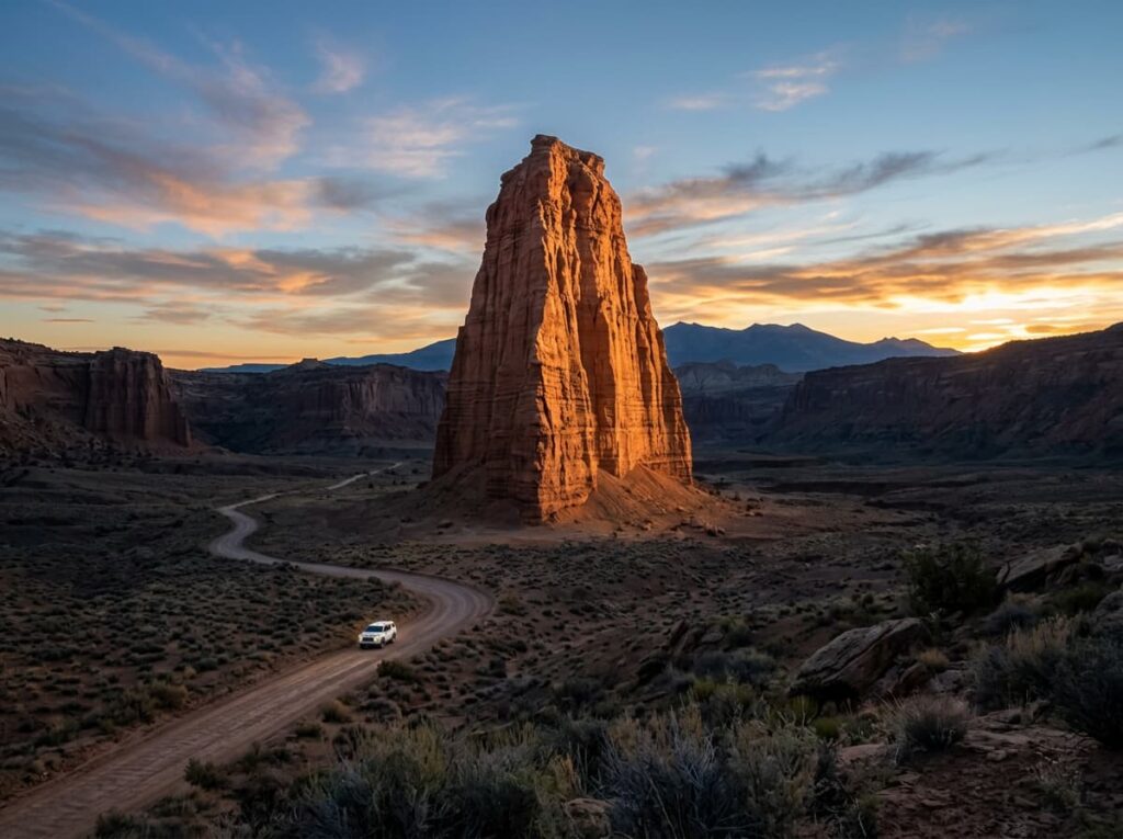
Cathedral Valley, at the park’s northern extreme, is the subject that most serious Capitol Reef photographers prioritize — a remote valley containing enormous sandstone monoliths called the Temples of the Sun and Moon, rising from the valley floor in isolated formations that produce one of the most dramatic sunrise photography subjects in the Utah parks system. Access requires a high-clearance vehicle and a dirt road crossing the Fremont River — conditions that filter out casual visitors and reward those who come prepared with a genuine solitude and a landscape that most national park visitors never reach.
The Photographer’s Chase
Capitol Reef is one of the least photographically crowded of the major Utah parks — the overlooks that draw shoulder-to-shoulder photographers at Arches and Bryce are largely absent here, and the park’s primary photography subjects reward the visitor who is willing to do a little more driving and a little more hiking than the main road requires. That combination of strong subjects and manageable crowds makes it one of the most genuinely rewarding parks in the Utah circuit for a photographer with the time to explore.
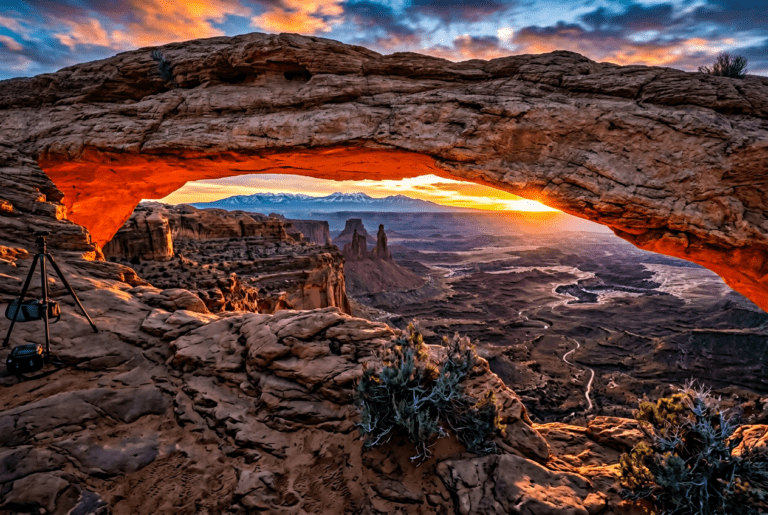
The Hickman Bridge trail — a 2-mile round trip from the Highway 24 trailhead — reaches a natural sandstone bridge 133 feet wide, framing the Capitol Dome and the Fremont River canyon below. The morning light from the east illuminates the bridge face and the canyon below simultaneously, and the position beneath the bridge looking up through the span produces the scale composition that communicates how the bridge relates to the landscape it spans. This is the Capitol Reef photograph most people come for — accessible, rewarding, and consistently less crowded than its counterparts at Arches.
The Goosenecks Overlook, a short walk from a parking area on Sulphur Creek Road, provides one of the most dramatic river meander views in the Southwest — the Sulphur Creek making a series of tight bends 800 feet below the overlook rim, the cream and red canyon walls reflecting in the creek surface far below. A telephoto lens compresses the meander loops in a way that the wide angle flattens; the late afternoon light, when the sun is dropping toward the western horizon and the canyon walls go from shadow to warm amber in the low-angle illumination, is the window for the river bend photography.
Cathedral Valley is the expedition photography — requiring the high-clearance vehicle, the Fremont River ford, and the 60-mile dirt road circuit that most visitors are not equipped or prepared for. The Temple of the Sun, a 400-foot sandstone monolith rising from the valley floor, at sunrise in the first direct light of the day — the formation going from silhouette to the warm orange of direct sun while the valley floor stays in shadow — is the photograph that serious Capitol Reef photographers make the Cathedral Valley trip specifically to find. No crowds. No pavement. Just the monolith and the light and the Utah sky doing what the Utah sky does.
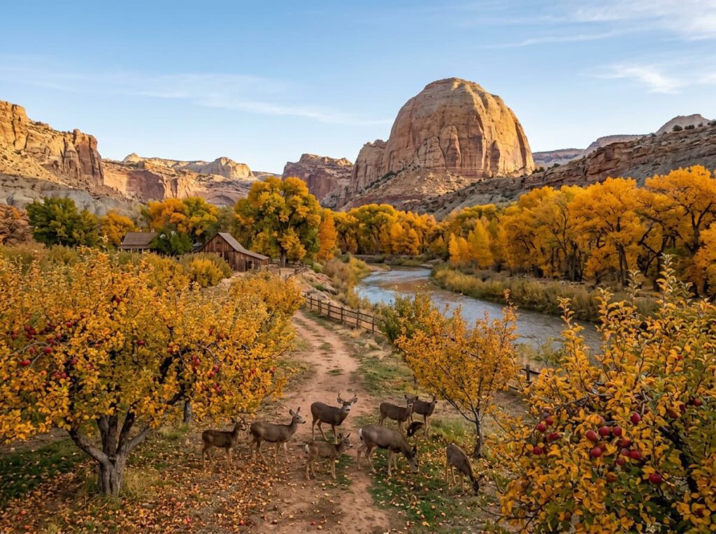
The historic Fruita orchard in late September and early October — the apple trees heavy with fruit, the cottonwoods along the Fremont River going gold, the Capitol Dome rising above the orchard — is the human history and landscape combination that makes Capitol Reef unique among the Utah parks. Photographing the orchard in the early morning light, with the deer that regularly graze among the trees and the canyon walls framing the scene on both sides, is the intimate and specific Capitol Reef image that the geological drama cannot provide.
Visiting the Park
Capitol Reef is open year-round and no timed entry reservations are currently required — one of the practical advantages of a park that the Utah tourist circuit has not yet overwhelmed. The main park road and Highway 24 through the Fremont River corridor are paved and accessible in all weather for standard vehicles. The Cathedral Valley and the southern Waterpocket Fold roads require high-clearance vehicles and are impassable when wet — the bentonite clay soil turns to a surface approaching quicksand after rain and requires waiting for full dry conditions before attempting.
Spring and fall are the primary photography seasons. May brings wildflowers in the canyon and the orchard in bloom — the apple blossoms against the red canyon walls in early May are one of the park’s most distinctive and most fleeting photography subjects. September and October bring the fall color in the cottonwoods along the Fremont River, the apple and pear harvest in the Fruita orchard, and the low-angle autumn light that is ideal for the Waterpocket Fold’s layered geology. October is arguably the finest single month in the park — the orchard, the fall color, the light, and the lowest crowds of the season all converging.
The nearest significant airports are Salt Lake City (SLC), about 220 miles north, and Las Vegas (LAS), about 230 miles southwest — both serviceable for a fly-drive visit with Capitol Reef as part of a broader Utah circuit. Torrey, the small town immediately west of the park entrance, is the gateway community and a genuinely pleasant base.
Where to Stay
There is no in-park lodging at Capitol Reef. Torrey, five miles west of the park entrance on Highway 24, is the natural base — a small Utah town that has developed a surprisingly strong independent lodging and dining scene relative to its size. The Lodge at Red River Ranch, about 15 miles west of the park on Highway 24, is the standout property in the area — a 1930s working ranch converted to upscale lodge accommodation with canyon views and a position that puts Capitol Reef accessible without being in the tourist infrastructure of Torrey itself.
Capitol Reef Resort in Torrey, Torrey Schoolhouse Bed and Breakfast, and several vacation rental properties in the area provide additional options across price ranges. The Entrada at Capitol Reef sits immediately outside the park boundary with direct canyon views — the closest outside lodging to the park’s primary photography subjects.
For campers, Fruita Campground inside the park is the most desirable in-park option — set in the historic orchard at the heart of the Fremont River corridor, with the cottonwood trees overhead and the canyon walls immediately present. It fills quickly for the spring and fall seasons; reservations through recreation.gov are essential. RVs are accommodated but the campground has size limitations; check current maximums before routing. Cathedral Valley Campground, in the remote northern section, is primitive and accessible only by high-clearance vehicle — the right base for the Temple of the Sun sunrise photography.
If I Were Planning My First Visit
October. Fruita Campground or the Lodge at Red River Ranch. The orchard in the early morning light — the apple trees, the deer, the canyon walls, the fall color in the cottonwoods. That is the establishing image of the park and it is available only in a narrow window each year.
The Hickman Bridge trail before sunrise on the first morning — in position beneath the bridge before the light arrives, the Capitol Dome framed through the span. The Goosenecks Overlook in the late afternoon for the river meander in the low-angle light.
And the Cathedral Valley circuit if the vehicle allows and the road is dry — an early departure, the Fremont River ford at low water, 60 miles of dirt road to the Temple of the Sun. Being in position at the base of the monolith before sunrise. The valley floor in shadow, the formation going from silhouette to lit, the Utah sky doing its work above it all.
Capitol Reef is the Utah park that most rewards the visitor who arrives without the agenda set by the more famous parks on either side of it. No crowds telling you where to stand. No iconic shot everyone is racing to replicate. Just the fold and the light and 100 miles of geological drama that most people drive past on the way to somewhere else.
The Light I’m Curious About
It is the Temple of the Sun at first light — the specific moment when the formation transitions from pre-dawn silhouette to the first warm direct sun on the sandstone face, while the Cathedral Valley floor below it stays in shadow for another twenty minutes.
The isolation of the monolith is the thing I keep coming back to in the photographs I have studied. Most of the Utah park geology is contextual — the canyon walls, the hoodoos, the arch — subjects that exist in relationship to the surrounding landscape. The Temple of the Sun stands alone on an open valley floor with nothing nearby to diminish it or explain it. It is simply there, 400 feet of sandstone in a remote valley, and the light arrives on it each morning the way light arrives on anything that has been standing in the same place for 170 million years — with complete indifference to the photographer waiting at its base.
That indifference is the point. Capitol Reef does not perform. It simply is, in a way that the more visited Utah parks — where the crowds and the tripods and the social media pressure create a kind of performance around the iconic shots — cannot quite replicate. The light at the Temple of the Sun is not famous. It is just extraordinary. That is sometimes the better combination.
A Deeper Exploration
This article is part of my ongoing project documenting and photographing all 63 national parks across the United States.
Along the way, I’m creating deeper guides that explore photography locations, travel planning, seasonal light conditions, and personal reflections from the road. Capitol Reef is the Utah park this series was most clearly missing — the middle child between the more famous parks, patient enough to wait for the photographers who finally give it the time it deserves.
Because 100 miles of geological wrinkle in the earth’s crust does not need to be famous to be worth understanding. It just needs a photographer willing to drive the dirt road.
One more thing — just between us.
Capitol Reef already runs quieter than its Utah neighbors, but the surrounding canyon country rewards the visitor who looks beyond the park boundary. Three places worth knowing for the trip that takes the time to explore.
Goblin Valley State Park — about 45 miles southeast on Highway 24 — protects a valley floor covered in thousands of mushroom-shaped sandstone hoodoos unlike anything in the national park system. Free-range walking through the goblin formations, no designated trails, completely strange and completely photogenic. The late afternoon light in Goblin Valley, when the formations cast their shadows across each other and the warm sandstone goes orange, is the most otherworldly landscape photography in the region.
Burr Trail Road — running east from Boulder through the southern section of Grand Staircase-Escalante and into the Waterpocket Fold — is one of the great scenic drives in Utah and almost entirely unknown to visitors who stick to the main highway. The Burr Trail switchbacks descending into the fold are the most dramatic road photography in the Capitol Reef region and the approach to the park from the south that the guidebooks rarely describe.
And for a complete Utah canyon country circuit, Grand Staircase-Escalante National Monument — bordering Capitol Reef to the south and west — is one of the largest roadless areas in the lower 48 and contains slot canyon, arch, and canyon photography that the national park circuit barely touches. The photographers who know this monument keep it quietly to themselves. Now you know it too.