A South Florida Photographer’s First Look at the National Park in His Own Backyard — Mostly Underwater
When planning a visit to America’s national parks, most people think of destinations that require a flight and a rental car and a hotel reservation made months in advance. Biscayne National Park is about 25 miles from where I live. I have driven past its general vicinity more times than I can count. I have not visited it properly.
This pattern — the national park closest to home receiving the least attention — has become a recurring theme in this series. The Everglades post covered it honestly. Biscayne is the second act of the same story, and it has an added layer: 95 percent of Biscayne National Park is underwater. The park protects the northernmost Florida Keys, the longest living coral reef system in North America, and Biscayne Bay — but almost none of it is accessible from the shore. Getting to the heart of this park requires a boat. Getting to the best photography requires going beneath the surface.
My closest reference point for this kind of underwater park experience is John Pennekamp Coral Reef State Park in the Florida Keys — my first visit there was on a high school scuba diving club trip, one of those experiences that stays with you not because of anything dramatic that happened but because of the specific quality of being underwater for the first time in a coral reef environment. The light filtering through the water column. The fish moving through the coral with the complete indifference of creatures operating in their own world. The silence that is not actually silence but the sound of the reef itself — the snapping shrimp, the parrotfish grazing on coral, the water moving against the formations.
I have not been underwater much since then. The certification has lapsed in any practical sense. Getting back into the water properly — recertified, equipped with an underwater housing, and genuinely ready to photograph what is down there — is the plan for this visit. Biscayne is the motivation. The reef has been there the whole time, 25 miles from my house.
The Landscape That Draws People Here
Biscayne National Park protects 172,000 acres of southern Biscayne Bay, the upper Florida Keys, and the offshore coral reefs — making it one of the largest marine national parks in the system and the largest national park in Florida by area. The park’s above-water component is relatively small: a narrow strip of mangrove coastline on the mainland, the Dante Fascell Visitor Center at Convoy Point, and a chain of small islands — the northern Keys — that are accessible only by boat. Elliott Key, the largest island in the park, has a campground, hiking trails through tropical hardwood hammock forest, and the swimming beach at Hurricane Harbor.
The reef is the reason the park exists. The Florida Reef Tract — the third largest coral barrier reef system in the world after the Great Barrier Reef and the Mesoamerican Reef — runs parallel to the Florida Keys from Biscayne south through the Florida Keys National Marine Sanctuary. The Biscayne section protects the reef’s northern end and contains some of its most diverse and most accessible sections. The Maritime Heritage Trail connects six historic shipwrecks on the ocean floor, all within recreational diving depth, forming one of the most remarkable underwater archaeology trails in the national park system.
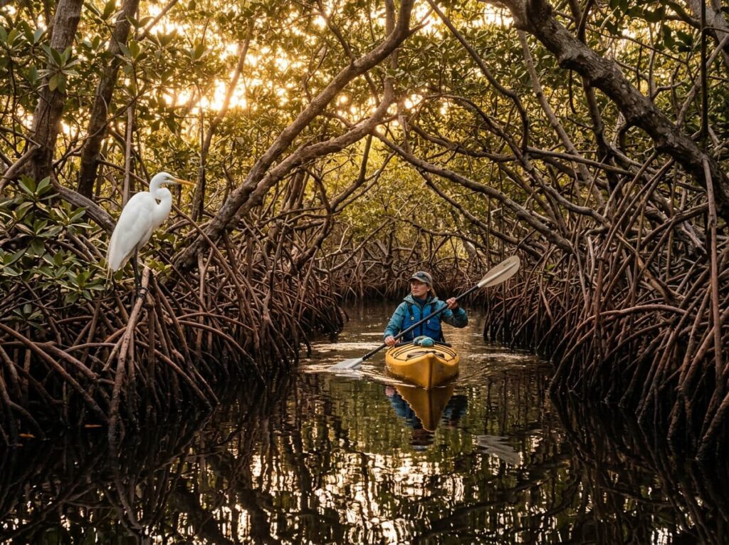
The park’s mangrove coast is its most overlooked above-water photography subject — the tangle of red mangrove prop roots along the shoreline provides the most specific Florida coastal imagery available, with the roots creating an architectural complexity above and below the waterline that the open ocean cannot match. Kayaking through the mangrove channels of Biscayne Bay at dawn, when the light catches the root systems and the wading birds are active in the shallows, is the above-water version of the park experience that most visitors never access because they are waiting for a boat tour to the reef.
The Photographer’s Chase
The underwater photography is the primary subject and it requires the preparation that most casual park visits do not. For anyone whose scuba certification has lapsed — which describes my current situation honestly — a refresher course or full recertification is the first step before planning the dive photography. PADI and NAUI both offer refresher programs that take a day or two for certified divers returning to the water after a long absence; a full open water certification takes a weekend for new divers. Several dive operators in the Homestead and Key Largo area offer both, along with guided dive trips to the Biscayne reef that provide access to the Maritime Heritage Trail shipwrecks and the best reef sections.
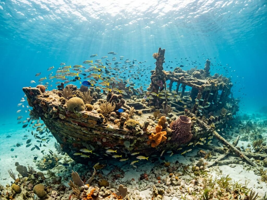
The Maritime Heritage Trail shipwrecks are the most distinctive underwater photography subjects in the park — six vessels ranging from a 19th-century sailing ship to a 20th-century cargo vessel, all within recreational diving depth and all heavily colonized by coral, sponges, and the fish communities that artificial reef structures attract. The Mandalay, a 1921 lumber schooner in 23 feet of water, is the most accessible and the most heavily photographed — a wide angle from the bow, looking stern-ward along the deck with the coral colonization and the fish school visible, is the wreck photography that communicates both the history and the ecology of what happens when a vessel becomes a reef.
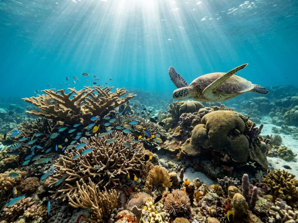
For snorkelers — and for the recertification process that gets the camera underwater properly — the shallow reef sections along the park’s outer reef line provide accessible coral photography in 10 to 20 feet of water. The early morning snorkel session, before the afternoon wind chop develops on the bay surface, is the underwater light window. The sunlight penetration through calm morning water produces the shaft-of-light-through-the-reef photography that deep-water afternoon diving cannot replicate.
Above water, the kayak photography through the mangrove coast is the subject I am most curious about as a South Florida resident who has not properly explored what lives in those root systems. The mangrove channels along the park’s mainland shore and around the northern Keys islands support roseate spoonbills, great white herons, manatees in the warmer months, and the American crocodile — the only place in the world where alligators and crocodiles coexist, the same ecological distinction that makes the Everglades unique. A kayak puts you at water level in the mangrove root architecture in a way that a powerboat cannot, and the early morning light in those channels, with the birds active in the shallows, is the Biscayne Bay photography that the reef-focused visitor never finds.
Visiting the Park
Biscayne National Park is unique in the system in that it is essentially inaccessible without a boat. The Dante Fascell Visitor Center at Convoy Point in Homestead is the mainland entry point — free to visit, with exhibits about the park’s ecology and history — but the reef, the islands, and the shipwrecks are all accessible only by water. The park concessionaire, Biscayne National Park Institute, operates boat tours, snorkel trips, and dive trips from Convoy Point; advance booking is recommended for peak season visits. Visitors with their own vessels can launch from the Convoy Point ramp and navigate to the islands and reef independently.
The primary season runs from November through April — the dry season when the water clarity is best, the crowds are manageable, and the temperatures are comfortable both above and below water. Summer brings warmer water temperatures that are pleasant for diving but also the possibility of tropical weather systems and afternoon thunderstorms that develop quickly over South Florida. The park is open year-round; the boat tour schedule varies by season and should be confirmed at nps.gov/bisc before planning.
As a West Palm Beach resident, this is the park with the shortest commute in the entire 63-park project. The drive to Convoy Point takes about an hour from West Palm Beach. The only reasonable excuse for not having visited properly — and I am aware of the irony of saying this in a post for a national parks photography project — is the same excuse that applies to the Everglades: the parks closest to home are the easiest to defer indefinitely. That deference ends with this trip.
Where to Stay
There is no lodging inside Biscayne National Park on the mainland. Elliott Key has a primitive campground accessible by boat — tent camping on the largest island in the park, with the tropical hardwood hammock forest overhead and the reef offshore. It is the most immersive Biscayne experience available and books through recreation.gov. For a photographer targeting the dawn mangrove kayak sessions and the morning reef snorkeling, camping on Elliott Key eliminates the boat commute from the mainland entirely.
Homestead, the gateway city immediately west of the park, provides the full range of lodging and is also the gateway for Everglades National Park — making it the natural base for a combined South Florida parks visit. Florida City, immediately south, has additional options at slightly lower prices. The combination of Biscayne and the Everglades in a single multi-day South Florida trip is the logical itinerary for anyone making the drive down from the Palm Beach or Miami areas — two national parks, two completely different ecosystems, both within an hour of each other.
There is no RV camping at the Elliott Key campground — boats only, primitive sites. For RV travelers based at Homestead, the drive to Convoy Point is straightforward and the mainland visitor center provides the orientation for boat tour bookings. The Long Pine Key campground in Everglades National Park, about 15 miles west, provides an RV-accessible in-park camping option that serves both parks conveniently.
If I Were Planning My First Visit
The recertification comes first. A PADI refresher course in South Florida — there are multiple operators in the Homestead, Key Largo, and Miami areas — gets me back in the water properly before the park visit. The underwater housing gets tested in a pool before it goes on the reef. That preparation is not optional for the photography I want to make.
A December or January visit — peak water clarity season, comfortable temperatures, low crowds. The morning snorkel trip to the reef section closest to the outer keys, in the water before 9am when the surface is calm and the light penetration is best. The Maritime Heritage Trail dive on the second day — the Mandalay specifically, in the 23 feet of clear water, with the wreck photography that the reef sections cannot provide.
And a dawn kayak through the mangrove channels before either of those — the above-water Biscayne that most people driving to the Keys never stop for, the root systems and the birds and the crocodile habitat that is specific to this corner of South Florida and completely unlike anything the reef experience shows. Both versions of this park. The full picture of what 25 miles from home has been holding.
The Light I’m Curious About
It is the underwater morning light — the shafts of sunlight penetrating through calm surface water into the reef, the way the light moves and shifts with the water surface above and illuminates the coral formations from above at an angle that changes with every small wave.
I remember this light from the Pennekamp trip in high school — the specific quality of being 20 feet underwater with light coming from above through the water column, landing on coral in the way that no above-water light source replicates. The fish catching that light as they move through it. The coral formations casting their own shadows on the sand below. It is a light that exists only underwater and only when the surface conditions and the sun angle align — early morning, calm water, clear visibility.
That light has been 25 miles away for years. The recertification, the underwater housing, and the December morning boat ride are the three things standing between me and it. None of them is a significant obstacle. I have been manufacturing obstacles. The reef is still there.
A Deeper Exploration
This article is part of my ongoing project documenting and photographing all 63 national parks across the United States.
Along the way, I’m creating deeper guides that explore photography locations, travel planning, seasonal light conditions, and personal reflections from the road. Biscayne is the second home-region park in this series after the Everglades — the national park that South Florida residents are closest to and most likely to perpetually defer. The 63-park project is, among other things, the reason to stop deferring.
Because the reef does not require a flight. It requires a boat, a certification card, and the decision to go. All three of those are manageable. The light underwater is waiting.
One more thing — just between us.
Biscayne already runs quiet relative to the more famous South Florida parks, but here are three places worth knowing for the visit that wants to go deeper into what this corner of Florida offers.
John Pennekamp Coral Reef State Park in Key Largo — immediately south of the park along US-1 — is the state park that protects the Keys reef ecosystem in the same way Biscayne protects it further north. Pennekamp has a well-established snorkel and dive tour operation, the famous Christ of the Abyss underwater statue, and the infrastructure for a day trip that complements the Biscayne visit.
For the photographer who wants the above-water Florida Keys experience, Dagny Johnson Key Largo Hammock Botanical State Park — just north of Pennekamp — protects the largest tract of West Indian tropical hardwood hammock in the United States, with trails through old-growth tropical forest that most Keys visitors drive past on US-1 without slowing down. The light in that forest on an overcast morning, with the gumbo limbo and mahogany and the endemic Key Largo woodrat habitat, is the terrestrial Florida Keys photography that the reef narrative almost always leaves out.
And for the South Florida experience that connects Biscayne to the broader ecosystem, a dawn boat trip through Florida Bay — the shallow inland sea between the Everglades and the Keys that both national parks border — produces the wading bird and marine wildlife photography that sits between the two parks geographically and ecologically. Roseate spoonbills, American flamingos in recent years, bottlenose dolphins, and manatees in the seagrass beds. A very small club of South Florida photographers knows this water. You are an hour away.