A Photographer’s First Look at the Ancient Reef Above the Desert — and Texas’s Highest Peak
Every photographer eventually builds a list of landscapes that exist in genuine geological relationship with each other. Guadalupe Mountains National Park and Carlsbad Caverns National Park are the above and below of the same ancient story — the Capitan Reef, a massive coral reef that grew at the edge of an inland sea 265 million years ago and now forms both the cave systems of Carlsbad and the mountain mass rising from the Chihuahuan Desert in West Texas.
The caves show what the reef looks like from the inside — the dissolved limestone, the formations growing in permanent darkness, the scale of a geological structure that time and chemistry have hollowed out from below. The mountains show what the same reef looks like from the outside — the exposed cliff faces, the layered limestone rising to 8,751 feet at Guadalupe Peak, the highest point in Texas, and the canyon systems carved through the ancient reef by millions of years of erosion. Same geological structure. Completely different photography.
I have not been to Guadalupe Mountains. The research I have done in preparation for this post has consistently impressed me with how different the park is from the cave experience immediately to its north — how much vertical drama, how much fall color, how much solitude it delivers for a park that sees relatively few visitors. Guadalupe Mountains is one of the least visited national parks in the contiguous United States, which for a photographer is not a drawback. It is an invitation.
The Landscape That Draws People Here
Guadalupe Mountains National Park covers 86,367 acres of the Guadalupe Mountain range in the Trans-Pecos region of West Texas, immediately south of the New Mexico border. The park contains four of the five highest peaks in Texas, the most extensive Permian fossil reef on earth, and one of the finest examples of an undisturbed Chihuahuan Desert ecosystem anywhere in the region. The landscape ranges from the desert scrub of the Salt Basin at 3,500 feet to the forested summit of Guadalupe Peak at 8,751 feet — an elevation change that produces a remarkable variety of plant communities compressed into a relatively small area.
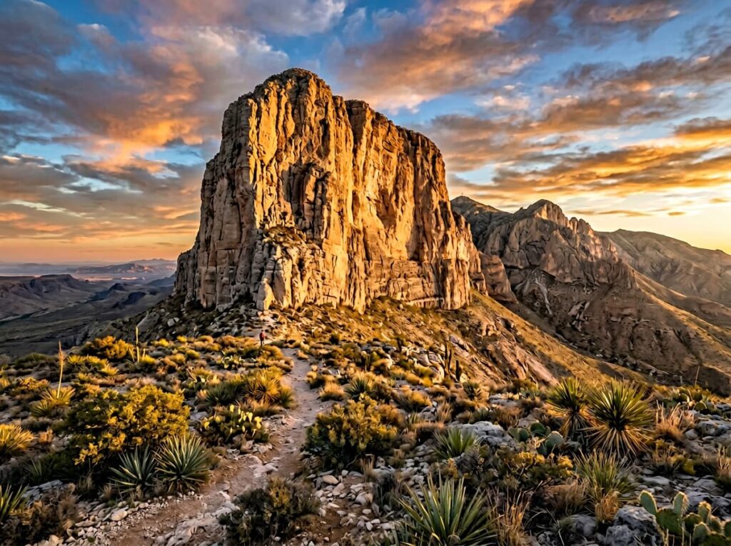
El Capitan — not the Yosemite formation but the massive limestone prow of the Guadalupe escarpment rising above US-62/180 near the park’s southern boundary — is the park’s most immediately striking visual element and the one that most visitors photograph from the highway before they even enter the park. The 1,000-foot cliff face of El Capitan, rising directly from the desert floor with no significant foothills to soften the transition, is one of the most dramatic cliff face compositions in the Southwest and one of the finest roadside photography subjects in Texas.
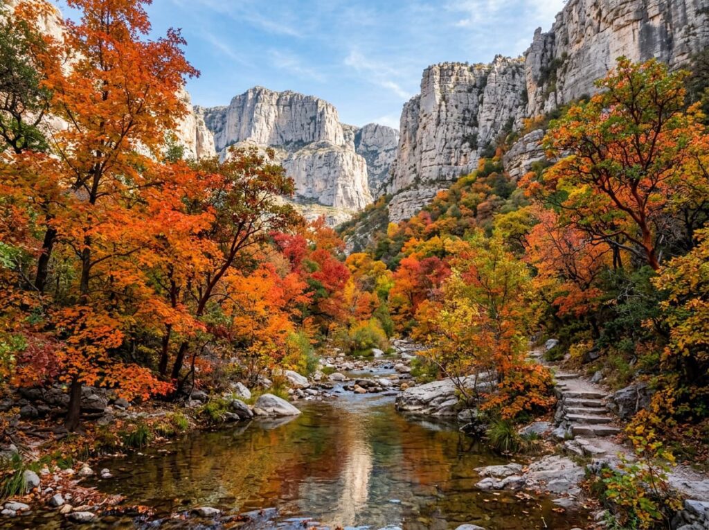
McKittrick Canyon, on the park’s northeastern edge, is the fall color destination that puts Guadalupe Mountains on the photography calendar of anyone who knows it — a limestone canyon cutting into the reef where a spring-fed creek supports a riparian forest of Texas madrone, bigtooth maple, velvet ash, and chinkapin oak that turns brilliant orange, red, and yellow in October. The fall color in McKittrick Canyon is routinely described as the finest in Texas and among the finest in the Southwest, concentrated in a narrow canyon that frames the color against the limestone walls above. The peak typically runs from mid to late October and lasts one to two weeks.
The Photographer’s Chase
El Capitan from the highway is the establishing shot — roadside, accessible, and most powerful at sunrise when the eastern light hits the cliff face directly and the desert floor below is still in shadow. The pullouts on US-62/180 south of the visitor center provide clean sightlines to the cliff with the desert foreground; a long lens compresses the cliff layers and isolates the geological detail in the limestone face, while a wide angle from the highway captures the full scale of the cliff rising from the flat desert floor. Either composition communicates the park’s defining visual quality: the abrupt, dramatic transition from desert flatness to vertical reef.
McKittrick Canyon in October is the primary photography target for the serious Guadalupe Mountains visit — a 4.8-mile round trip from the McKittrick Canyon trailhead to the Pratt Cabin, following the creek through the canyon where the fall color concentrates. The canyon walls of pale limestone above, the orange and red of the maples and madrones below, and the clear creek reflecting both — that three-layer composition is the McKittrick Canyon photograph that photographers who know the park travel specifically to make. The peak is brief and the park gets genuinely crowded for it by Guadalupe Mountains standards, which still means far fewer people than any comparable fall color destination in the region.
The Guadalupe Peak trail — 8.4 miles round trip with 3,000 feet of elevation gain — reaches the highest point in Texas with 360-degree views that take in the Chihuahuan Desert below, the salt lakes of the Salt Basin to the west, the Carlsbad area to the north, and the Davis Mountains to the south. The summit in the early morning light, before the afternoon thunderstorms that build over the high country in summer and fall, is the elevated landscape photography that rewards the elevation gain with a view of the full Trans-Pecos landscape spread below. A bronze pyramid at the summit marks the highest point in Texas — a compositional element that provides human history context in a purely geological landscape.
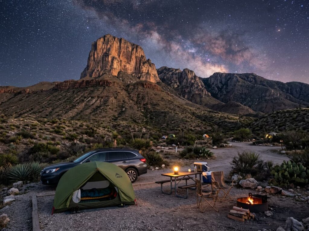
The dark sky photography at Guadalupe Mountains is a natural extension of the Carlsbad Caverns visit — the same remote West Texas location, the same absence of urban light pollution, and above-ground access to the same extraordinary night sky. The desert floor near the Pine Springs Campground, with El Capitan silhouetted against the Milky Way to the south, is the astrophotography composition that connects the above-ground park to the dark sky quality that the cave visit cannot provide.
Visiting the Park
Guadalupe Mountains is open year-round and no timed entry reservations are currently required. The park is one of the least visited in the system — fewer than 200,000 visitors annually — which means the trails, the overlooks, and the campgrounds are consistently uncrowded except during the October fall color peak in McKittrick Canyon, when the canyon trail sees its largest crowds of the year. Even at peak the numbers are modest by national park standards.
October is the primary photography month — the McKittrick Canyon fall color, the lower-angle autumn light that does the most interesting things to El Capitan’s limestone face, and the first possibility of snow on the high country above 8,000 feet. Spring brings wildflowers to the desert floor and moderate temperatures for the Guadalupe Peak hike. Summer temperatures can be extreme at the lower elevations — the Chihuahuan Desert in July is a serious heat environment — though the high country above 7,000 feet remains manageable. Winter brings occasional snow to the peaks and genuine solitude to every trail in the park.
The nearest airport is El Paso International (ELP), about 110 miles west — a straightforward drive on US-62/180 through the pass between the Guadalupe and the Franklin Mountains. The drive from El Paso passes through the town of Hudspeth County’s sparse ranching landscape and arrives at the park with a gradual sense of increasing remoteness that prepares the visitor for what the park actually is. Carlsbad, New Mexico, 35 miles north, provides the alternative base for a combined Carlsbad Caverns and Guadalupe Mountains visit.
Where to Stay
There is no in-park lodging at Guadalupe Mountains. The Dog Canyon Ranger Station on the park’s remote northern end has a small campground; the Pine Springs Campground near the visitor center is the main in-park camping option. Both are first-come, first-served and rarely fill except during October fall color weekends.
White’s City, the small commercial complex at the Carlsbad Caverns entrance 35 miles north, serves both parks and is the most convenient overnight base for a combined visit. The city of Carlsbad, New Mexico, provides the broadest range of lodging and services. Van Horn, Texas — about 65 miles south on I-10 — is the closest Texas town with lodging, a small crossroads community that serves the highway traffic between El Paso and the Permian Basin.
For RV travelers, Pine Springs Campground accommodates standard rigs with a manageable number of sites. The campground’s position at the base of the Guadalupe escarpment, with El Capitan visible from the sites and the trailhead for the Guadalupe Peak summit within walking distance, is one of the more dramatically positioned campgrounds in the Texas park system. The remote Dog Canyon Campground on the north end is accessible by a long paved road from the New Mexico side and provides the most isolated in-park camping — a handful of sites in a pinyon-juniper woodland with almost no other visitors.
If I Were Planning My First Visit
The natural circuit is Carlsbad Caverns first, then Guadalupe Mountains — the cave story followed by the mountain story, the interior of the reef followed by the exterior. Two nights at White’s City or Carlsbad covers both parks with room for the bat flight at Carlsbad and the El Capitan sunrise and the McKittrick Canyon hike at Guadalupe.
October for the McKittrick Canyon color — the canyon trail in the early morning before the day hikers arrive, moving slowly up the creek toward the Pratt Cabin, the color building as the canyon narrows and the limestone walls close in on both sides. The El Capitan roadside pullout at sunrise on the second morning, with the long lens on the cliff face layers and the desert floor still in shadow below.
And the dark sky on at least one clear night — the campground at Pine Springs, the Milky Way above El Capitan, the same West Texas sky that makes Carlsbad Caverns’ bat emergence feel like it happens under the finest outdoor ceiling in the region. The cave and the mountain, above and below the same ancient reef, under the same extraordinary sky. That is the complete Guadalupe story.
The Light I’m Curious About
It is the October morning light on McKittrick Canyon — specifically the hour when the low eastern sun clears the canyon rim and the direct light first reaches the maple and madrone color in the canyon below, creating the specific condition where the orange and red of the fall foliage is backlit from above and the canyon walls behind are still in cool shadow.
That backlit fall color against limestone shadow is the McKittrick Canyon photograph that the midday canyon visitor, with the overhead sun flattening everything, never finds. It exists for perhaps an hour in the early morning and it requires being in the canyon before the light arrives — the same discipline the series has been building toward since Yosemite, applied to a limestone canyon in West Texas that most photographers have never heard of.
The cave showed me the reef from the inside. The mountain will show me the reef from the outside. And McKittrick Canyon in October will show me what happens when the ancient limestone meets the one season that briefly makes a desert landscape do something unexpected and briefly beautiful.
A Deeper Exploration
This article is part of my ongoing project documenting and photographing all 63 national parks across the United States.
Along the way, I’m creating deeper guides that explore photography locations, travel planning, seasonal light conditions, and personal reflections from the road. Guadalupe Mountains completes the Capitan Reef story that Carlsbad Caverns began — above and below the same ancient structure, in landscapes that could not look more different and could not be more geologically connected.
Because the finest fall color in Texas is in a limestone canyon in a national park that fewer than 200,000 people visit each year. That sentence should be more widely known. Now it is.
One more thing — just between us.
Guadalupe Mountains already sees far fewer visitors than almost any comparable national park — but the surrounding Trans-Pecos region rewards exploration well beyond the park boundary. Three places worth knowing for the trip that takes the time to look around.
Davis Mountains State Park — about 100 miles south near Fort Davis — is the most scenic state park in Texas and the heart of the Trans-Pecos mountain country. The McDonald Observatory on the summit above the park is one of the premier astronomical research facilities in the world and offers public star parties on select nights — the darkest sky in Texas, professional telescopes, and a ranger program that puts the Guadalupe dark sky in cosmic context.
Hueco Tanks State Park near El Paso protects granite rock formations covered in pictographs — thousands of images made by Native peoples over 10,000 years of use at a desert water source. The pictograph photography, with the ancient images on weathered granite surfaces, is the human history photography that the Guadalupe Mountains’ geological focus cannot provide.
And for the full West Texas road trip experience, the Chinati Foundation in Marfa — about 75 miles south — closes the circuit with the art destination that Donald Judd built in the West Texas desert and that has made Marfa internationally known. Same landscape, different century, completely different human response to it. Worth the drive.