A Photographer’s First Look at Colorado’s Most Improbable Landscape — Where the Timing of Light Is Everything
Some landscapes become part of our imagination through sheer improbability. Great Sand Dunes National Park contains the tallest sand dunes in North America — rising to 750 feet — standing directly at the base of the Sangre de Cristo Mountains in the San Luis Valley of southern Colorado. The dunes are not a transitional landscape between the mountains and the desert. They are pressed against the mountain wall, the sand meeting the snow-capped peaks at their base in a juxtaposition that the eye keeps trying to rationalize and cannot.
I have driven through Colorado many times and never made it to the San Luis Valley. The park sits in the southeastern corner of the state, off the main travel corridors, and the combination of the valley’s remoteness and the park’s relatively recent national park designation in 2004 means it gets skipped the way Capitol Reef gets skipped in Utah — by visitors who are heading somewhere more famous without knowing what they are passing.
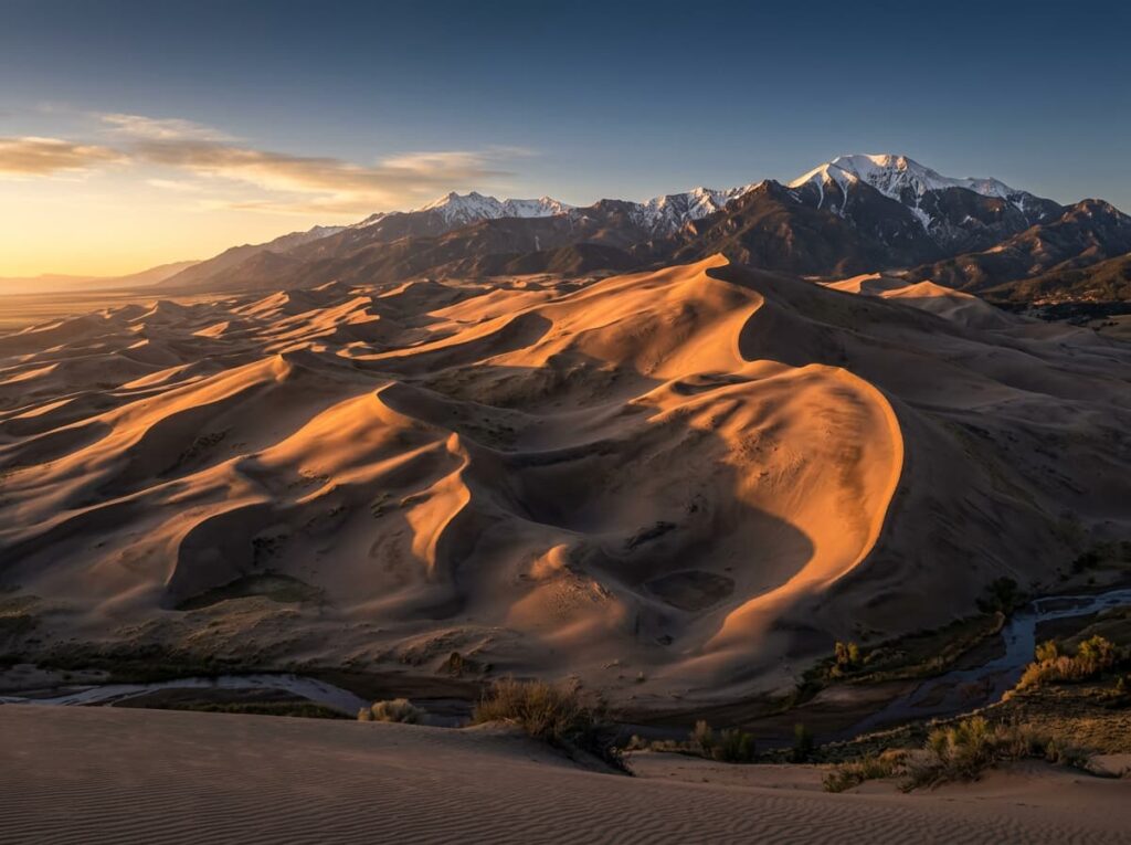
The photographs I have been looking at online have settled the question of when I correct that oversight. The light on sand dunes is among the most time-sensitive and most rewarding in landscape photography. The dunes change completely depending on the sun angle — at midday they are bleached and flat, their three-dimensional form invisible. In the early morning and late afternoon the raking light builds shadow into every ripple and ridge line, transforming the dune field from a flat pale surface into a deeply sculptural landscape. And in the hour around sunrise and sunset, with the Sangre de Cristo Mountains catching alpenglow above and the dune faces in warm direct light below, Great Sand Dunes produces the kind of photograph that makes people stop scrolling.
The Landscape That Draws People Here
Great Sand Dunes National Park and Preserve sits in the San Luis Valley of south-central Colorado, a broad flat valley floor at 7,500 feet elevation surrounded by mountains on three sides. The dunes were formed over hundreds of thousands of years from sand carried by wind across the valley floor and trapped against the Sangre de Cristo Mountains by three creek systems whose seasonal flows push the sand back from the mountain base and keep it concentrated in the dune field. The result is the largest dune field in North America — 30 square miles of active sand — pressed against a mountain range that reaches 14,000 feet above sea level.
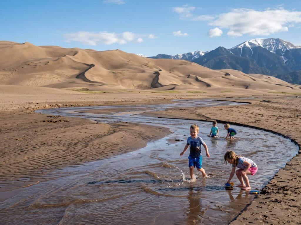
Medano Creek runs along the base of the dunes between the sand and the park campground, producing one of the park’s most unusual and most family-beloved features — a shallow seasonal stream that flows across a sandy creek bed in surge pulses created by the same sand dam and release dynamics that produce waves on a beach. The creek flows from late spring through early summer, and the sight of children playing in the shallow water with 750-foot sand dunes directly behind them is the human-scale photograph that the pure dune images cannot provide.
The Sangre de Cristo Mountains rising directly behind the dunes provide the backdrop that makes the park’s landscape so visually improbable. The mountains contain several 14,000-foot peaks — Crestone Peak, Crestone Needle, Kit Carson Peak — visible above the dune field and snow-capped well into June. The combination of the sand foreground and the alpine background is the Great Sand Dunes composition that most landscape photographers come specifically to make, and the light quality in the hour before and after sunrise is when the two elements relate to each other most dramatically.
The Photographer’s Chase
The timing of light is the single most important planning decision at Great Sand Dunes and it cannot be overstated. The dunes face generally west and southwest, which means the morning light from the east illuminates the dune faces directly and the western dune shadows are at their deepest and most dramatic in the early morning hours. This is the primary photography window. The afternoon light from the west reverses the shadow pattern, and the late afternoon positions the shadows differently on the eastern faces. Both windows produce strong images but the sunrise window is the one most photographers who know this park prioritize.
The position matters as much as the timing. Shooting from the valley floor at the dune base produces the mountains-above-dunes composition with the maximum vertical drama. Climbing into the dunes themselves — High Dune is the first major summit at 699 feet, reachable in one to two hours of strenuous hiking in loose sand — provides the elevated perspective from which the full dune field is visible and the San Luis Valley spreads below. The summit of High Dune at sunrise, with the dune field dropping away in every direction and the Sangre de Cristos lit from behind by the rising sun, is the composition that rewards the early alarm and the sand climb.
The Medano Creek foreground photography is specific to late May and June when the creek flows most actively. A wide angle from the creek bed with the shallow water in the immediate foreground and the dunes rising behind produces the depth and the scale that a pure dune shot cannot achieve. The surge pulse photography — waiting for the wave-like surge to pass through the shallow water and catching it at the moment of maximum height against the dune backdrop — is the technical challenge that the creek offers photographers willing to work the timing.
The dark sky at Great Sand Dunes is exceptional — the park is designated as an International Dark Sky Park and the San Luis Valley’s remoteness and high elevation produce some of the finest stargazing in Colorado. The Milky Way above the dune crests on a moonless night, with the dune field as foreground and the mountain silhouette above, is the astrophotography composition that the same raking light principle produces at night. The sand dunes under the galaxy, in the same darkness that makes the dune shadows so dramatic at dawn, is the image that requires the overnight stay.
Visiting the Park
Great Sand Dunes is open year-round and no timed entry reservations are currently required. The park entrance is accessible from US-160 via CO-150, about 35 miles northeast of Alamosa. The drive into the park on CO-150 across the San Luis Valley floor, with the dune field becoming visible against the mountains from a distance of 20 or more miles, is itself a photography subject — the gradual revelation of the improbable landscape ahead.
Spring and fall are the strongest photography seasons. Late May through early June brings the Medano Creek flow at its peak, wildflowers in the surrounding grasslands, and comfortable temperatures for the dune hikes. September and October bring the low-angle autumn light that is ideal for the dune shadow photography, the first dusting of snow on the Sangre de Cristo peaks above, and the significantly reduced crowds of the shoulder season. Summer brings peak crowds and afternoon thunderstorms that build over the mountains — the monsoon light at Great Sand Dunes, with the storm building behind the dunes against the Sangre de Cristos, is a dramatic photography condition but the afternoon lightning in an open dune field is a serious hazard.
The nearest airports are Colorado Springs (COS), about 160 miles north, and Albuquerque (ABQ) in New Mexico, about 170 miles south. Both require a significant drive across southern Colorado or northern New Mexico. Alamosa, about 35 miles southwest of the park, is the nearest city with lodging and services.
Where to Stay
There is no in-park lodging at Great Sand Dunes. The Zapata Ranch, operated by The Nature Conservancy about 3 miles south of the park entrance on CO-150, is the most distinctive accommodation option in the area — a working bison ranch with guest lodge rooms and guided activities on the ranch property. Staying at the Zapata puts you within minutes of the park entrance for pre-dawn starts and provides the San Luis Valley ranch experience that most park visitors never access.
Alamosa provides the broadest range of lodging at a manageable distance. The Great Sand Dunes Lodge, immediately outside the park entrance, offers the most convenient outside option for photographers targeting multiple dawn and dusk sessions. Several vacation rental properties in the Crestone area, in the mountain community above the valley to the northeast, provide the most atmospheric lodging with Sangre de Cristo views and proximity to both the park and the unusual spiritual community that Crestone has become.
Pinyon Flats Campground inside the park is the in-park camping option — 88 sites in the pinyon-juniper woodland at the dune base, reservable through recreation.gov for peak season. Being inside the park for the pre-dawn dune photography starts is the practical advantage that no outside lodging can match. RVs are accommodated at Pinyon Flats with a size limit; the campground provides the closest possible access to the dune field and the dark sky positions for night photography.
If I Were Planning My First Visit
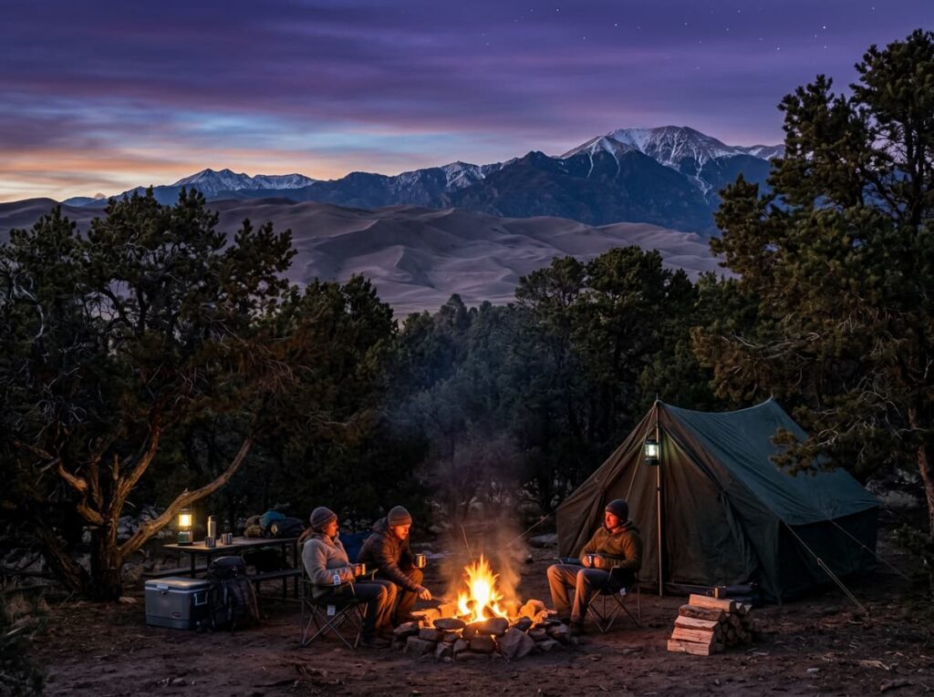
September or October. The autumn light, the snow beginning on the peaks above, and the crowds thinned from the summer peak. Two nights at Pinyon Flats Campground inside the park — the pre-dawn walk to the dune base without a commute, the full dark sky for the night photography, and the morning light available without any logistical friction.
The first morning in position at the dune base before sunrise — the wide angle for the mountains-above-dunes composition, waiting for the alpenglow to touch the Sangre de Cristo peaks above and the direct light to begin building shadow into the dune faces below. The High Dune climb on the second morning — starting in darkness with a headlamp, reaching the summit before the light arrives, shooting from elevation as the dune field below goes from shadow to gold.
A moonless night between the two mornings for the Milky Way above the dunes. The dark sky that the San Luis Valley’s remoteness and elevation provide is one of the park’s underused photography assets and it requires nothing except being there after dark and pointing the camera at the sky.
The San Luis Valley has been passing by on the far side of my Colorado drives for years. The dunes have been there the whole time. The morning light arrives whether or not a photographer is in position for it. This trip is about being in position.
The Light I’m Curious About
It is the specific moment in early morning when the first direct sun clears the horizon to the east and the raking light hits the dune ridgelines while the dune valleys are still in deep shadow — the transition from the pre-dawn blue light that illuminates the dune field evenly to the direct warm light that builds three-dimensional form into the sand in the space of a few minutes.
Sand dune photography is among the most light-dependent landscape work available because sand has no color of its own — it reflects whatever the sky and the sun provide. In the flat light of midday the dunes are pale and featureless. In the raking light of early morning they are sculptural and deeply shadowed and the ripple patterns on each face become individual compositions within the larger landscape.
That transition — from even blue to raking gold — lasts perhaps fifteen minutes at Great Sand Dunes and then the light rises high enough to begin reducing the shadow depth. Being in position before it starts is the entire discipline of this park. The dunes are there every morning. The light arrives on schedule. The question is whether the photographer arrives first.
A Deeper Exploration
This article is part of my ongoing project documenting and photographing all 63 national parks across the United States.
Along the way, I am creating deeper guides that explore photography locations, travel planning, seasonal light conditions, and personal reflections from the road. Great Sand Dunes is the Colorado park this series most needed — a landscape that the state’s more famous parks cannot offer, in a valley that most Colorado visitors drive around rather than through.
Because the tallest sand dunes in North America are pressed against a 14,000-foot mountain range in southern Colorado, and the morning light there does something to sand and shadow and stone that no other park in this series replicates. The drive through the San Luis Valley has been overdue for a long time.
One more thing — just between us.
Great Sand Dunes draws its visitors to the dune base and the Medano Creek area, which is the right starting point. Here are three places worth knowing for the visit that looks beyond the obvious.
The town of Crestone — in the mountain community above the valley on the Sangre de Cristo’s western slope — is one of the more unusual small communities in Colorado, with a concentration of spiritual centers and retreat organizations that has made it internationally known in certain circles. The Crestone area in the early morning, with the San Luis Valley visible below and the dune field visible to the south, produces the elevated valley photography that the park floor cannot provide.
Zapata Falls — a short hike from a BLM trailhead south of the park entrance — is a hidden waterfall in a narrow canyon slot that most park visitors drive past without knowing it exists. The waterfall inside the canyon slot, with ice formations in winter and clear water in summer, is the close-range geological photography that the open dune landscape cannot provide.
And for the broader San Luis Valley context that frames the dune visit, the Alamosa National Wildlife Refuge — about 35 miles south near Alamosa — is a critical stopover for sandhill cranes and whooping cranes during the spring and fall migrations. The crane photography at Alamosa, with the Sangre de Cristo Mountains visible to the east, is the wildlife subject that most dune visitors never connect to the same trip. The San Luis Valley delivers more per square mile than the road map suggests.