A Photographer’s Return to Colorado’s Ancient Cliff Cities — This Time Understanding What I’m Looking At
When planning a visit to America’s national parks, most destinations can be appreciated without significant background knowledge. You arrive at the Grand Canyon and the scale does the work. You arrive at Yellowstone and the thermal features explain themselves. Mesa Verde is different. Mesa Verde requires context before you arrive, or the cliff dwellings risk becoming something you photograph without fully understanding — impressive stone structures tucked into canyon walls, beautiful and ancient and somehow incomplete without the human story behind them.
I know this from experience. I visited Mesa Verde two decades ago on a Southwest trip with my then-wife and her sister — joined their sisters’ getaway late, arrived at the park in the middle of the day, stopped at a few overlooks and perhaps one cliff dwelling, and left without a clear sense of what I had been looking at. The midday light was flat and harsh. The context was thin. I came home with photographs that documented the structures without capturing what they meant. The return trip is about arriving with both the light and the understanding that the first visit lacked.
Here is what I know now that I did not fully grasp then. The people who built these cliff dwellings — the Ancestral Puebloans, formerly called the Anasazi — lived on the Mesa Verde plateau for over 700 years. For most of that time they farmed the mesa top and built their homes in the open. Then, in the late 1200s, within a single generation, they moved their entire communities into the cliff alcoves — building elaborate stone cities in the canyon walls, accessible only by hand and toe holds carved into the rock. They lived there for approximately 100 years. And then, around 1300 AD, they left. Every single one of them. Where they went is known — south, to the pueblo communities of New Mexico and Arizona where their descendants live today. Why they left remains one of the great unanswered questions of Southwestern archaeology. Drought. Social pressure. Resource depletion. All of the above. The cliff dwellings they left behind sat empty and undisturbed for nearly 600 years before the outside world found them in 1888.
When you understand that, the photography changes. You are not documenting ruins. You are documenting the last address of a civilization.
The Landscape That Draws People Here
Mesa Verde — Spanish for green table — is a broad, flat-topped plateau rising 2,000 feet above the surrounding Montezuma Valley in southwestern Colorado. The plateau’s surface is covered in pinyon-juniper forest, and its edges are cut by a series of steep canyons where the cliff alcoves that sheltered the Ancestral Puebloan communities were formed by water seeping through the sandstone and freezing in the canyon walls. The alcoves face south and southwest, which was not accidental — the orientation captured the winter sun for warmth and provided shade from the summer sun. The people who chose these locations understood their climate in a way that informed every architectural decision.
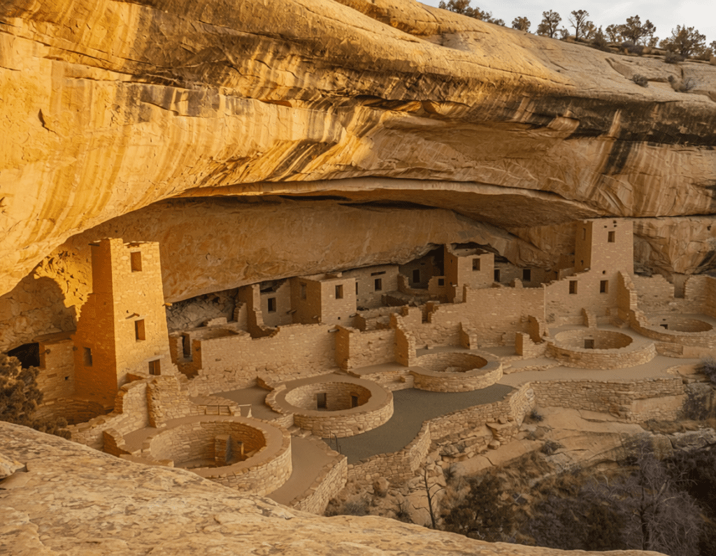
Cliff Palace is the largest cliff dwelling in North America — 150 rooms and 23 kivas, a kiva being the circular ceremonial chamber that was the spiritual center of Puebloan community life. It sits in a south-facing alcove in Cliff Canyon and is visible from the Cliff Palace overlook on the mesa rim above, where the full scale of the structure — tucked into the canyon wall, rising four stories in places, the tower at the far end still standing after 700 years — becomes comprehensible in a single view. Balcony House, accessible by a ranger-led tour that includes a 32-foot ladder climb and a tunnel crawl, provides the most intimate access to a cliff dwelling in the park. Spruce Tree House, the third largest dwelling, sits in a sheltered alcove near the Chapin Mesa Museum and is the most accessible of the major sites.
The park is not only about the cliff dwellings. The mesa top contains thousands of archaeological sites — pit houses, kivas, check dams, agricultural terraces — that tell the 700-year story of the community’s evolution from mesa-top farmers to cliff-dwelling architects. The Chapin Mesa Archeological Museum provides the essential context that the overlooks and the tours cannot fully deliver, and spending an hour there before visiting the cliff dwellings changes what you see when you stand in front of them.
The Photographer’s Chase
The cliff dwelling photography at Mesa Verde is governed by the orientation of the alcoves and the arc of the sun more precisely than almost any other subject in the park system. The south and southwest-facing alcoves receive direct sunlight for only a portion of the day — typically the afternoon hours when the sun has moved far enough west to illuminate the dwelling faces directly. The Cliff Palace overlook in the late afternoon, when the warm southwestern light fills the alcove and the sandstone walls glow amber against the canyon shadow behind them, is when the structure looks most alive. The midday overhead light that I experienced on the first visit flattens the architectural detail and washes the warm sandstone tones — the same reason midday is the wrong time at every canyon park, amplified here by the fact that the dwellings are inside alcoves that block the overhead sun entirely.
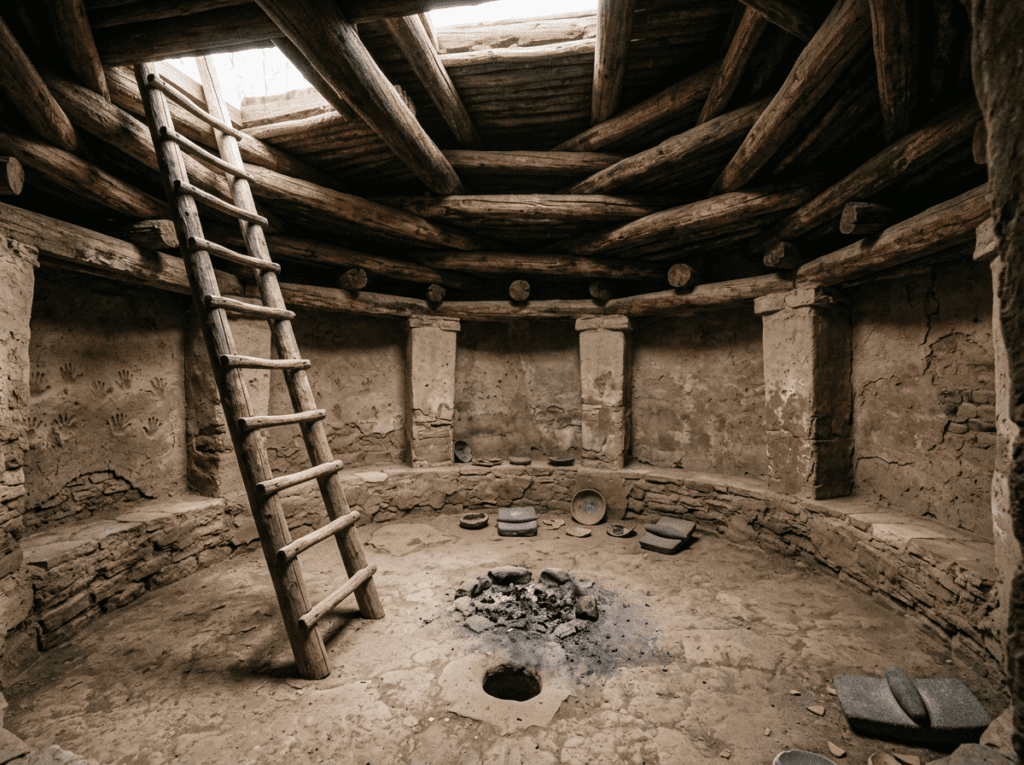
The ranger-led tours are the only way to access the cliff dwelling interiors — Cliff Palace, Balcony House, and Long House in the Wetherill Mesa section require tickets purchased in advance through recreation.gov. The tours are small groups with close access to the structures, and the photography inside the dwellings — the kiva interiors, the fingerprints of the original builders still visible in the plaster walls, the T-shaped doorways that are the signature architectural detail of Ancestral Puebloan construction — requires the kind of intimate access the overlooks cannot provide. Book the tours before anything else. They sell out.
The Chapin Mesa overlooks provide the landscape-scale photography that contextualizes the cliff dwellings within the canyon system — the dwellings small against the canyon walls, the scale of the alcoves communicated by the human-made structures within them. A telephoto lens compresses the canyon layers and isolates the dwelling detail in a way the wide angle cannot. The canyon light in the golden hour, with the cliff face going from shadow to warm amber as the sun drops, is the fifteen-minute window that produces the images the park is famous for.
Wetherill Mesa, the western section of the park accessible by a seasonal road, provides access to Long House — the second largest cliff dwelling — and a section of the park that most visitors never reach. The road is narrower and the crowds are dramatically thinner. Long House faces northeast rather than south, which means the morning light illuminates it directly — the opposite of Cliff Palace. Planning for both dwellings means planning for both light windows: morning at Long House, afternoon at Cliff Palace.
Visiting the Park
Mesa Verde is open year-round but the primary season runs from late April through October, when the ranger-led tours operate and the Wetherill Mesa road is open. The cliff dwelling tours — Cliff Palace, Balcony House, and Long House — require advance tickets through recreation.gov and sell out for peak summer season weeks in advance. Book the tours before booking lodging or making any other plans. The tour times determine the rest of the day’s photography schedule.
Late spring and fall are the most productive photography seasons. May brings wildflowers on the mesa top and the lowest crowds of the operating season. September and October bring the low-angle autumn light that is ideal for the cliff dwelling photography, thinning crowds, and the possibility of the first dusting of snow on the mesa rim — snow on the cliff dwelling walls, in the warm tones of the sandstone, against the canyon shadow behind, is one of the park’s most dramatic and most rare photography conditions.
The drive into the park from the Highway 160 entrance climbs steeply to the mesa rim — about 15 miles of switchbacks before reaching the main park road. The drive itself is a photography subject on clear days, with the Montezuma Valley spreading below and the La Plata Mountains visible to the northeast. Check current road conditions before arriving in shoulder season — snow and ice on the entrance road can close it without warning.
Where to Stay
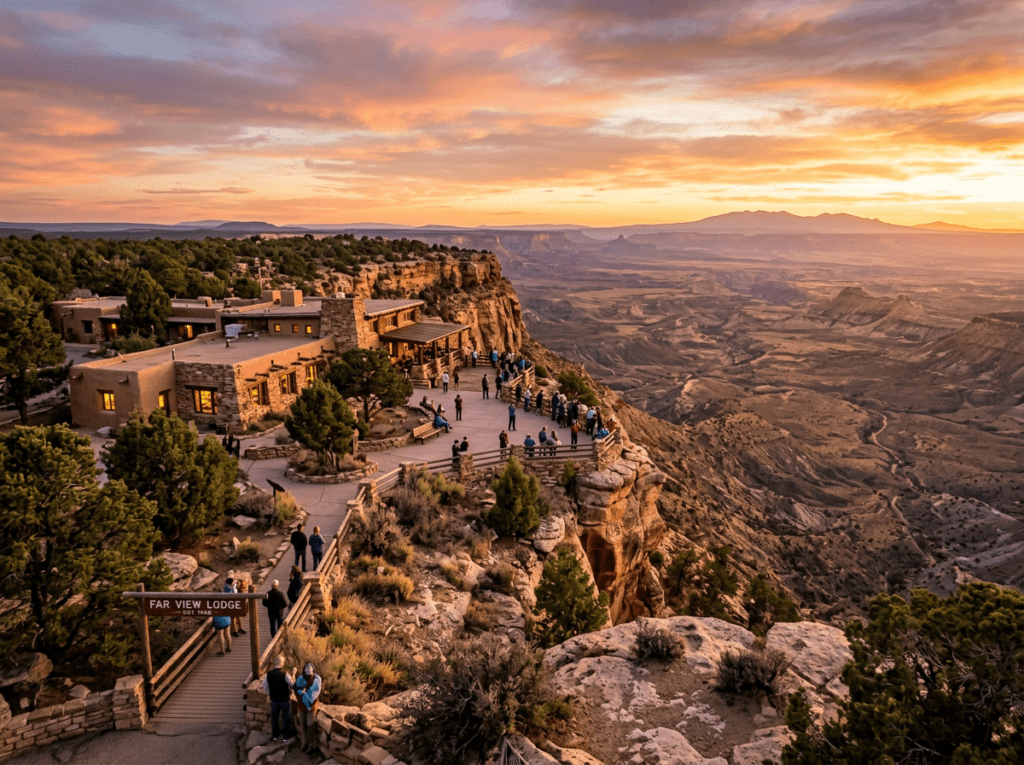
Far View Lodge, inside the park on the mesa top, is the only in-park lodging and provides the access that makes early morning and late afternoon photography practical. The lodge sits at 8,200 feet with views across the Montezuma Valley and the surrounding Four Corners landscape — the sunsets from the mesa rim near the lodge are among the finest in the Southwest. It operates from late April through late October and books out for peak season well in advance.
Cortez, the largest city in the area about 10 miles from the park entrance, provides the full range of chain and independent lodging and is the practical base for most visitors. Mancos, a smaller historic town 7 miles closer to the park entrance, has more character and a growing independent lodging scene. Durango, 36 miles east, is a full mountain resort town with exceptional dining, the historic Durango & Silverton Narrow Gauge Railroad, and lodging that makes it a natural anchor for a broader Four Corners itinerary.
Morefield Campground, 4 miles inside the park entrance, is the only in-park camping — 267 sites in a meadow setting with a camp store and full facilities. It accommodates RVs up to 35 feet and is the most convenient camping option for the cliff dwelling photography. The campground sits below the mesa rim in a protected valley, which means the morning drive to the cliff dwelling overlooks takes about 20 minutes — manageable for pre-dawn starts.
If I Were Planning My First Visit
The first visit has been made — in flat midday light, without enough context, on someone else’s schedule. The return is built differently from the ground up.
Cliff Palace tour booked first, for the latest available afternoon slot when the light fills the alcove from the southwest. Long House tour on the second morning for the opposite light window. An hour at the Chapin Mesa Archeological Museum before either tour — reading the timeline, understanding the pit house to cliff dwelling transition, looking at the artifacts that connect the structures to the people who built them. Arriving at a cliff dwelling knowing what a kiva is, what a sipapu represents, what the T-shaped doorway means — that knowledge changes what the camera finds.
And the mesa rim at sunset. Far View Lodge or the overlook near it, the Montezuma Valley going purple below, the La Plata Mountains catching the last light to the northeast, the cliff dwellings somewhere below in the canyon shadow. The landscape that the Ancestral Puebloans chose for 700 years, in the light that tells you why they chose it.
The Light I’m Curious About
It is the afternoon light inside the Cliff Palace alcove — the specific moment when the southwestern sun finds the dwelling faces and the sandstone goes from cool shadow to warm amber in a progression that takes about twenty minutes.
I saw the dwellings in flat midday light and understood they were significant without understanding why. The return is about standing at the Cliff Palace overlook in the late afternoon with the full context of who built this and what it meant, watching the light move across the canyon wall and illuminate the rooms and the towers and the kiva walls one by one as the sun drops toward the horizon. Photography as comprehension — the camera as a way of paying the kind of attention that a rushed midday stop cannot.
The Ancestral Puebloans oriented these dwellings to face the winter sun. They understood that light. The return trip is about understanding it too — what it looks like when it arrives, what it does to 700-year-old sandstone walls, and what it communicates about the people who chose this particular canyon, this particular alcove, this particular angle toward the sky.
A Deeper Exploration
This article is part of my ongoing project documenting and photographing all 63 national parks across the United States.
Along the way, I’m creating deeper guides that explore photography locations, travel planning, seasonal light conditions, and personal reflections from the road. Mesa Verde is the park in this series that most clearly demonstrates what context does for photography — understanding what you are looking at before you raise the camera changes every decision you make from that point forward.
Because the cliff dwellings have been here for 700 years. They are not going anywhere. The least I can do is arrive knowing their story before I try to tell it in photographs.
One more thing — just between us.
Mesa Verde’s cliff dwelling tours fill up fast and the park road gets busy in peak summer. Here are three places in the Four Corners region that extend the Ancestral Puebloan story beyond the park boundaries — with almost no crowds and some of the finest archaeological photography in the Southwest.
Hovenweep National Monument — straddling the Utah-Colorado border about 45 miles west — protects six prehistoric villages including remarkable tower structures that stand alone on canyon rims and in canyon bottoms. No crowds, no tours required, and the towers in the golden hour light are extraordinary architectural photography subjects.
Canyon of the Ancients National Monument — the largest concentration of archaeological sites in the United States, right next door to Mesa Verde — has thousands of recorded sites across a stunning canyon landscape with almost no visitor infrastructure and almost no visitors.
And the town of Durango to the east deserves more than a fuel stop — the historic Durango & Silverton Narrow Gauge Railroad runs through mountain scenery that rivals anything in Colorado, and a morning on that train with a camera is a completely different story from the archaeological one. Same trip, entirely different chapter.